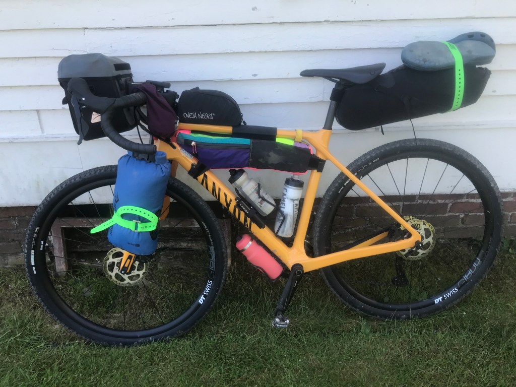
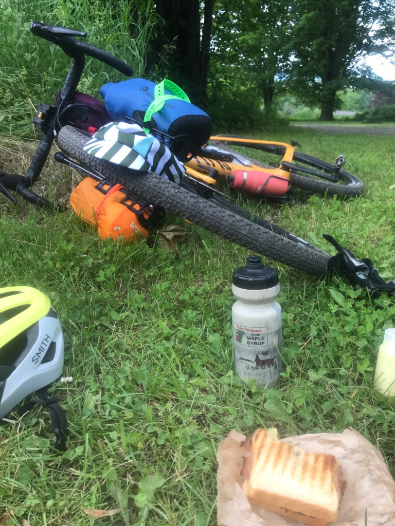
When I began this project, I knew I always wanted to incorporate some overnights into the routes. I’ve done some light touring on my Jamis touring bike, but that was using more of a classic set-up (rear panniers) as opposed to what these routes would require (full-on bikepacking). Bag and rack-wise, I ended up going with the following:
- Axiom bar bag (similar to this one)
- Topeak Versacages with a 5-Liter Sea to Summit Big River dry bag and an old Thermasest stuff sack
- Oveja Negra Bolt-on Snack Pack (bought as a Stupendiously Sexy Second!)
- Oveja Negra 1/2 Pack Frame Bag (in WACK PACK)
- An old Outdoor Research small stuff sack with a velcro stap that works well enough as a stem bag
- Outer Shell Seat Pack
Also, since I’d recently gotten the new bike, I wanted to see what it could do. However, being new to some of my bags and new to riding this bike loaded, I didn’t want to go crazy…well, too crazy.
I decided to go with an 87 mile route I’d do over two days. The first would be relatively short, but have a fair bit of climbing (5,220 feet over 34 miles). It would begin out of Saint Johnsbury and enter Essex County, the Northeast-est of the Northeast Kingdom counties. After getting everything packed up and having done a shakeout ride, I got up early on a Saturday and drove over to Saint J. Being the metropolitan hub of the NEK, Saint Johnsbury is fairly bustling. There was a farmer’s market going on and plenty of folks about. The town (yes it’s a town, not a city) grew somewhat out of its geography: the Moose and Passumpsic rivers meet right downtown, and it’s located very near to the confluence of the Passumpsic and Connecticut. However, it was really manufacturing that put it on the map. In 1830, Thaddeus Fairbanks invented a popular platform scale and (along with his brother Erastus) began a company that was based in Vermont until the 1970’s. He and his family were very philanthropically-inclined and gave to many causes including schools and libraries. One major vestige of that legacy is the Fairbanks Museum and Planetarium, begun by Erastus’s son Franklin Fairbanks in 1890 is one the best-known attractions in the area. I especially like it, because it’s the home to the “Eye on the Sky” crew who deliver my beloved daily weather forecast and almanac.
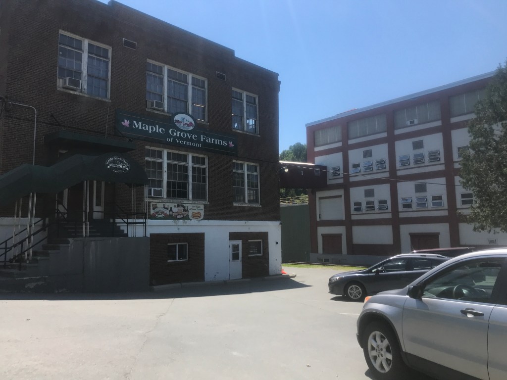
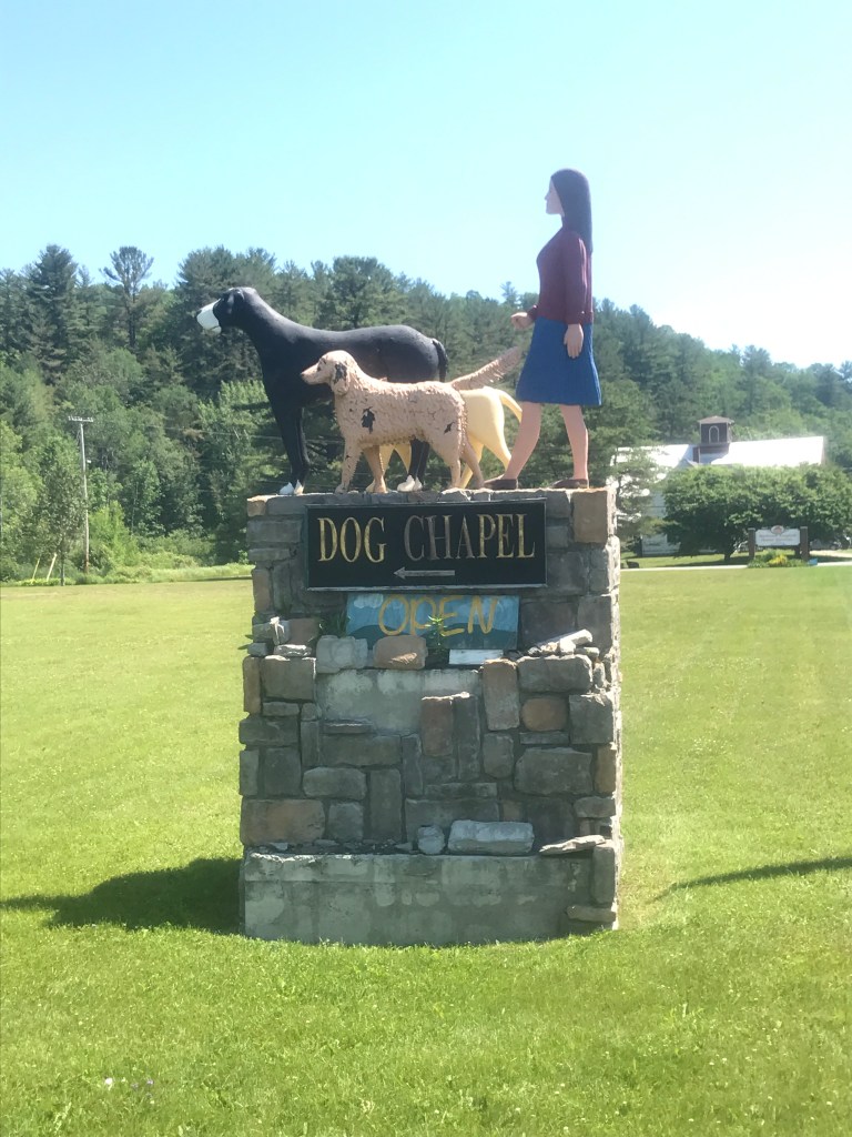
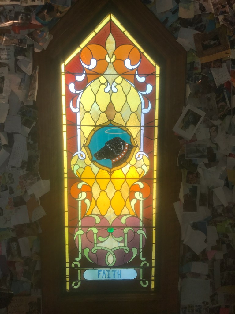
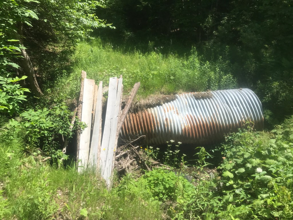
The town is certainly getting a bit hipper, and now boasts multiple trendy bars and cafes. I knew food stops would be virtually nonexistent on day one, so I was sure to swing by Boule Barkey and pick up a panini and spinach tart to store in my bag. From there, I headed east out of town on Route 2. After passing pancake, syrup and dressing producer, Maple Grove Farms, I turned onto Spaulding Road to make my way up to Dog Mountain. This 150 acre property was the brainchild of Gwen and Stephen Huneck. Stephen was an incredibly talented painter and sculptor, with much of his work focusing on our canine friends. They bought the property in the mid-90’s and turned the barn into a studio space. They built the chapel and opened it to the public in 2000 as a place for dogs to be remembered and celebrated. Sadly, in 2010 after needing to lay off most of his employees, Stephen shot and killed himself. And three years later, Gwen died via suicide as well. The property has continued under the management of “Friends of Dog Mountain”, but it’s always been both a place of both joy and melancholy to me. It was nice to stop in and the person working that day was kind enough to top off my water bottle. It was hot and I knew keeping enough water on the bike would be tricky. I had three regular bottles (one storing extra supplies, not water) and a 1.5 liter Nalgene bottle, but I’d be drinking a ton. There were more lovely views on Spaulding Hill and I soon came to a Class 4 section I wasn’t so sure about. Mt Pisgah and Chesterfield Hollow Roads look like they should connect, but it was a gamble. When I arrived at end and of Mt Pisgah, there was a washed out culvert, but luckily I found a snowmobile trail back down the road that connected. I followed it a bit, but I eventually realized I wasn’t actually on the old road bed. I was trending too far north, and since I’d already been pushing my bike a fair bit, I did a little bush whacking through a camp’s back yard and eventually made my way to Chesterfield Hollow. I’d certainly recommend finding a different way through if you want to try this route.


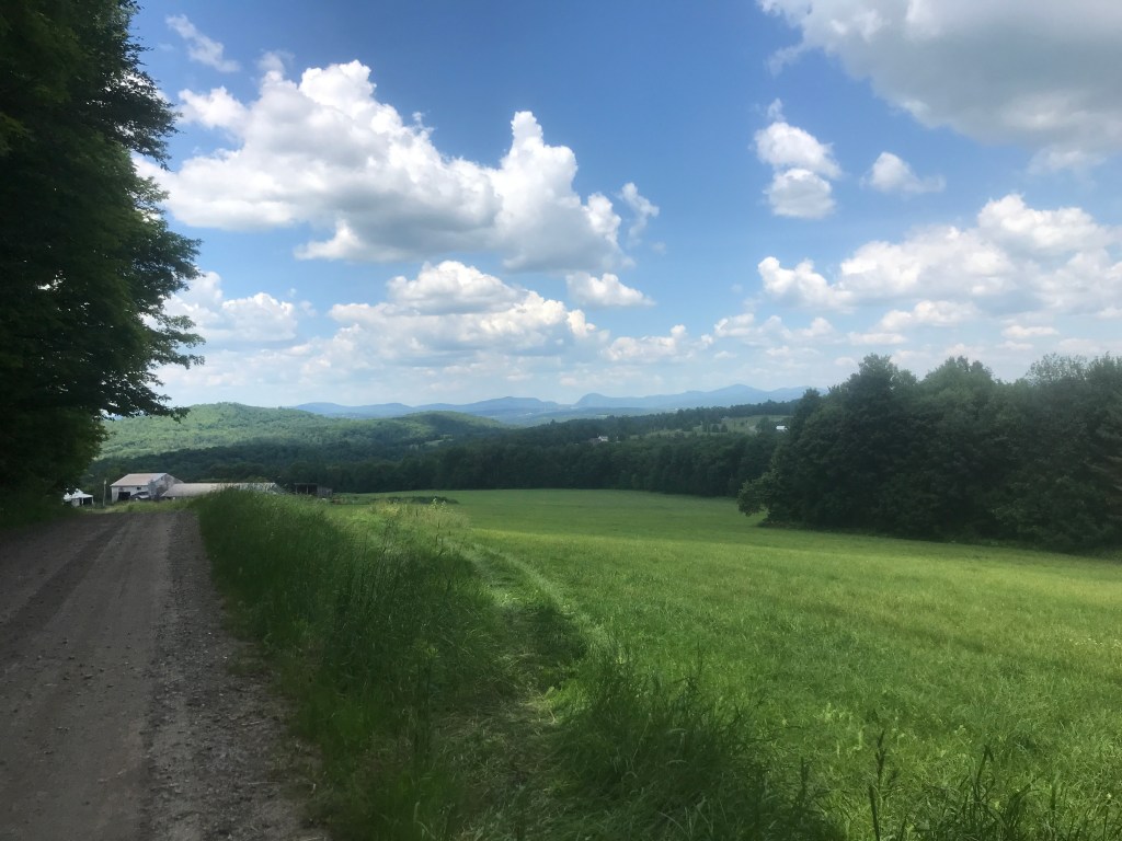
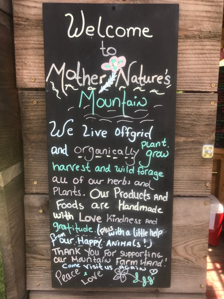
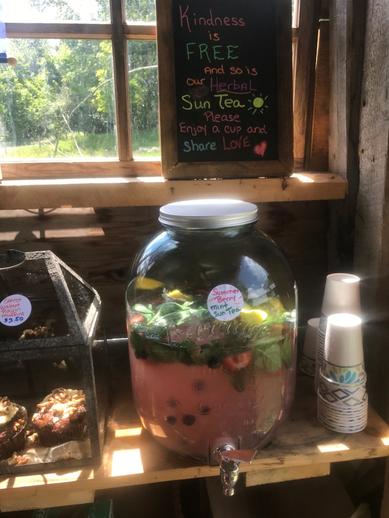
I eventually made my way into Kirby and stopped along a road called Willoughby View Road. It wasn’t false advertising: the views over towards the lake and the towns we covered on Ride 25, were fantastic. I stopped and ate my panini, taking my first major break of the day. I’d covered about half the milage, but had much more climbing ahead. Kirby doesn’t have a village and only 575 residents, but its mix of farms and wild remonteness was very nice to ride through. Also, interestingly enough, the town was originally granted in 1790 to Roswell Hopkins who was “Clerk of the House of Representatives and Secretary of State of Vermont, and he accepted the land grant in lieu of cash as payment for his government service.” Not a bad way to get paid. I turned onto Kirby Mountain Road, continuing the steep climb on Victory Road, which is seasonally closed. It became double track and is clearly a popular snowmobile route in the winter. After beginning to descend, the road narrowed a bit more and I came upon what seemed to be an aberration: Mother Nature’s Mountain farmstand. I later learned that it’s run by a couple named Flower and Jerry and they make tinctures, soaps and other natural products. They also had a solid selection of baked goods and some DELICIOUS, ICE COLD and FREE, strawberry, blueberry, mint sun tea. Seriously, it was a life saver. I was getting low on water again, and though I’d been mixing in Gatorade powder, this was obviously lightyears better. I decided that if I filled my bottles, there’d still be some left and I could pay them for it, so I filled away.
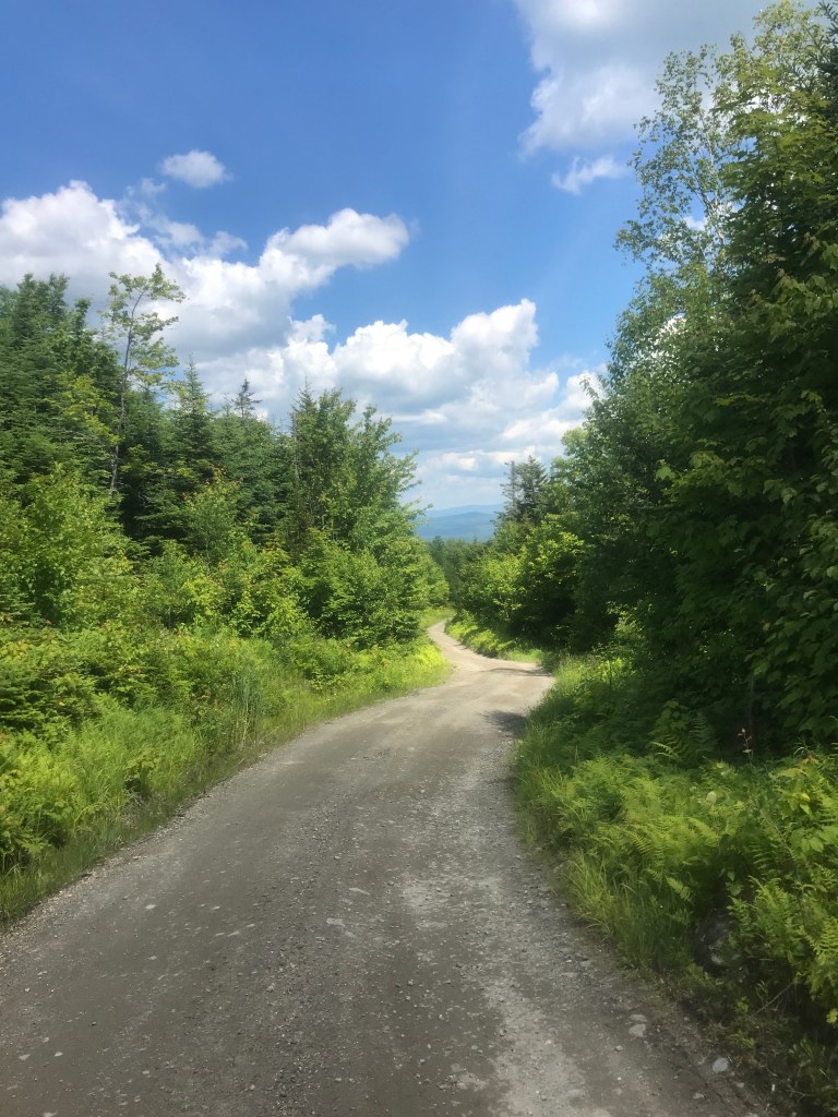
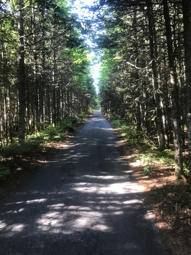
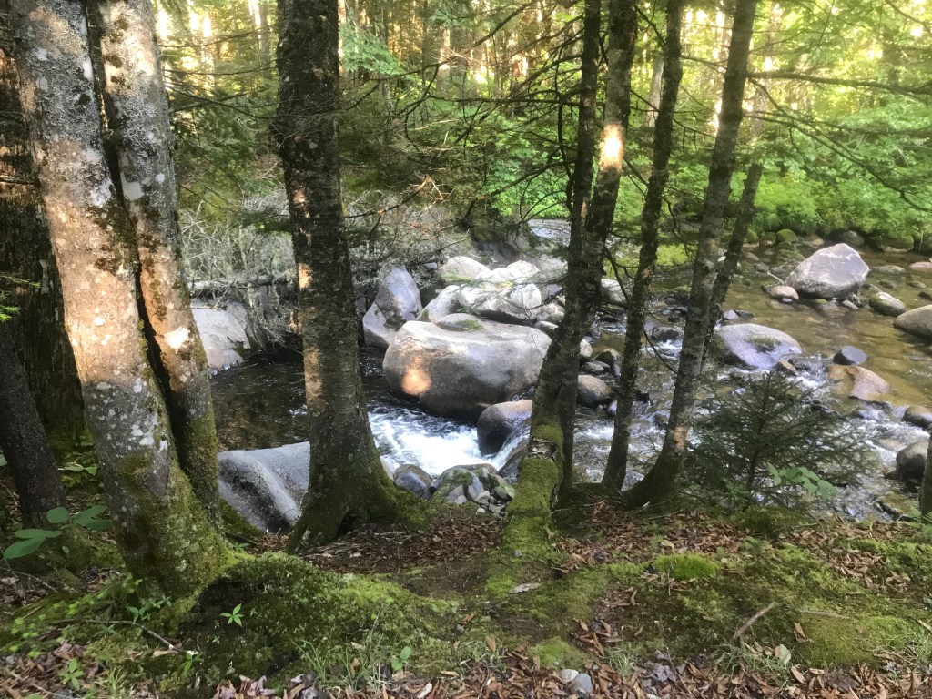
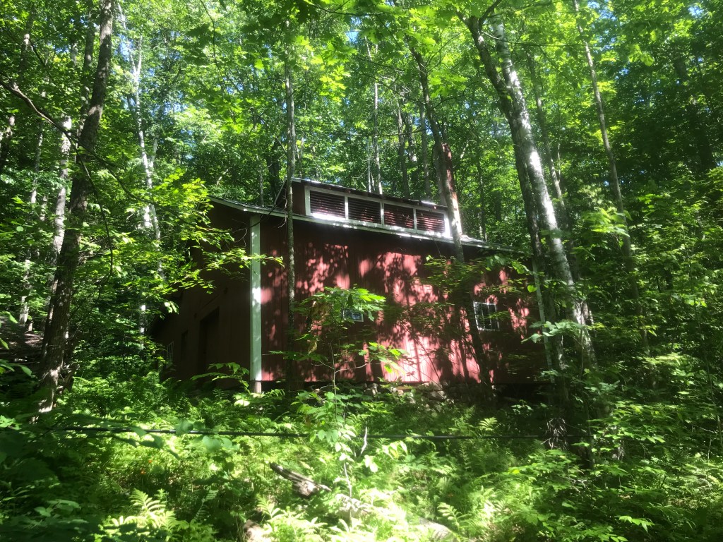
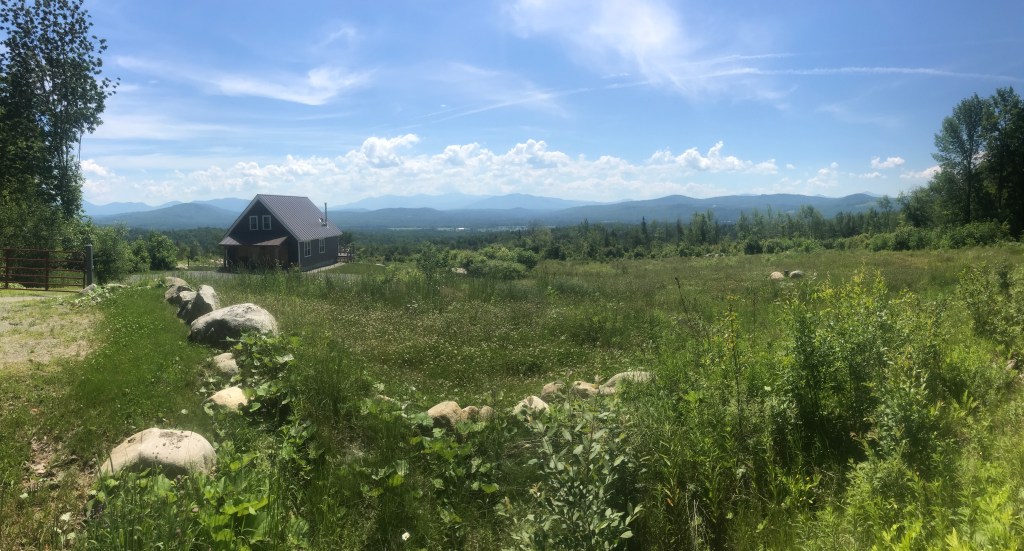
I continued east, catching my first glimpse of East Mountain, where I’d be camping. I was now in Victory, an even tinier town (population 70) that, in 1963, was one of the last two towns in Vermont to be connected to the power grid. I’ve actually ridden in Victory before. There was a mountain bike ride called the Circumburke that I rode in 2014 and 2015 which utilized some single track in town that’s on private land. The trails seem to be in some sort of red tape limbo relating to Act 250, but are still currently accessible for single rider, but not for the Circumburke. I entered the flatness of Victory Basin and followed the upper reaches of the Moose River for a while. I made a stop to sit by the water for a bit, but generally kept plugging away. After leaving the Wildlife Management Area, there were a few houses/camps and I made a pit stop at the Victory town offices. I topped off my bottles and steeled myself for the long climb up Radar Road. I entered the town of Granby and also crossed onto private timberlands that are publicly accessible, through an interesting partnership with multiple stakeholders, under the umbrella called “Kingdom Heritage Lands”. There weren’t many vehicles going on these roads other than 4×4 enthusiasts and logging trucks, so it was fairly quiet. As the road tipped up, it got more and more rough. I had a few cars pass me in each direction, most of them pretty rugged, but I did end up seeing a right-hand drive Japanese microvan which I’m shocked made it. I had to hike a few of the steeper bits, but all of a sudden I reached pavement. That magical change came about thanks to the US Military being who they are. I’d arrived at the barracks portion of the former Lyndonville Airforce Station. I’ll talk more about it below, but the instillation had two main sections: a lower base, part way up East Mountain, where servicemen lived. And and an upper base at the top, where the radar towers and other technical equipment was. I was happy to have the pavement ahead of me and besides a small detour around a large fuel tank of some kind, the road was amazingly smooth all the way up. It was also, however, steep. I again needed to hike a few spots, but after a lot of huffing and puffing, I made it to my camping spot for the evening!
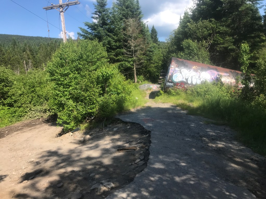
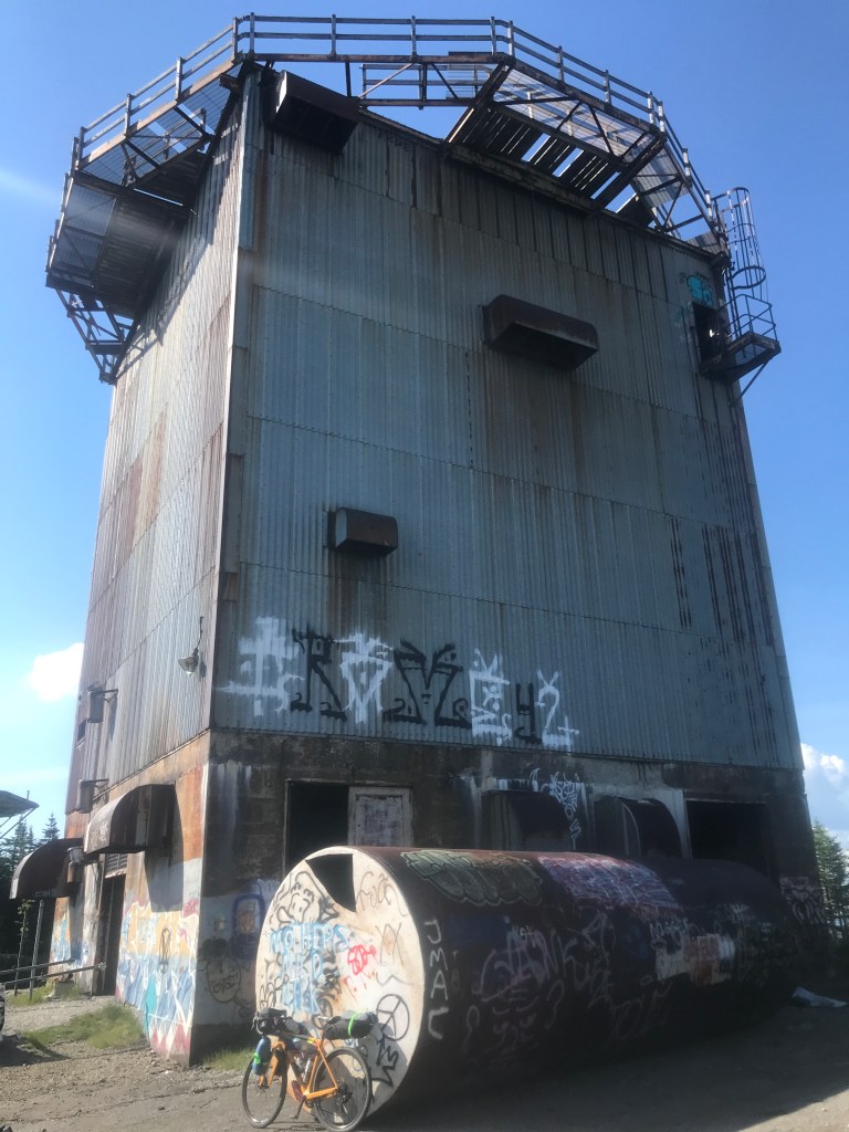
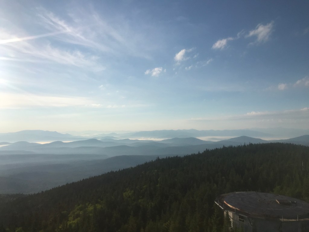
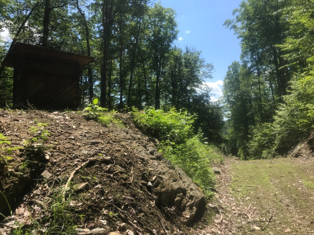
I began to poke around and scout out a place to pitch my tent. I quickly ran into a guy named Ben who’d been up there since the evening before with a couple of buddies. They’d all gone to UVM, and drove a new Bronco, some other SUV truck thingy and a Ducati motorcycle with slick tires up there for a guys weekend. Despite the warning barks of their dog Leo, they didn’t mind having a neighbor (and neither did Leo, once you gave him some pets) so I quickly set up my tent. I explored a bit but didn’t yet go into any of the five radar towers. There are a few other buildings but it’s pretty well overgrown. It’s not super rough, but there’s certainly garbage and graffiti up there. You can get a good sense of it from the various youtube compilations of artsy, spooky drone flights and explorer-types roughing it. If you really want to delve deep into the history of the base, I’d recommend reading this awesome article from Obscure Vermont. However, to put it succinctly, the base was build between 1954 and 1956 for $21 million. The Cold War was blazing hot and it was designed detect any sort of inbound Soviet strike. Around 174 men lived in the barracks and operated and maintained the equipment housed on the top of the mountain. Technology quickly outpaced the instillation and it was shuttered in 1963. It’s now privately owned by Matthew Rubin and he’s happy to allow people up there. “There’s nothing to steal. If you’re up there and want to take some scrap metal, please do!” he said in a recent Seven Days article. I’d best describe it as a post-apocalyptic state park. You see people relaxing, doing their own thing, but there are more folks carrying guns and there’s more drinking too. Not that everyone was wasted. The UVM guys graciously showed me how to access the top of the highest (and sturdiest) tower. It’s built mainly of concrete, unlike some of the smaller ones, which are mainly metal and rusting out. I spent some time up top, taking in the panoramic 360 view from the highest mountain in the Northeast Kingdom. I ate some dinner while battling the bugs and laid down a bit to wait for the sunset. At one point I hear some folks shooting and on the third and fouth *BANGS* I also heard a whirring like a drone, but it was short-lived. It turned out those were ricochets. They stopped shooting for the night after that, but it was certainly the sketchiest moment on the ride. I went up for more amazing views at sunset, then went to bed sleeping fairly well. At one point I was awoken by some people who had clearly driven up there after dark and were drinking. At least one guy was from Maine, because he kept saying “I love it he-yuh” with such a strong accent, I thought he was joking. I woke up in the morning and they were nowhere to be found. I went up for one last look from the tower, ate some oatmeal and packed up to head down.
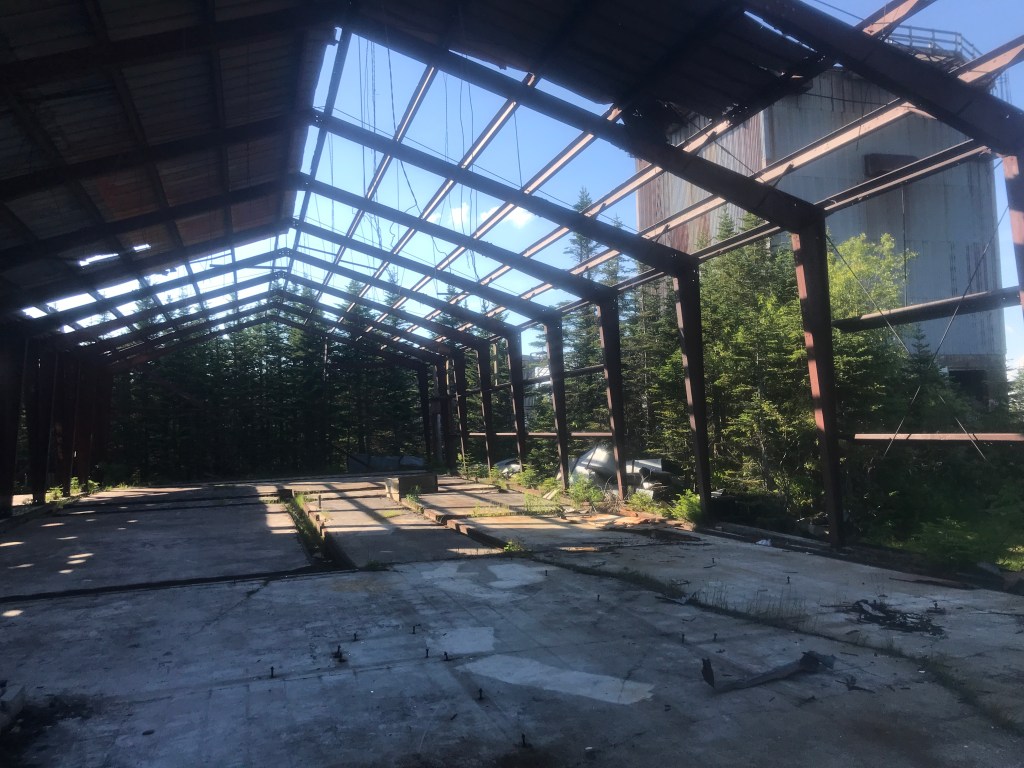
Building shell 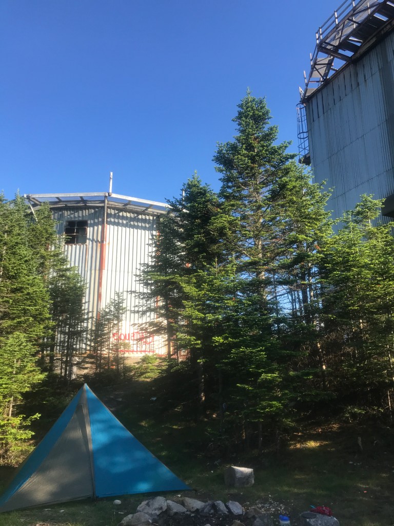
Camp spot 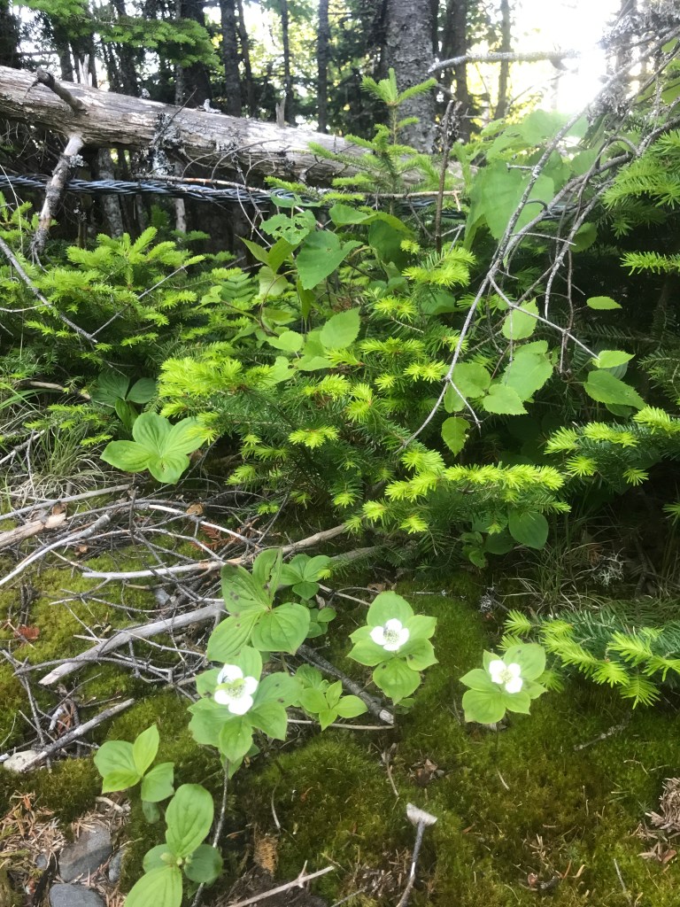
Bunchberry flowers alongside the road 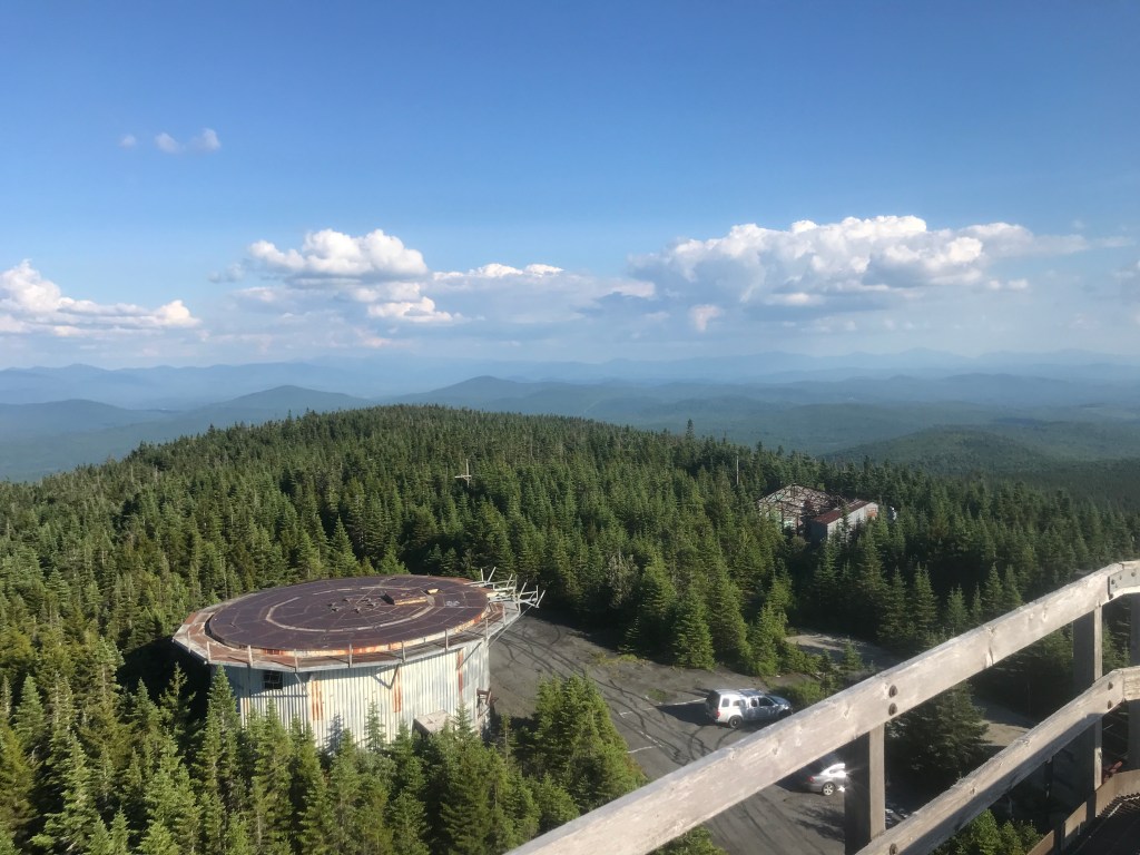
There’s always a parking lot to spoil the view 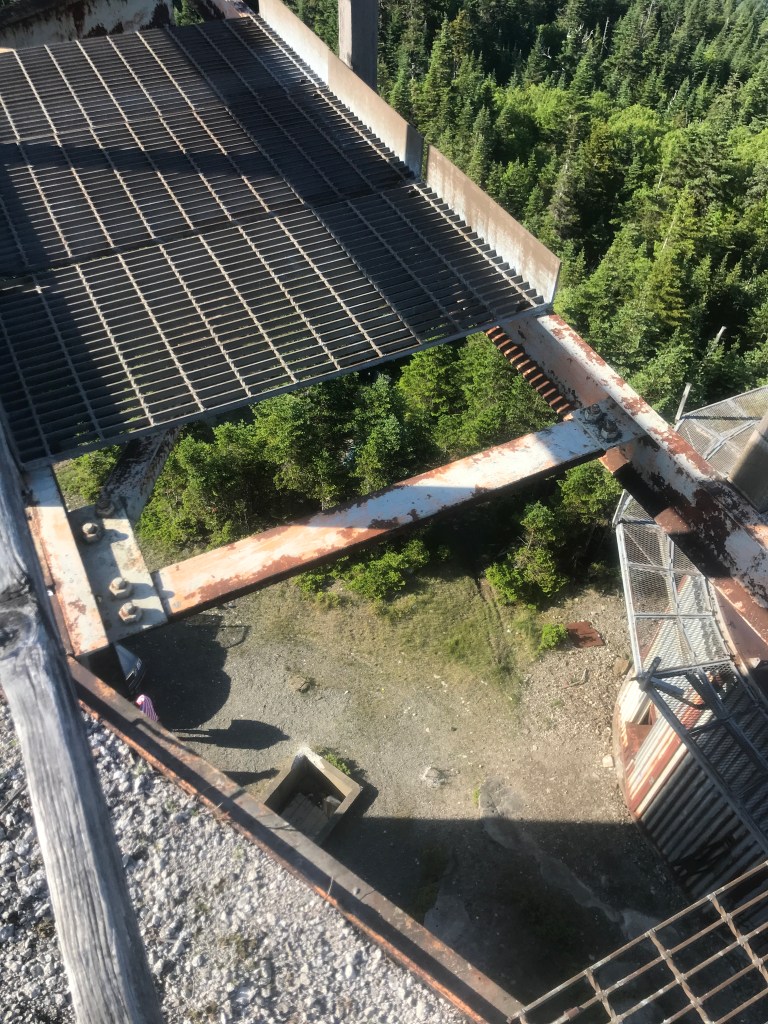
Watch your step (note: I didn’t even get close to that walkway) 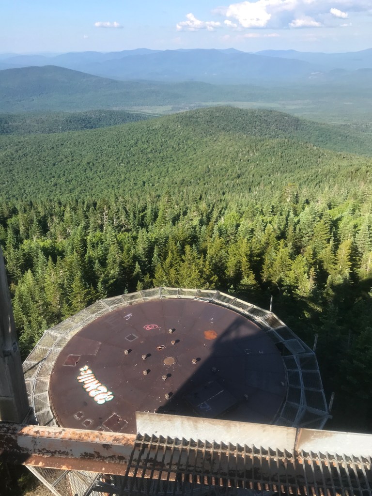
Down towards my tent site 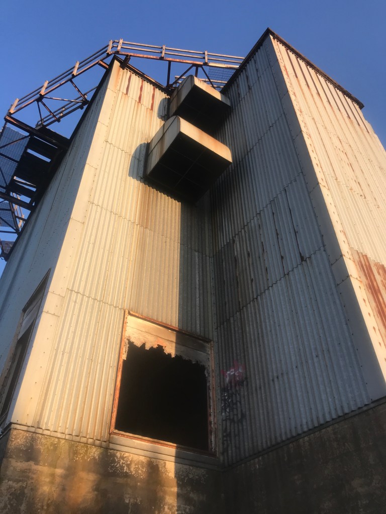
Golden hour begins 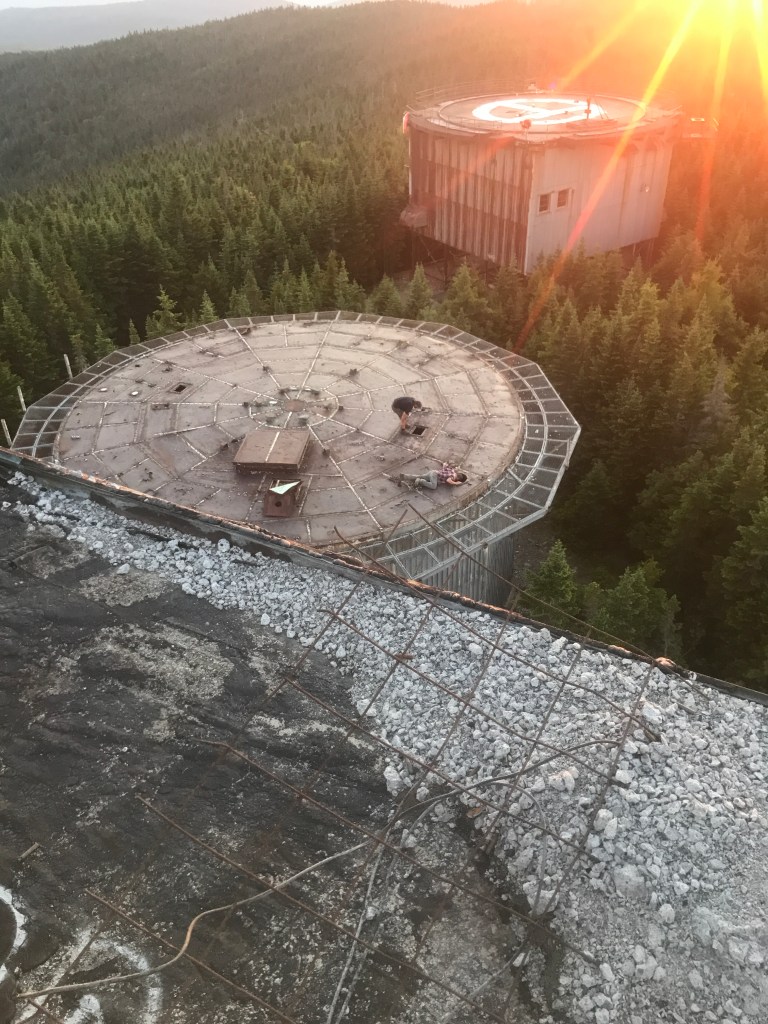
Other folks exploring other towers 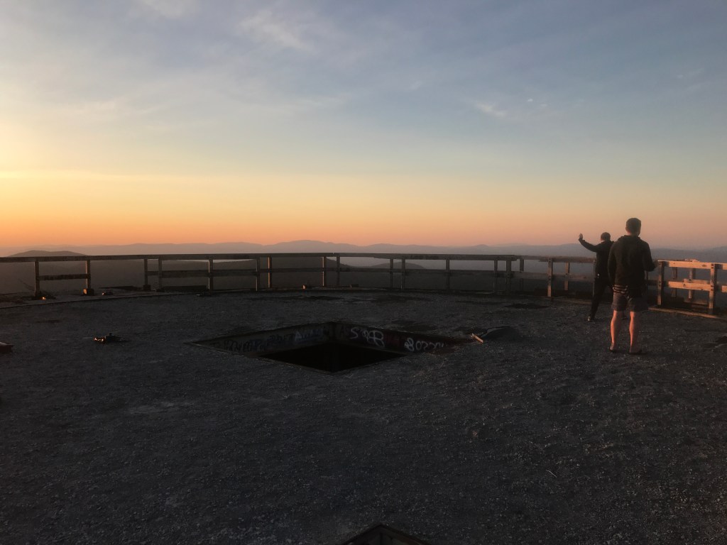
Sunset company, from New Hampshire 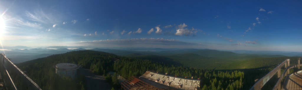
The next morning’s panorama
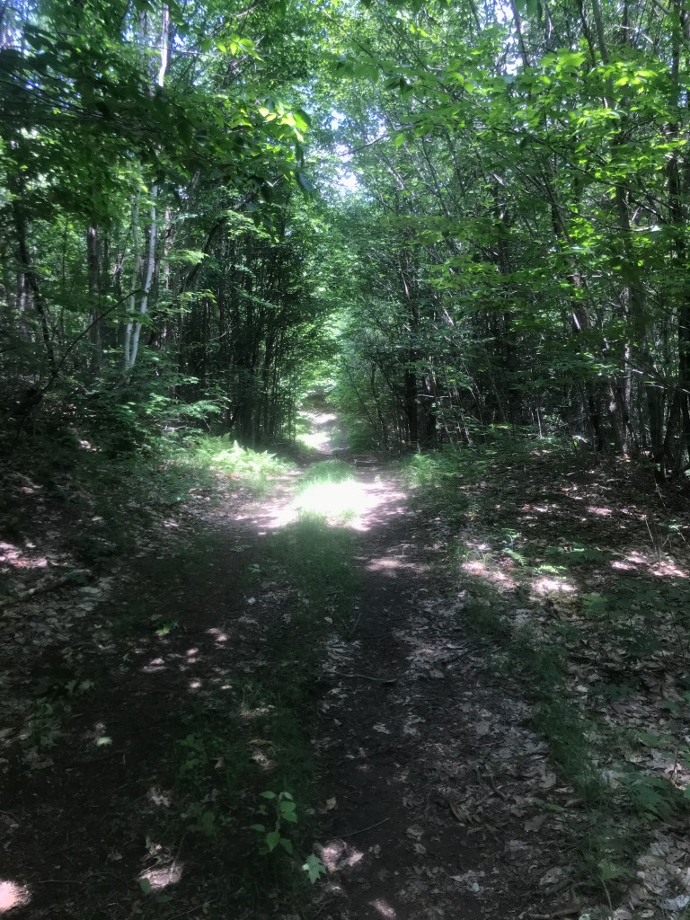
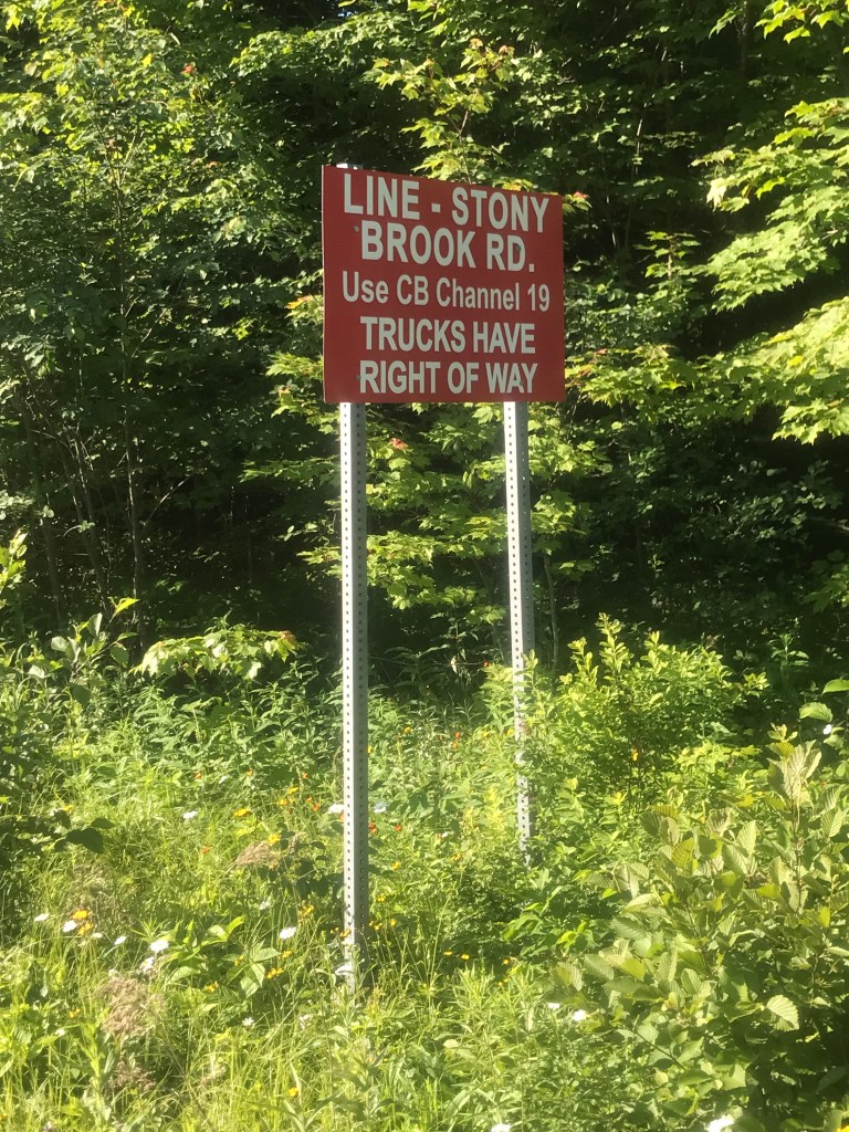
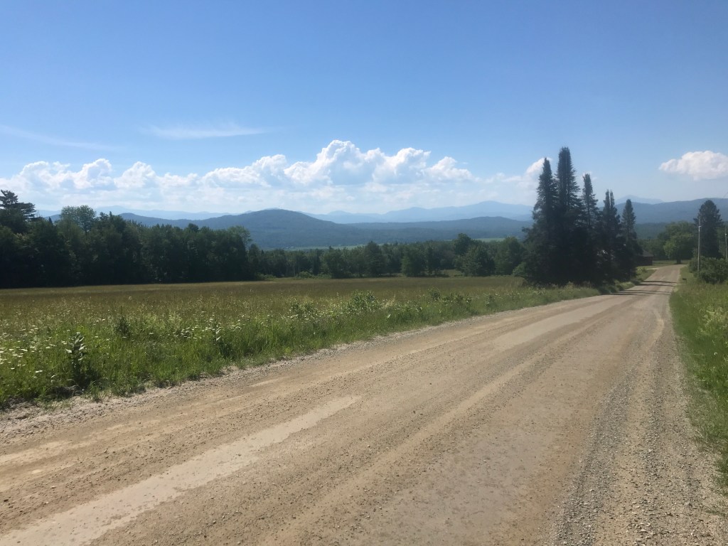
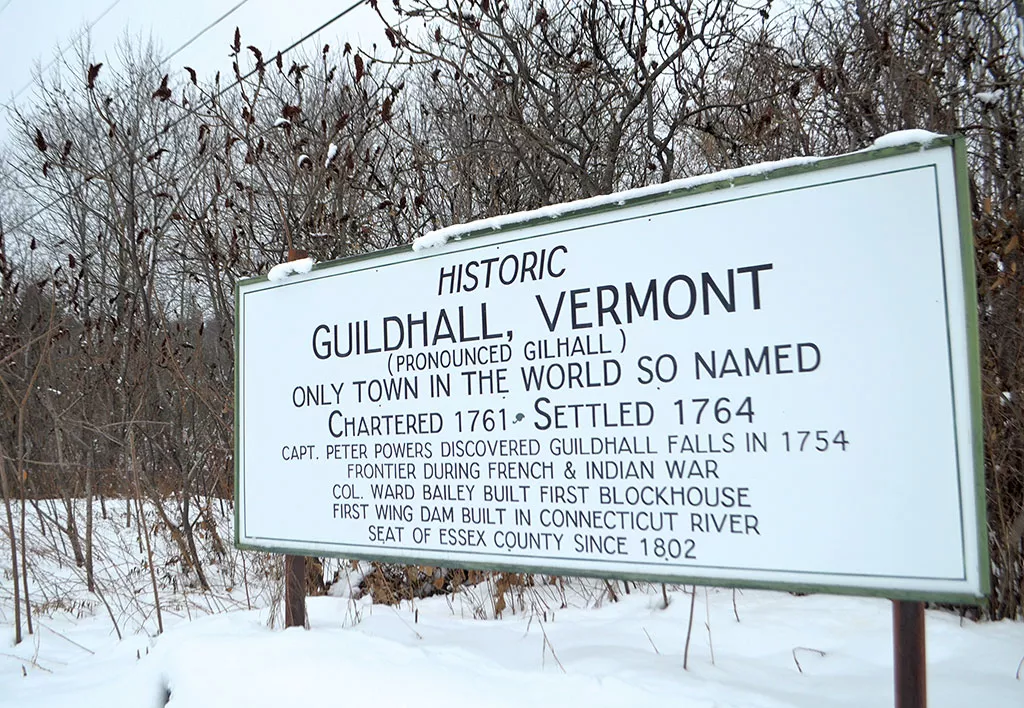
The ride down off of East Mountain was amazing. It was a bit chilly, but a sustained 6 mile downhill isn’t a bad way to start a ride. I eventually ended my back-tracking and was on new roads. This section was obviously used predominantly by logging trucks, to the point where there was a sign explaining which CB channel to use and that trucks had the right of way. It was these sort of roads for the next roughly ten miles. The scenery wasn’t anything too spectacular, but the sense of isolation was palpable. Despite being on a well maintained road, you’re way out there. I slid around a gate at one point and the road was more akin to a VAST trail, but overall it was more of the same until I reached Granby Road. I’d been in Granby pretty much the whole time on these roads, but I finally was passed by my first car of the day. There are only 81 people who live in Granby and there’s not much of a village, but it does have some history that folks are keeping alive. I worked my way through Guildhall (“the only town in the world so named”), yet another small town (population 262) that has a bit more going on down by Route 2 and the Connecticut River. The town has been a poster child of the lack of children in some parts of the state, but I just enjoyed it for the continued quiet roads, including a lovely Class 4 section between Fellows and Lamotte Roads. I crossed into Lunenburg and got some far flung views over to the White Mountains. The cruise down into town was especially lovely. I’d actually been to Lunenburg a few years before when I was doing professional development trainings. A colleague and I made the long drive out there to the Elementary School to teach about Social and Emotional Learning. There’s a small village on a rise and a newly reopened store, where I was happy to refill bottles and buy a few snacks. As I was sitting there enjoying the shade, amazingly enough I saw a Bronco drive by and it was Ben, from the top of East Mountain!

I took Route 2 west for less than a mile, had a brief climb up Baptist Hill, then had a good long cruise down to the village of Gilman. The village has a complex history involving power generation and paper mills and in fact used to be called Fitzdale. In the mid 1910’s Isaac Gilman began amassing controlling interest in the few companies that had mills in the village and soon after his name was applied to the whole area. Today the area is a hydroelectric dam and the mill buildings appear to be unused. Being right on the Connecticut River, and having crossed ever so slightly into New York during Ride 22, I decided to pop over into New Hampshire and buy a sandwich. I think I’ll try to pop into Massachusetts and Quebec when I’m doing adjoining town, to complete the set. The Dalton Country Store was yet another sparsely stocked rural store, but they had a deli counter, so I ordered a turkey sandwich and enjoyed the air conditioning while I wolfed it down. I then high tailed it back to the good old Green Mountain State to continue into Concord.
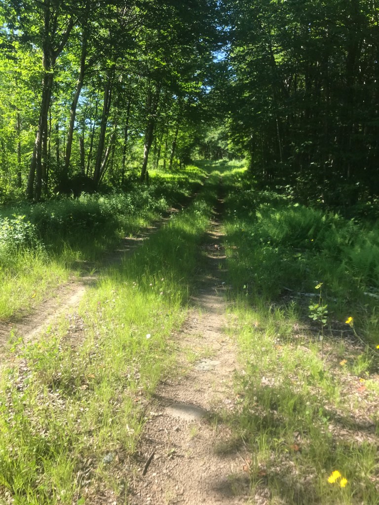
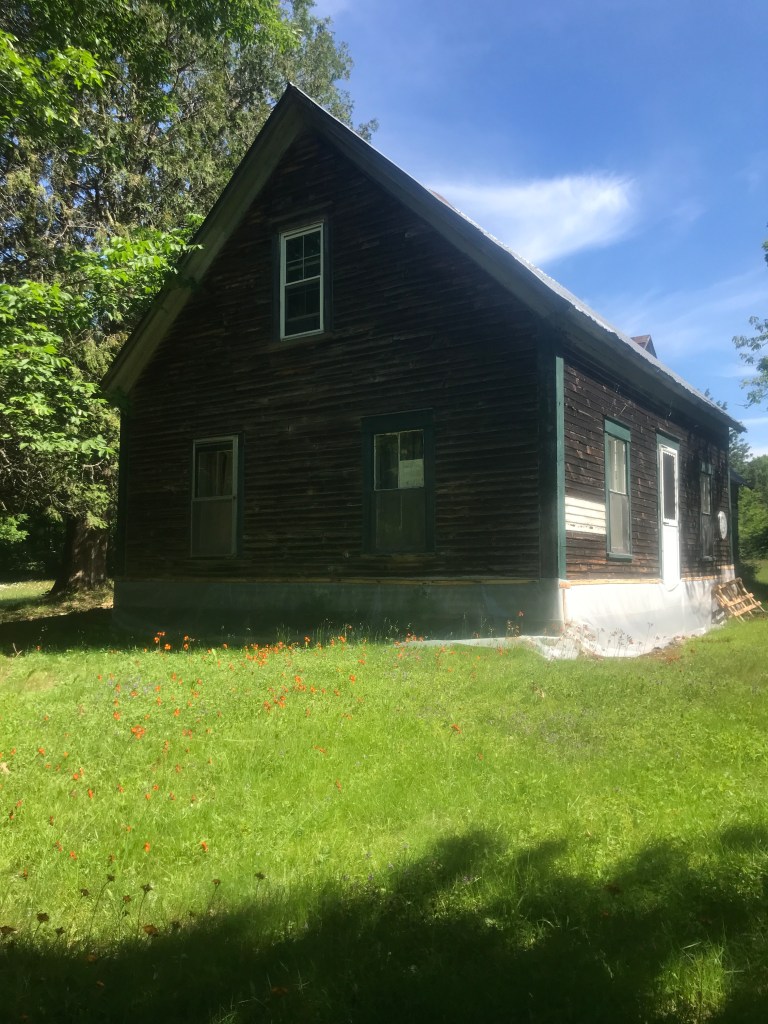
Much of my time in Concord was on Leonard Hill Road, a straight rolling road that I would describe thusly: camps, clearcuts and crummy views. No views really. The day was getting really hot and I was starting to drag. I saw on the map there’s an area called “Texas”, but sadly didn’t see a single sign to prove it. I eventually got to Concord Corner: the site of the first normal school in the US, founded by (the appropriately named) Samuel Read Hall, a location where Robert Frost apparently had owned property and the seasonal camp community around Shadow Lake. After getting some pretty nice views over the lake, I came to a mellow Class 4 section, before crossing Interstate 93 (for the first of two times) and taking a quick jog on Route 18. I was now in my last town of the day: Waterford. It’s another town with a picture postcard village that I unfortunately wasn’t passing through. My route took me along Duck Pond Road and eventually to my last Class road of the day. This deeply dug out track was lined with ancient trees and punctuated with one of the best preserved round barns I’ve ever seen. The West View Farm is home to not only this spectacular Lambert Packard designed barn, but numerous other barns and outbuildings as well as a rambling Greek Revival main house. The property was listed on the National Register of Historic Places in 1995. From there it was truly all downhill and I was quickly back at the car. I’d passed an ice cream stand in my last mile, so I quickly unloaded my bags and then backtracked in the car for a well deserved cold treat.
Baptist Hill views 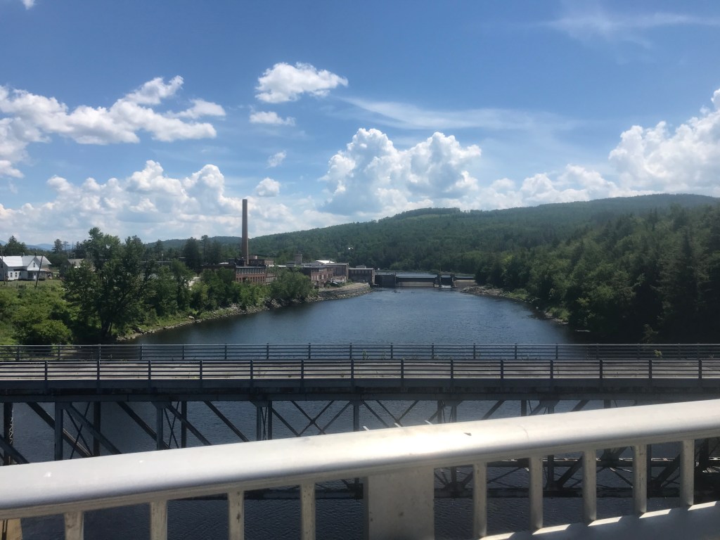
Gilman’s old bridges and factories 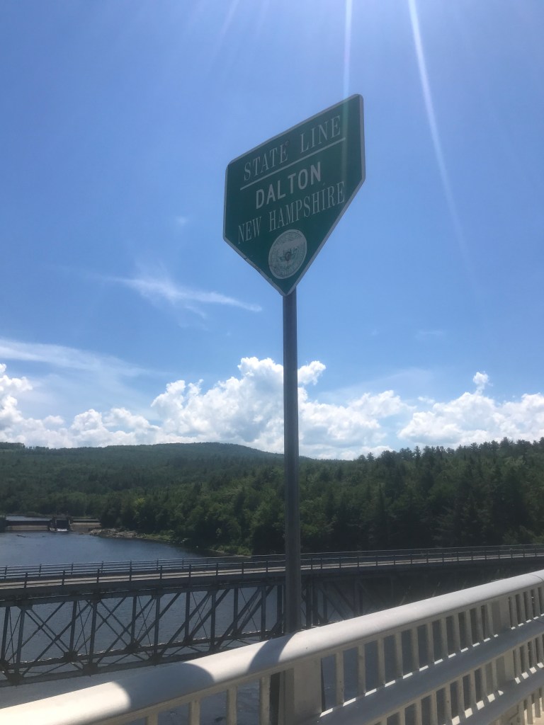
Crossing over to the dark side… 
Using a dead pine to mark a missing shoulder: genius! 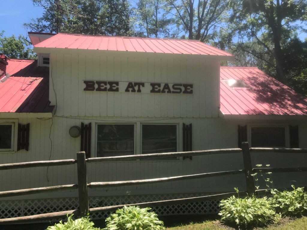
My kind of camp 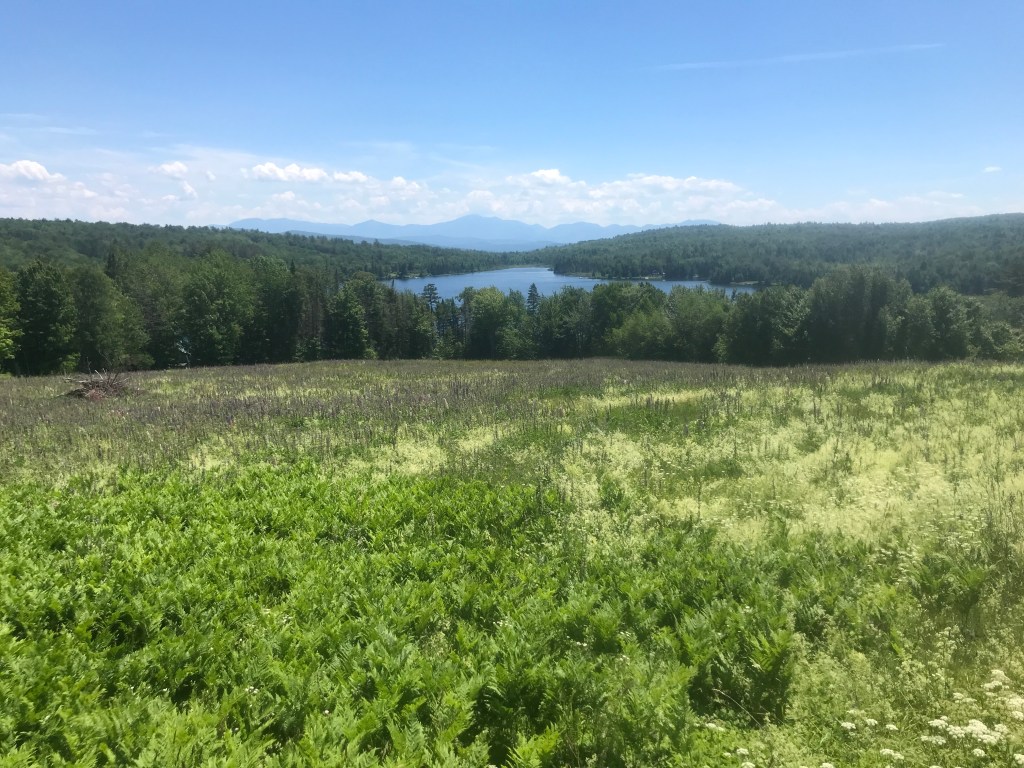
Shadow Lake views 
On Duck Pond Road? Impossible! 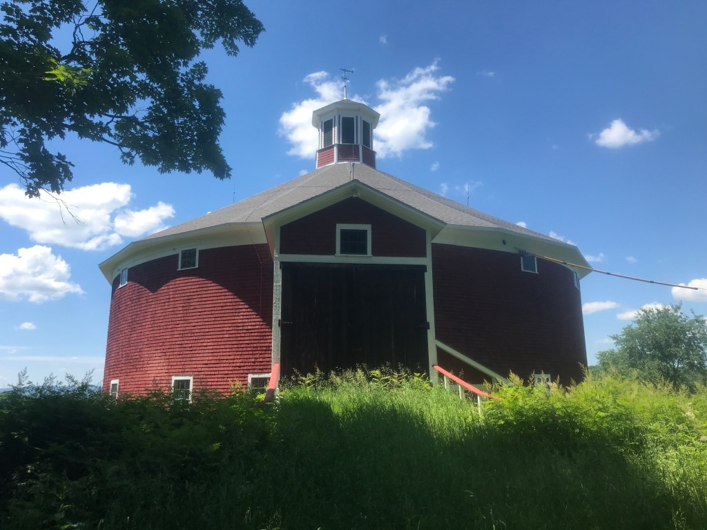
West View Farm Round Barn (c. 1903) 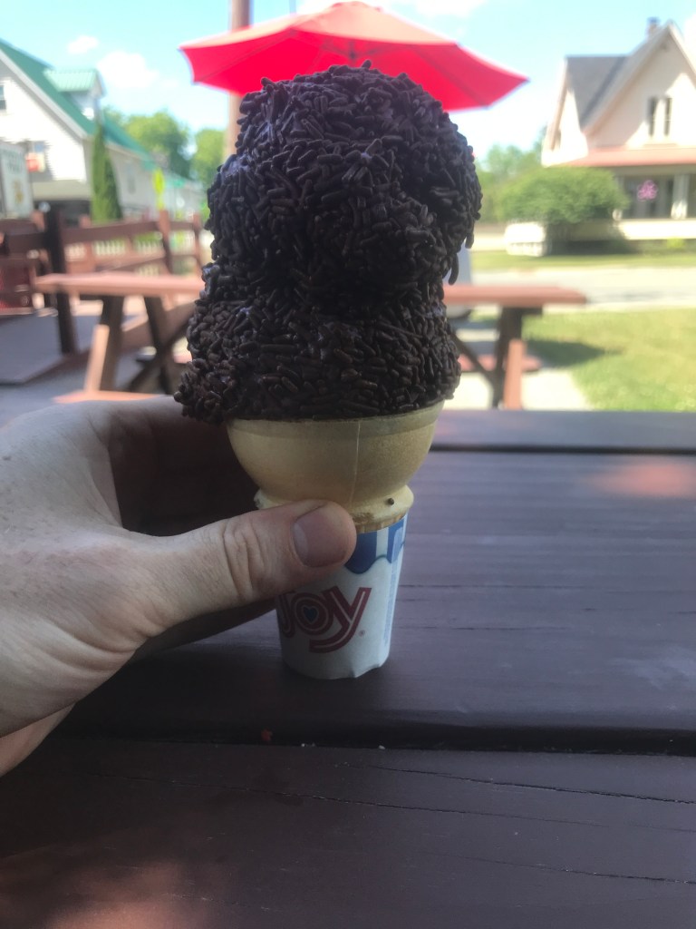
Black raspberry and chocolate sprinkles (forgot to ask for the sugar cone)
The Details:
https://www.strava.com/activities/7373365045
https://www.strava.com/activities/7373361359
https://ayvri.com/scene/gdkz16el5z/cl4xdx4if00013b6u2o86t6up
https://ayvri.com/scene/gdkz16el5z/cl4xeae7100013b6u7x9clywi

3 thoughts on “Ride 31: Saint Johnsbury, Kirby, Victory, Granby, East Haven, Guildhall, Lunenburg, Concord & Waterford”