Ride 14: Montpelier, East Montpelier, Plainfield, Marshfield, Cabot, Woodbury, Calais, Worcester & Middlesex

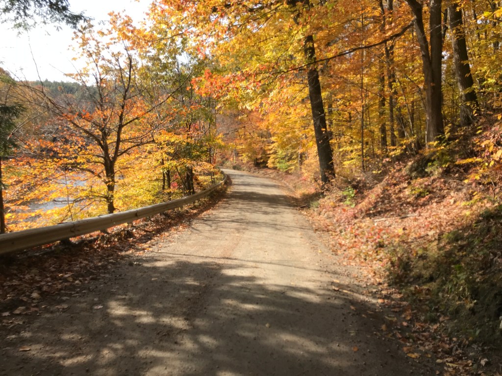
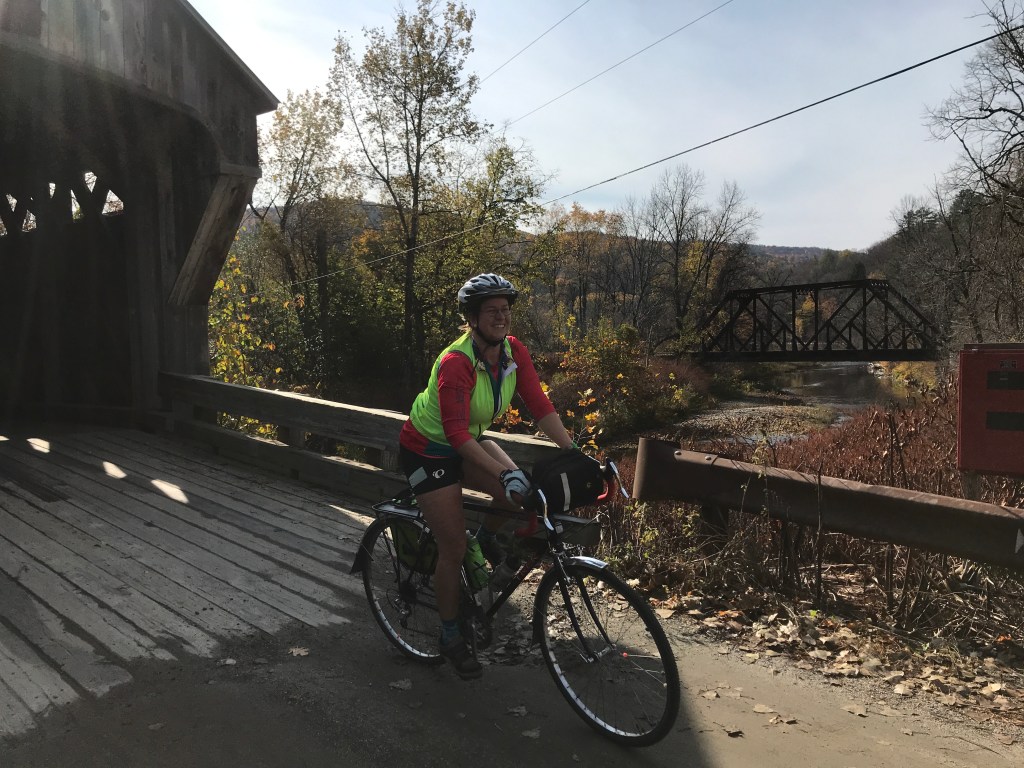
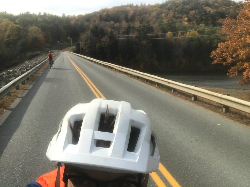
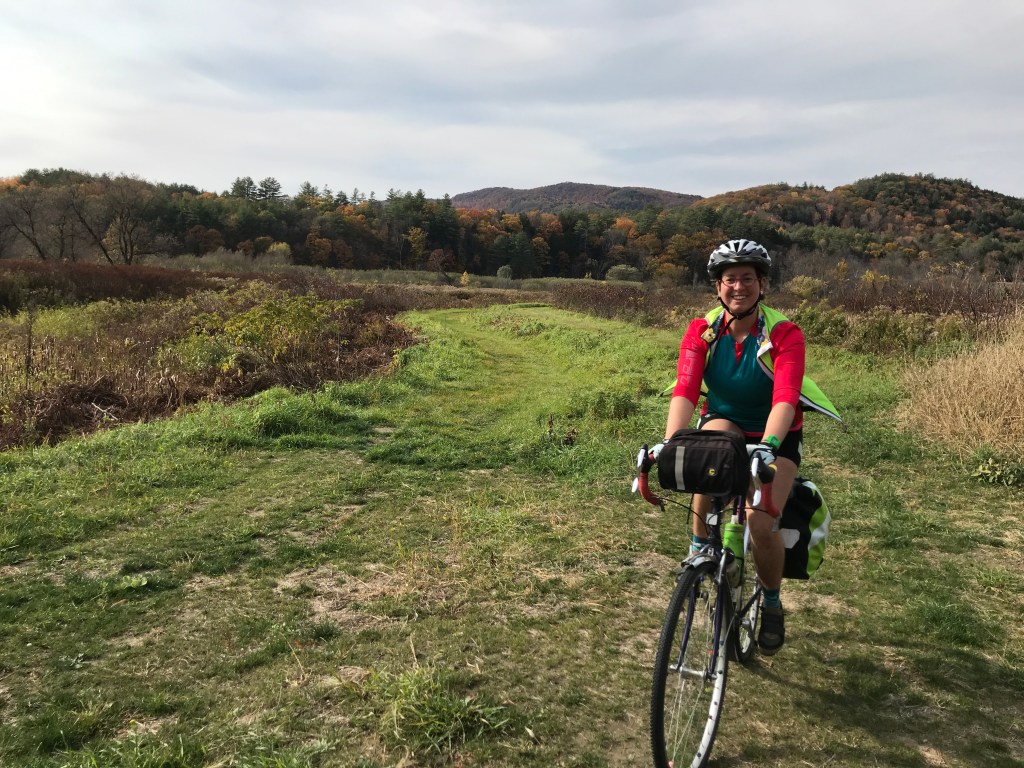
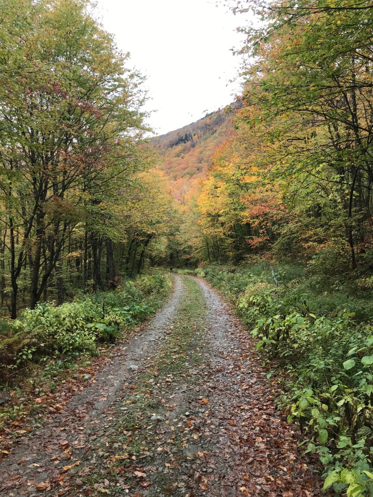
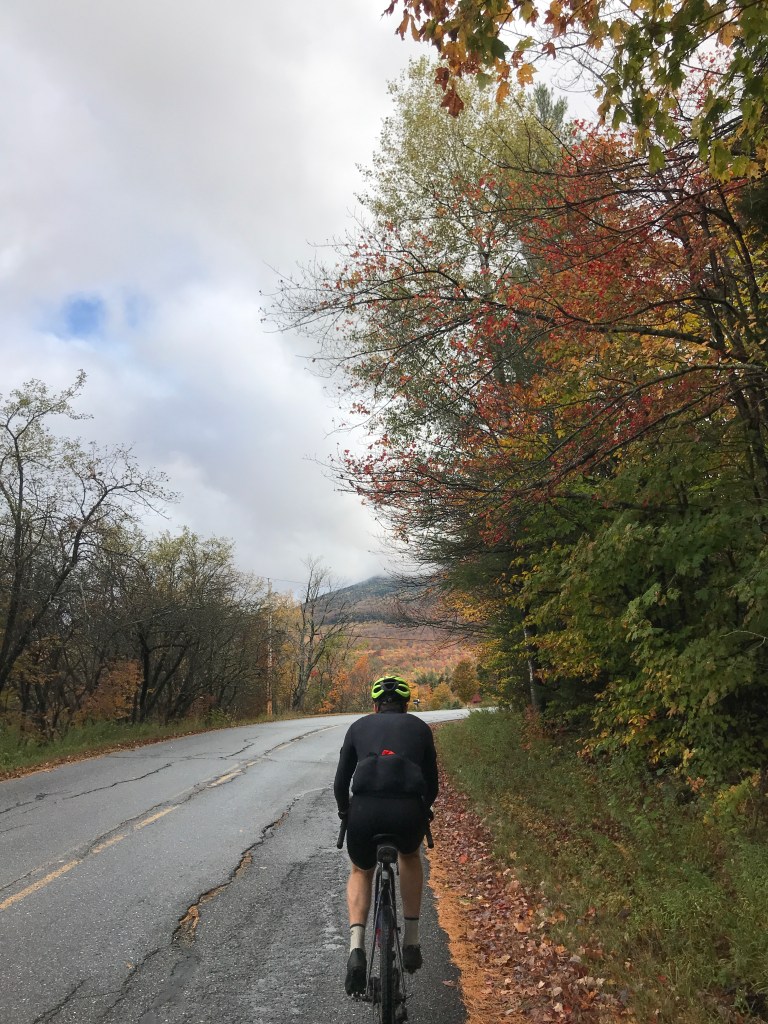
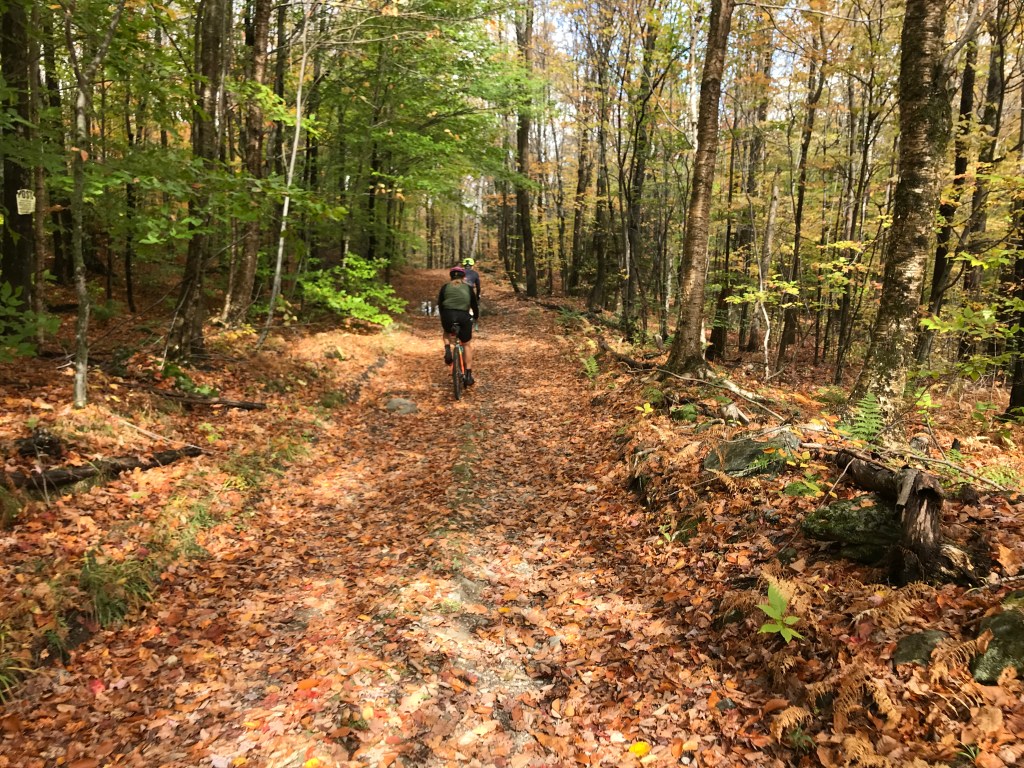
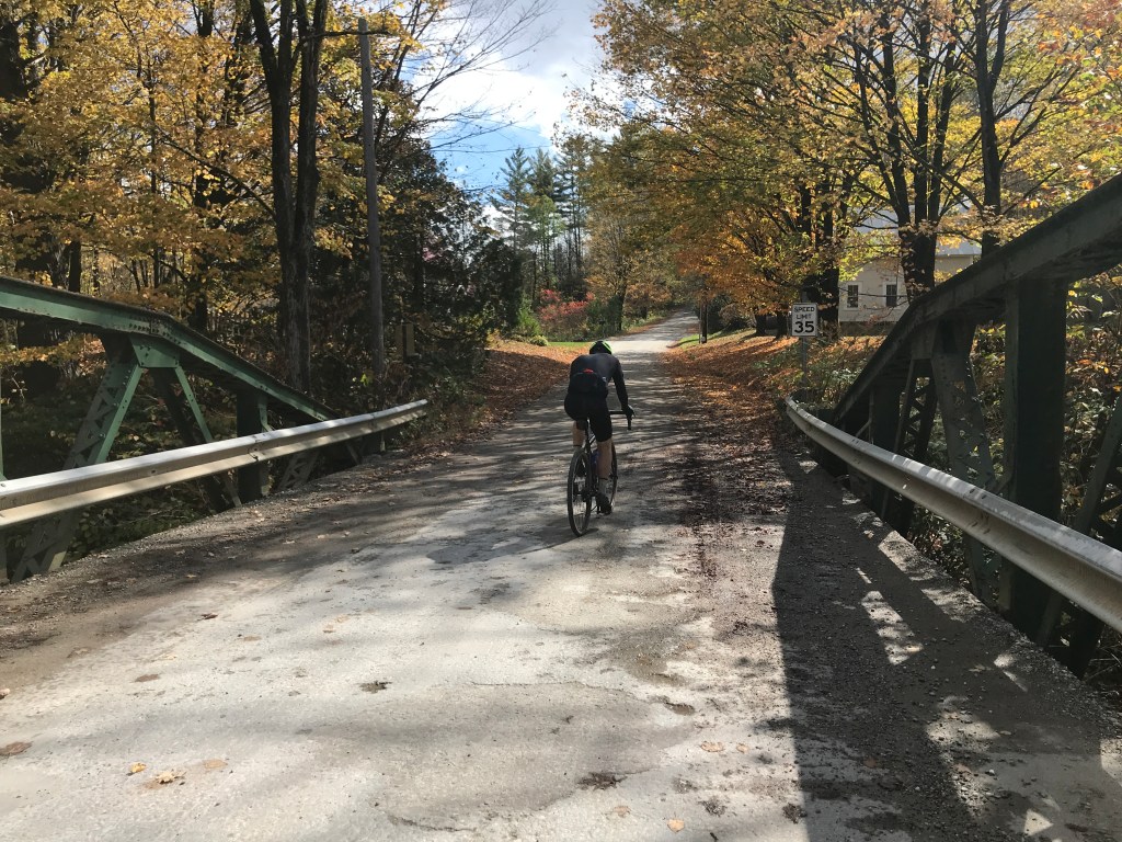
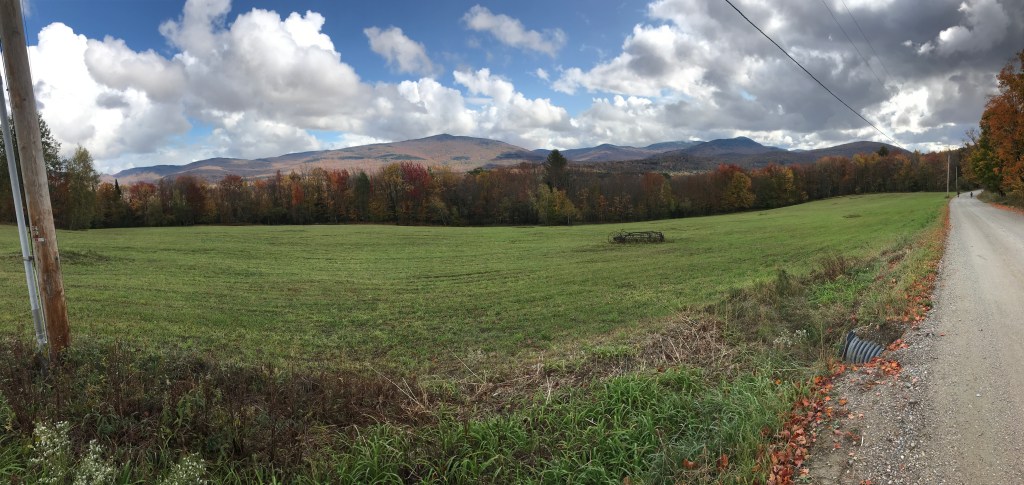
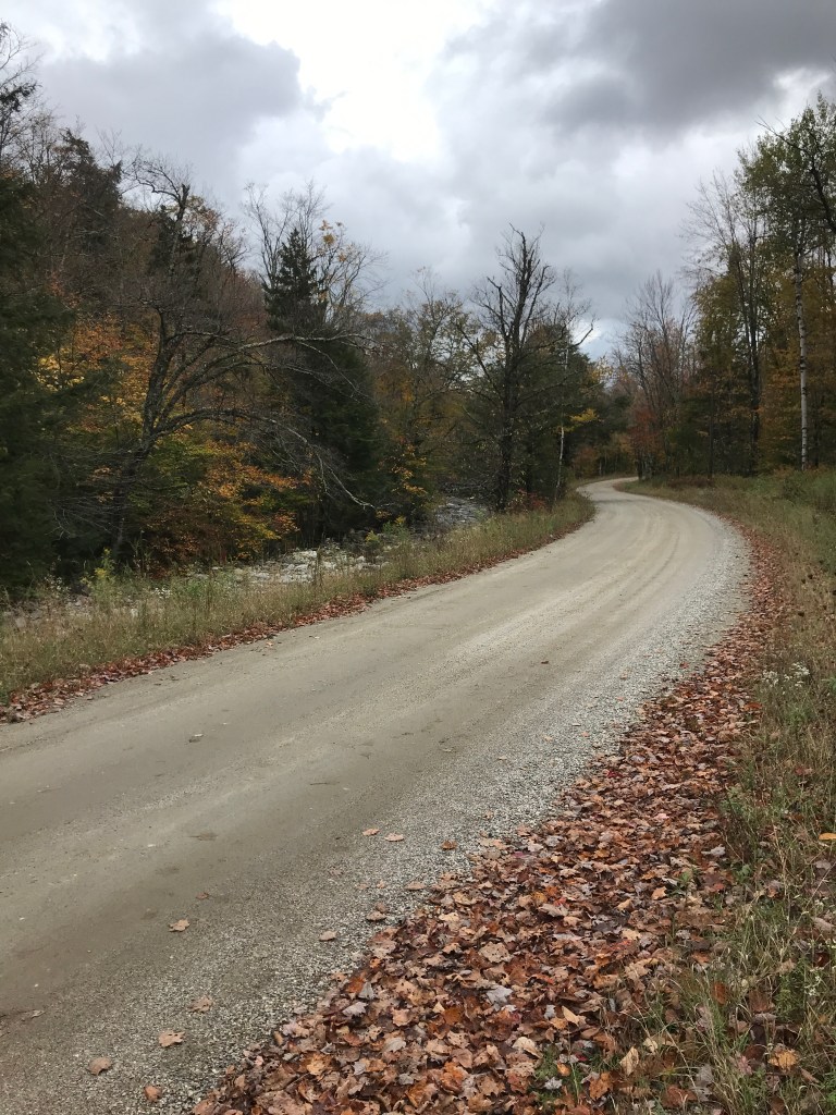
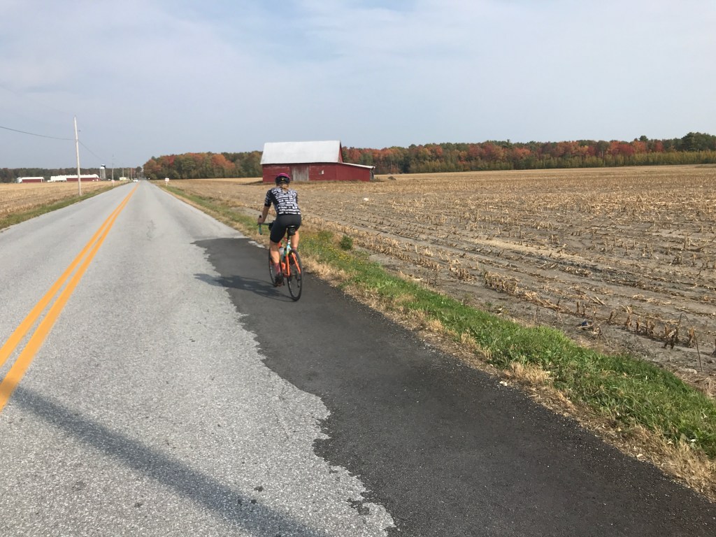
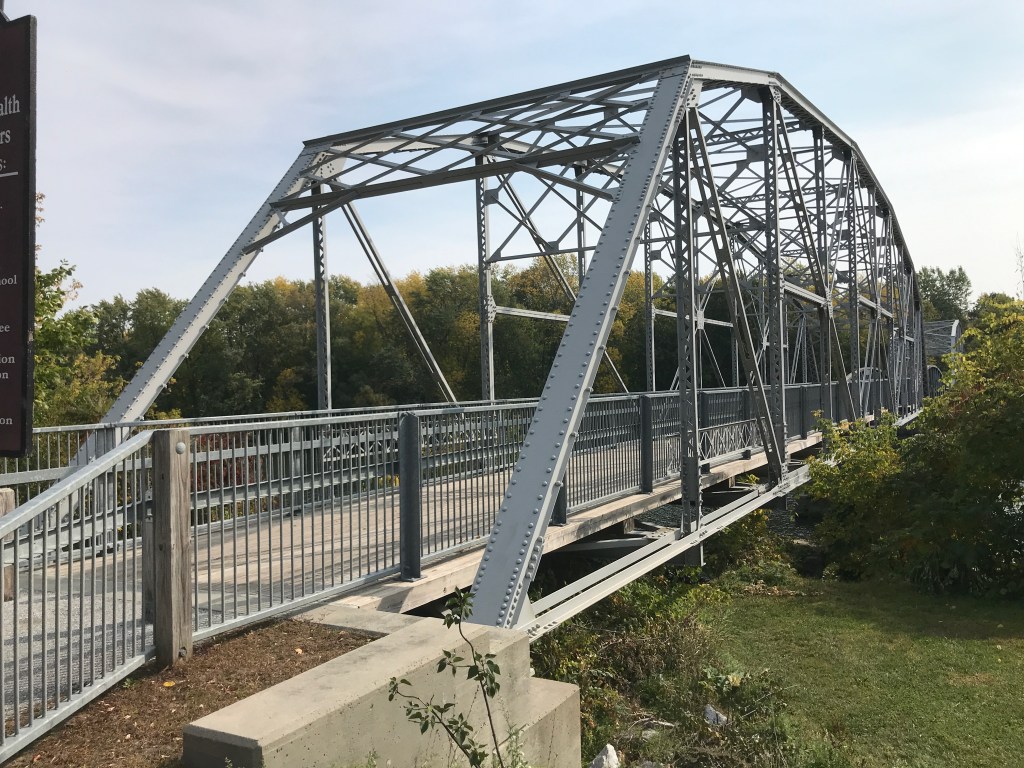
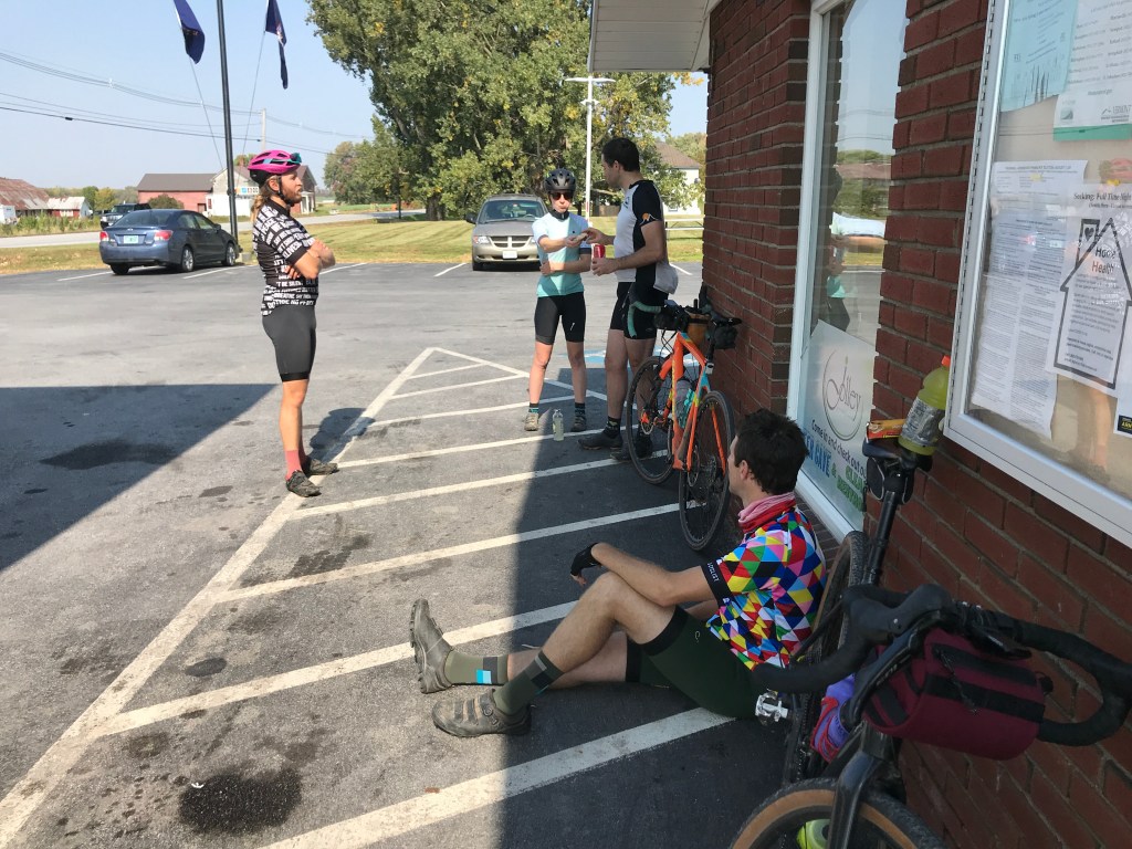
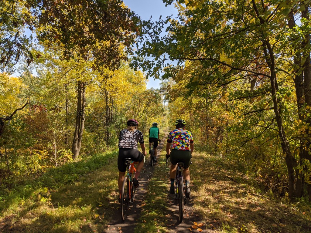
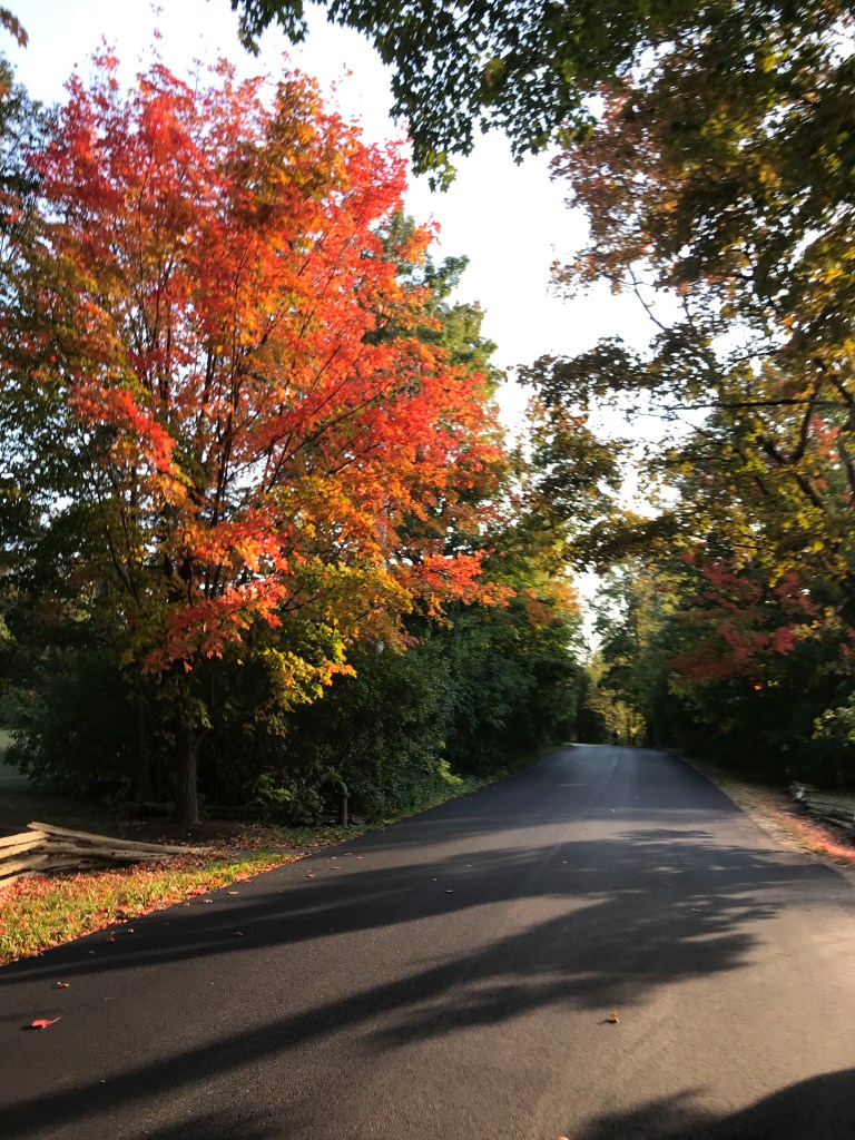
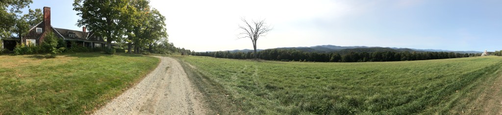
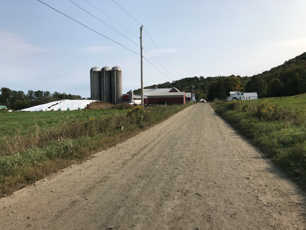
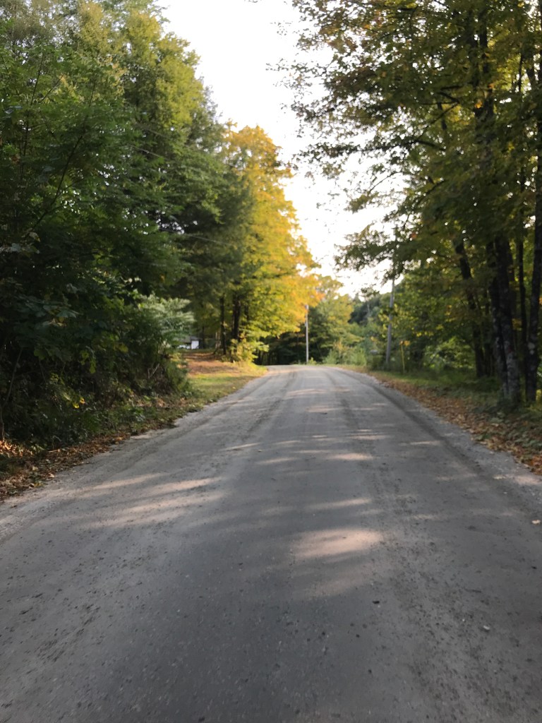
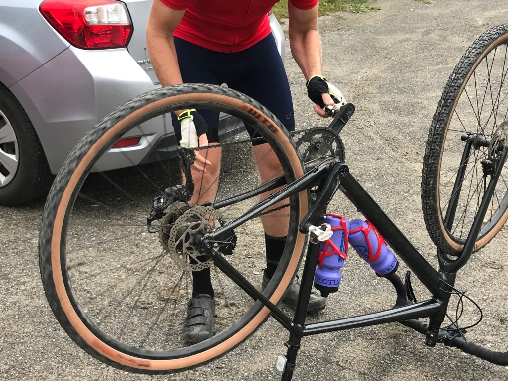
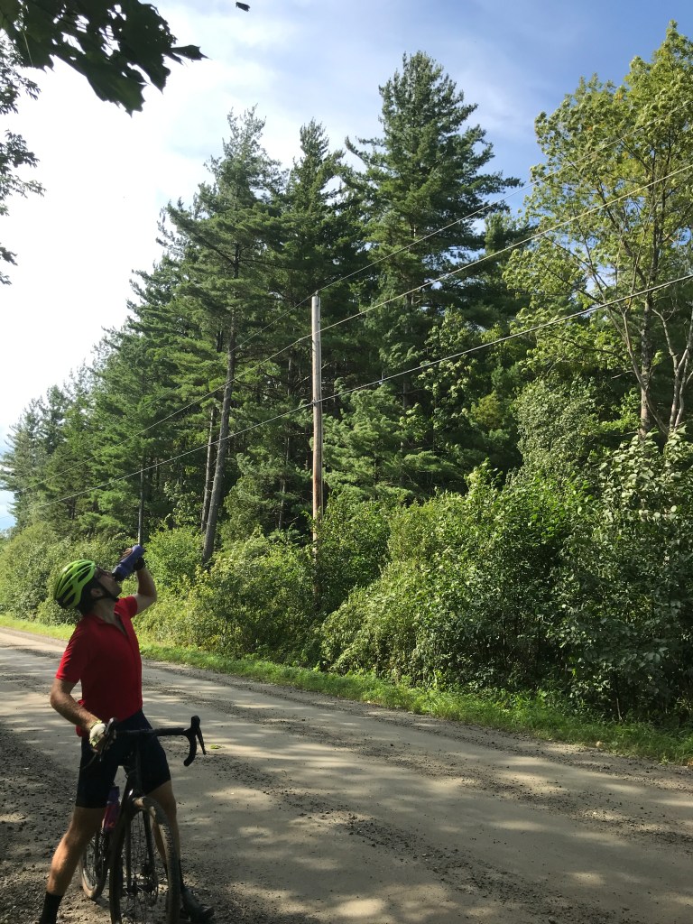
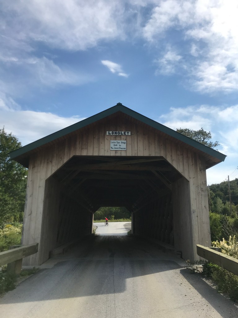
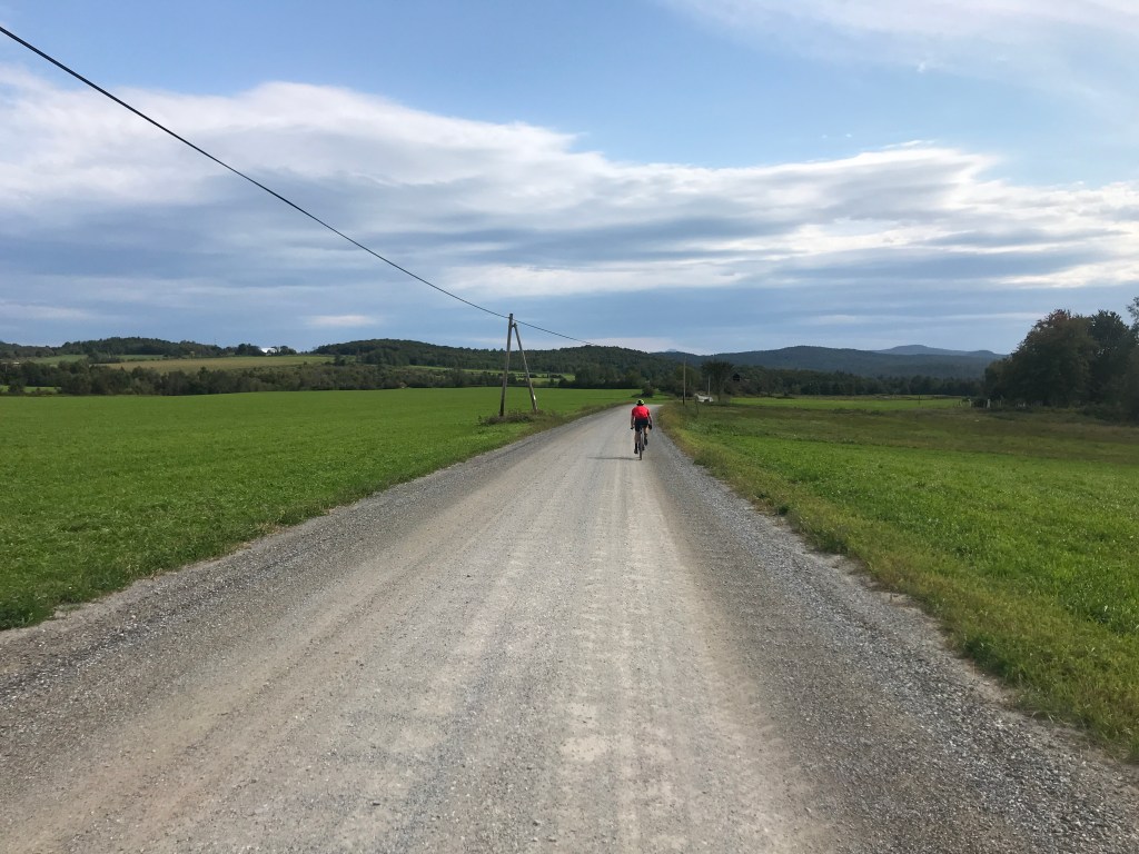
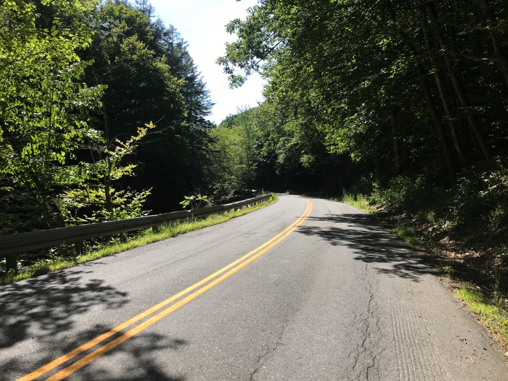
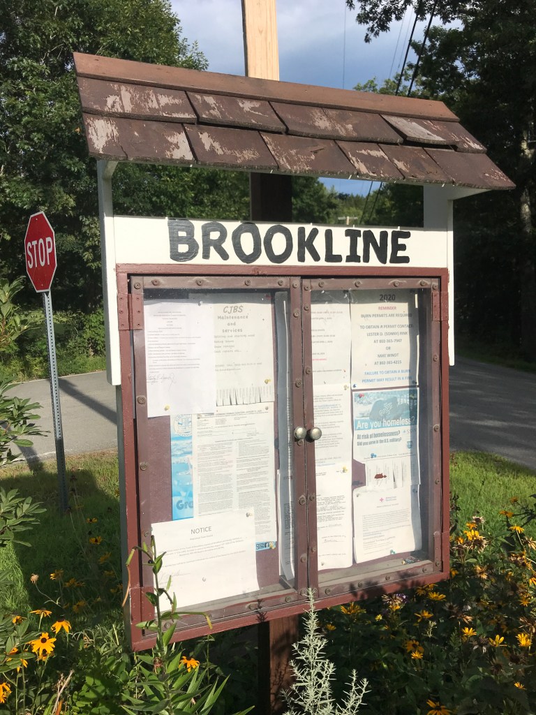
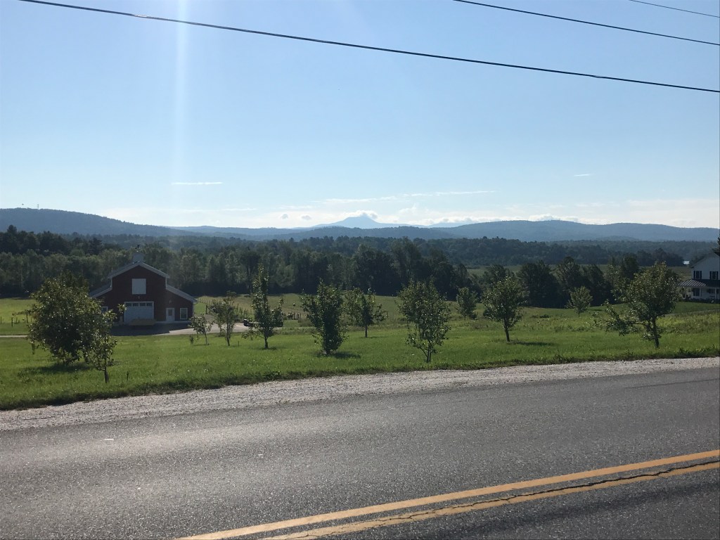
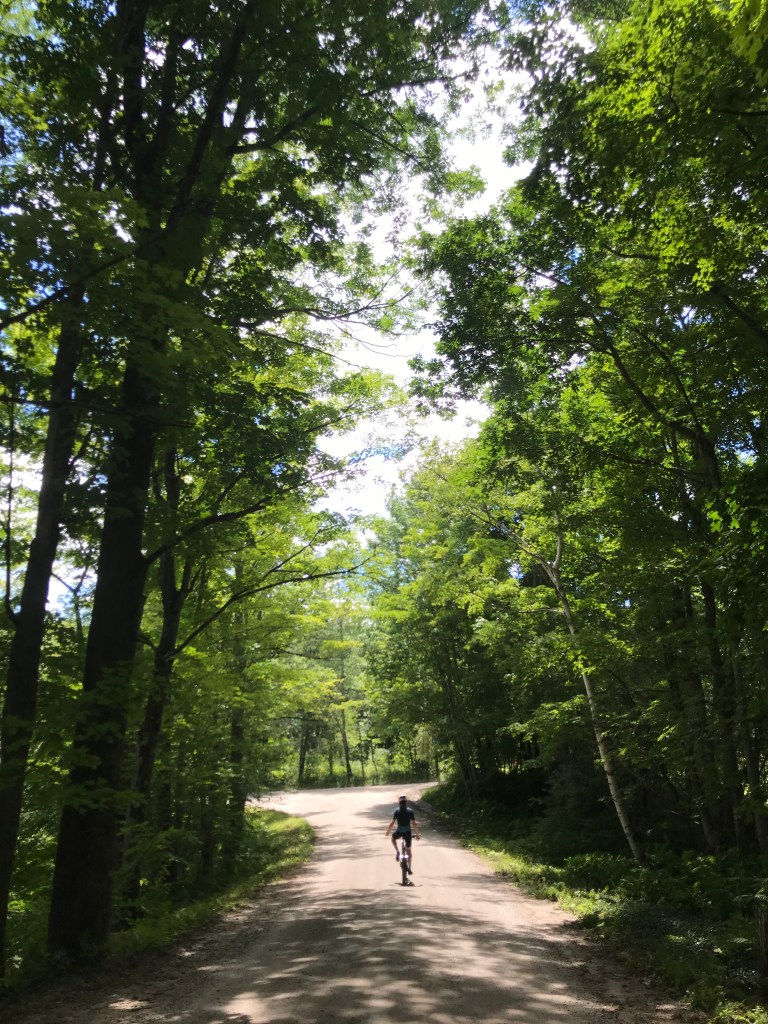
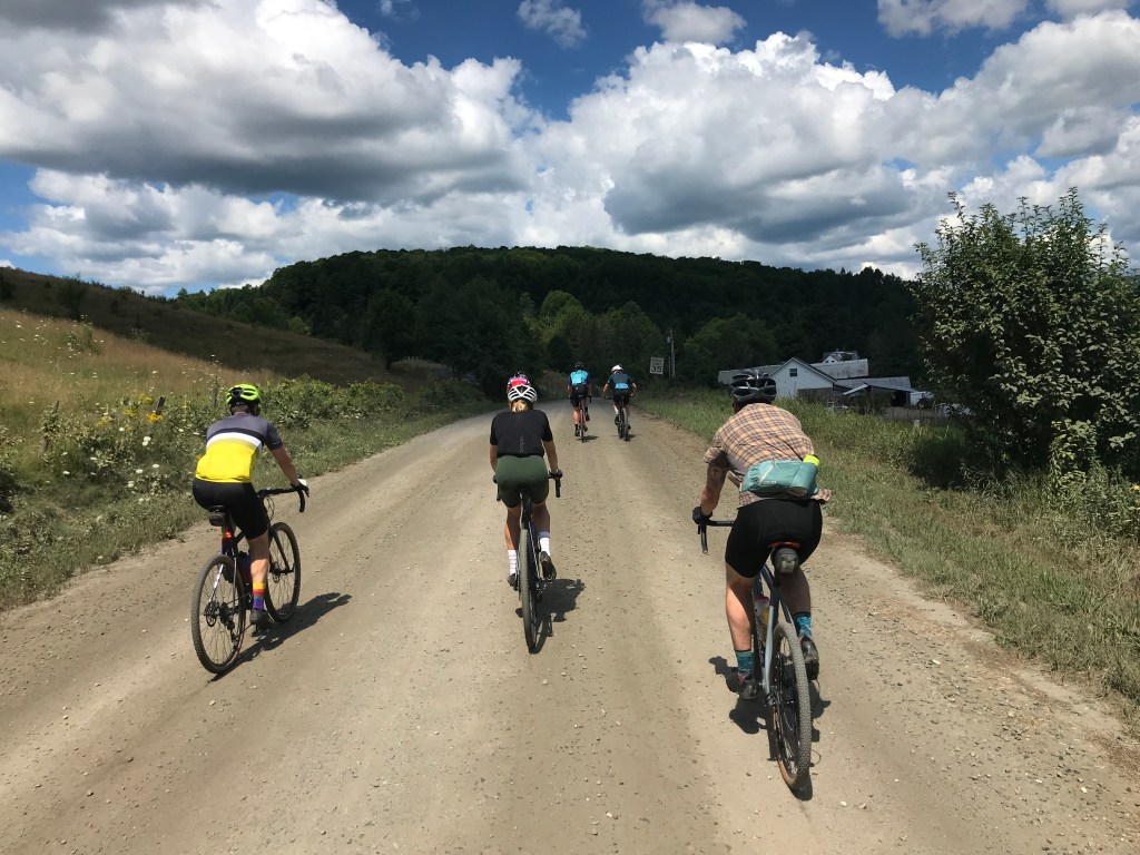
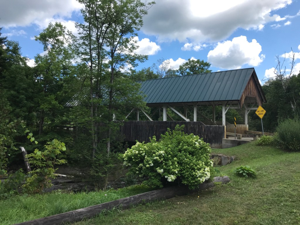
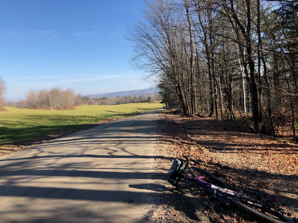
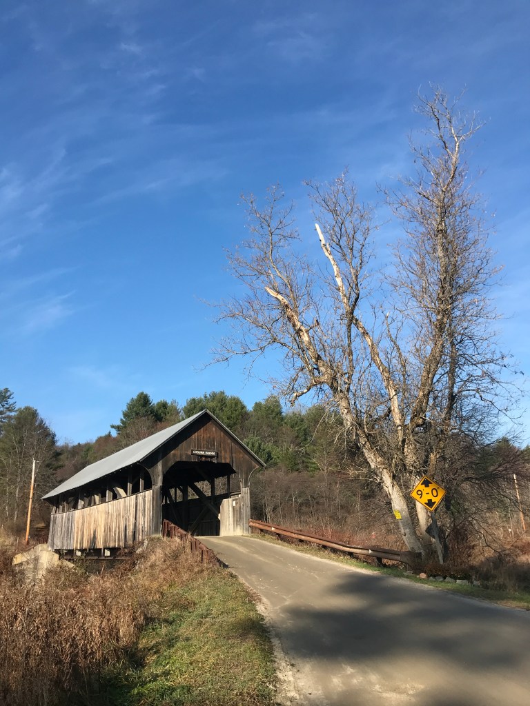
I’d kind of thought the Dirt 251 project had been put on hold until next spring. Temperatures were falling, Maddie and I had pretty much prepared the house for winter, and we got very decent snow! But as quickly as the inches piled up, they disappeared, fully succumbing to a streak of over 60° and sunny days. So it didn’t take much convincing to get me back out there. Because their route had somewhat fallen through, I also managed to get some partners for the ride too: Brad and Rafa. We all rendezvoused at the Montpelier Public Pool which has sadly been shuttered during COVID. I had chosen this route mainly for its easy access from home, but I’ve always had a soft spot for Montpelier too. It’s where Maddie was living when we first started dating, and it’s just a fun, historic, quirky, heartfelt, overgrown-town of a city. The weather still had a bit of a nip in the air, as the river valleys were still stubbornly holding on to their cloud cover (which often happens in fall). But wrapped in warm layers we were hoping to soon shed, we began our trip. The route I’d planned included some of the mountain bike trails accessed just on the other side of the river from the parking lot. Sadly, they’d already been closed for the season, so we needed to turn around and take the alternate route: North Street. On our way out to the main road though, Brad was battling his front derailleur. It had been sneakily getting worse and he was now stuck in the little ring. He tried valiantly to fix it with help and hints from me and Rafa, but he decided to throw in the towel and with a quick goodbye, wished us well. Luckily, he was able to get a ride in that day on his road bike, but he was sorely missed. So onwards Rafa and I rode to take on North Street. It wasn’t my first date with this steep street: Maddie and I had taken it on during a twoday tour last year. It took quite the effort then, so I was glad to not have loaded panniers and a heavy steel frame underneath me. We pushed up and up, eventually breaking into the sunshine. We cruised along and down the rollers of East Montpelier and made our way to Route 2 crossing the Coburn Covered Bridge which spans the main branch of the Winooski River.

The chilly, spooky starting scene.
Making our way up and out of Montpelier via North Street.
At the intersection of Sparrow Farm Road.
Rolling downward.
The Coburn Covered Bridge.

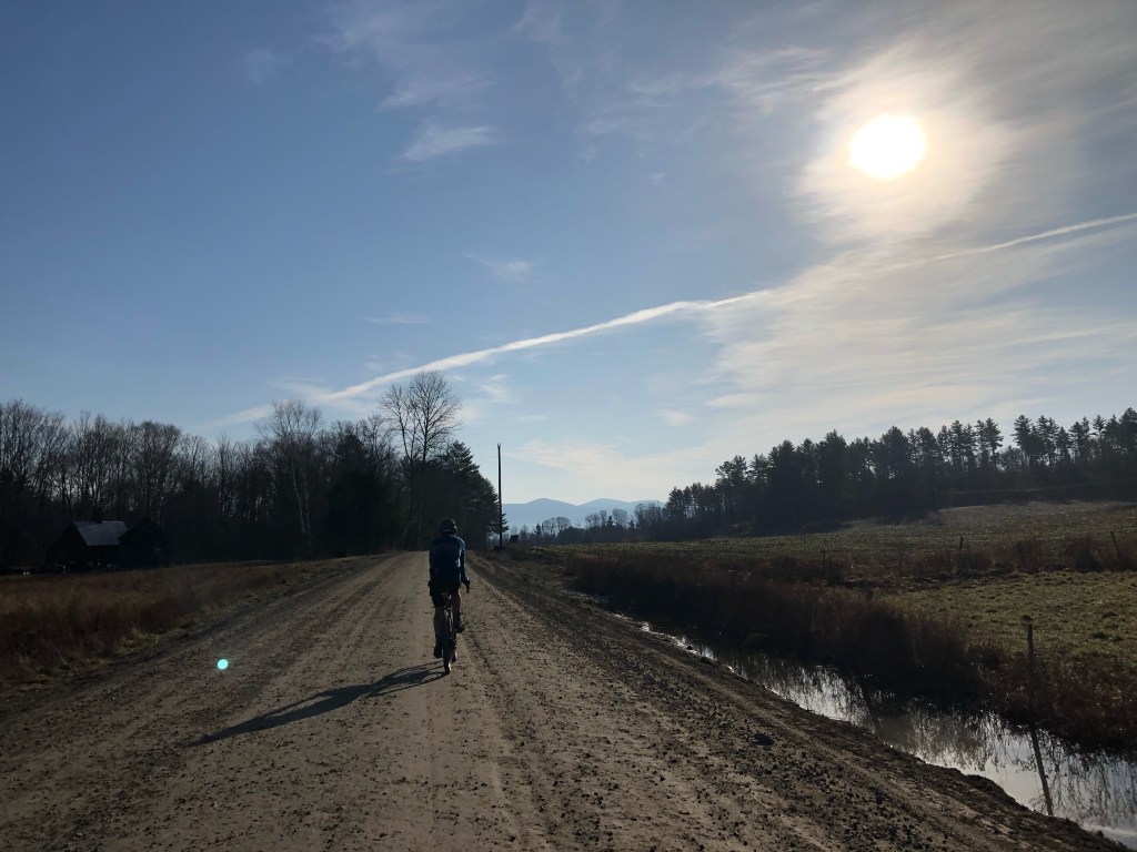
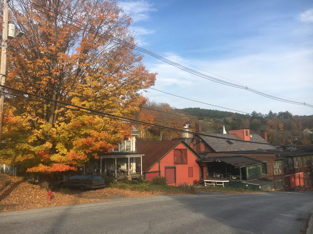
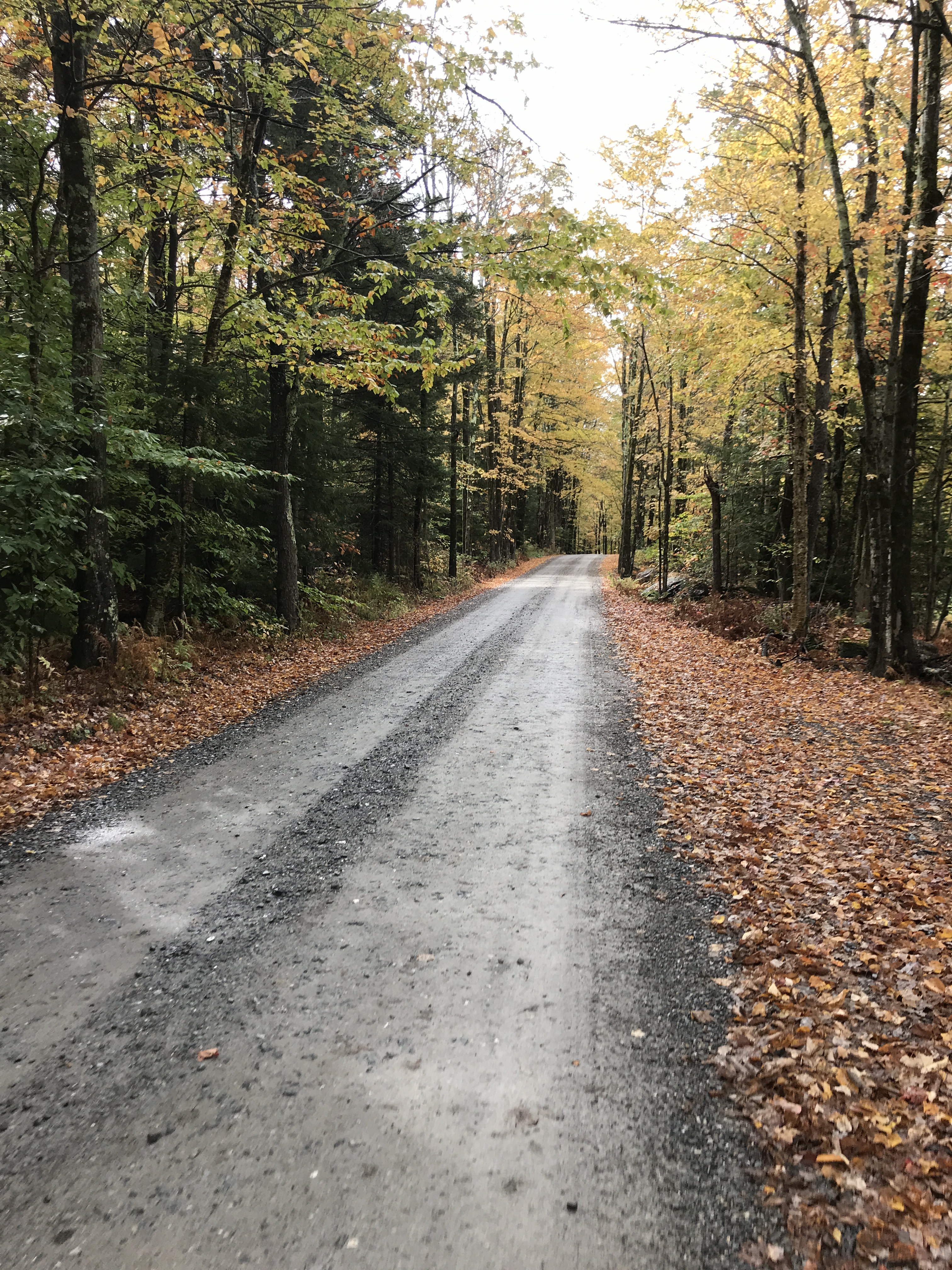
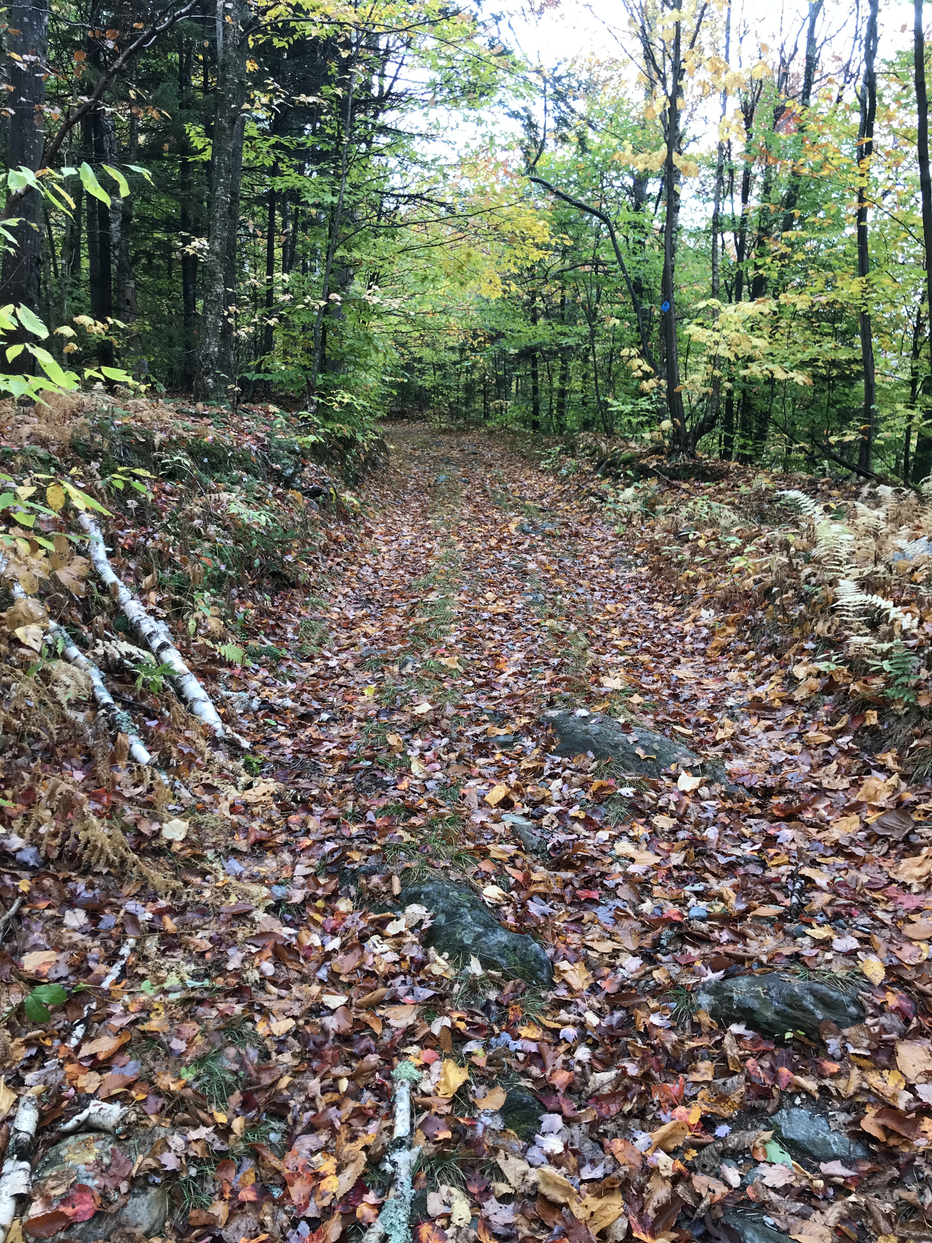
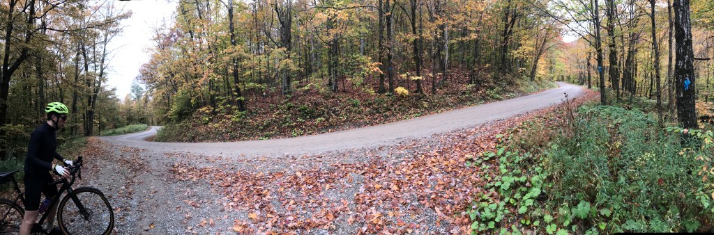
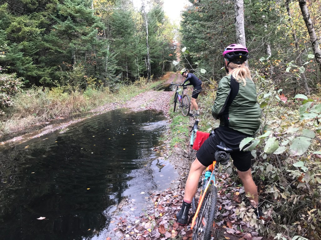
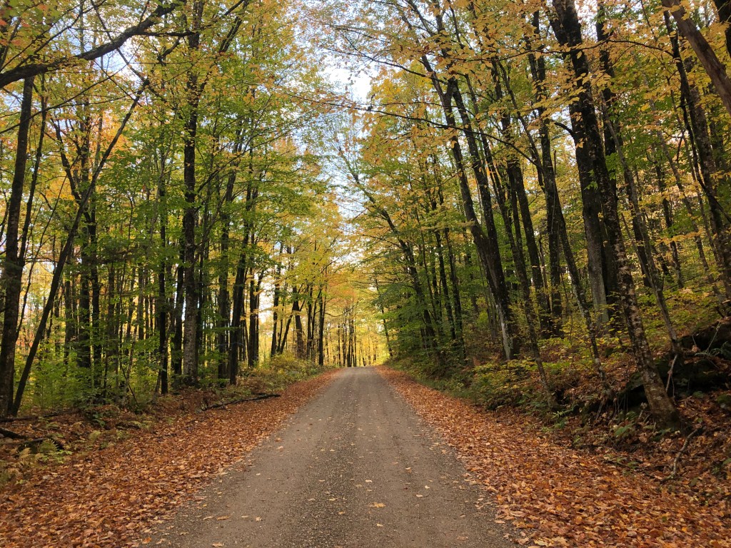
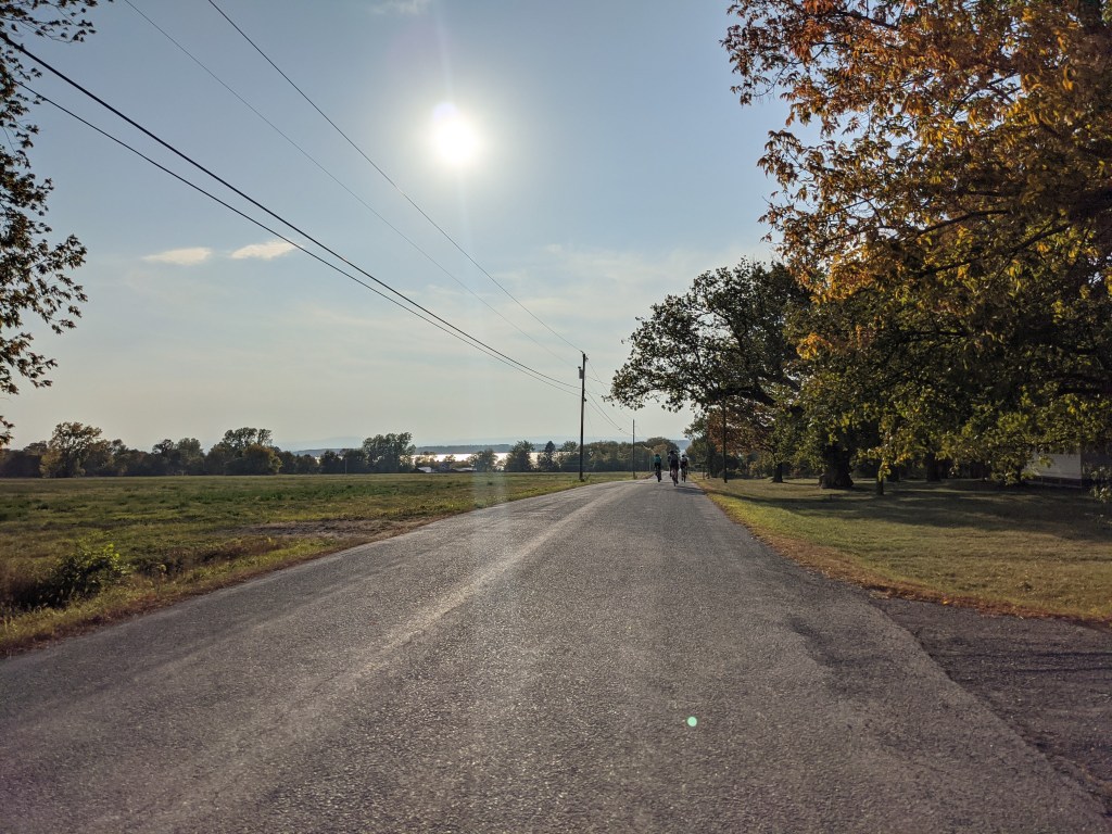
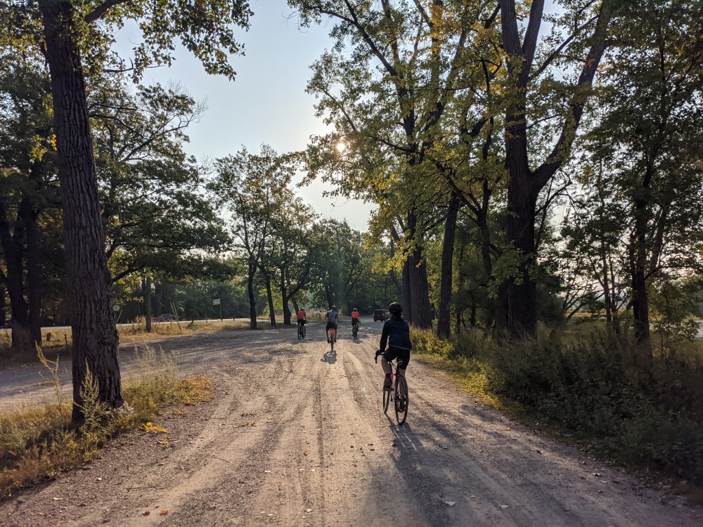
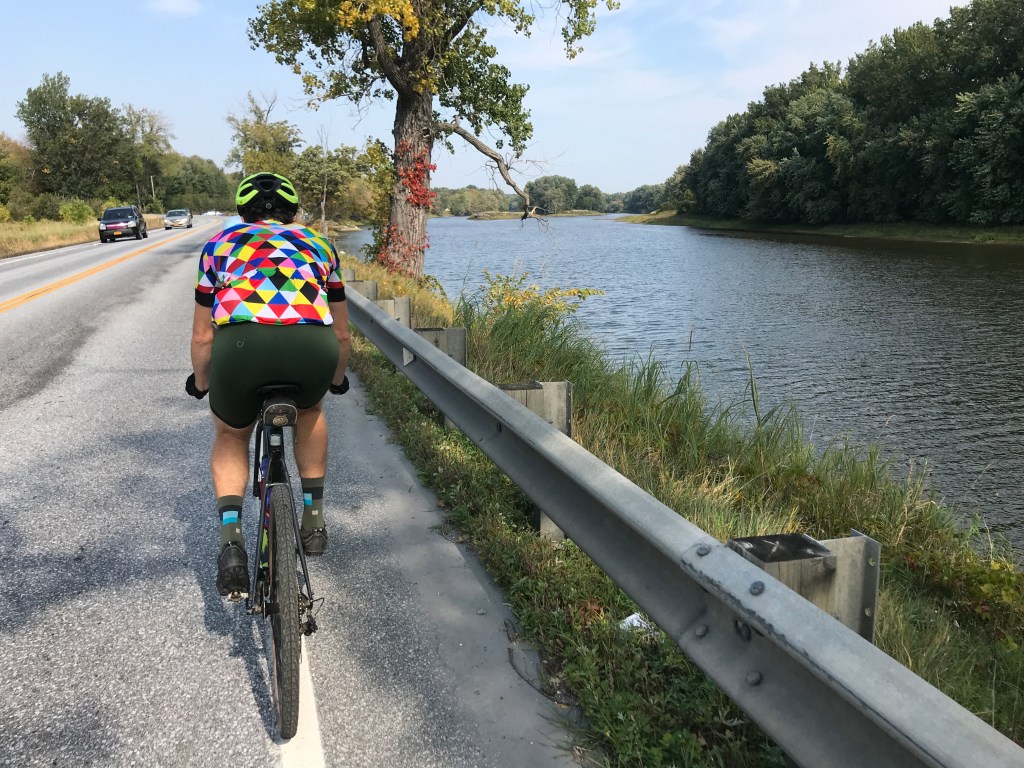
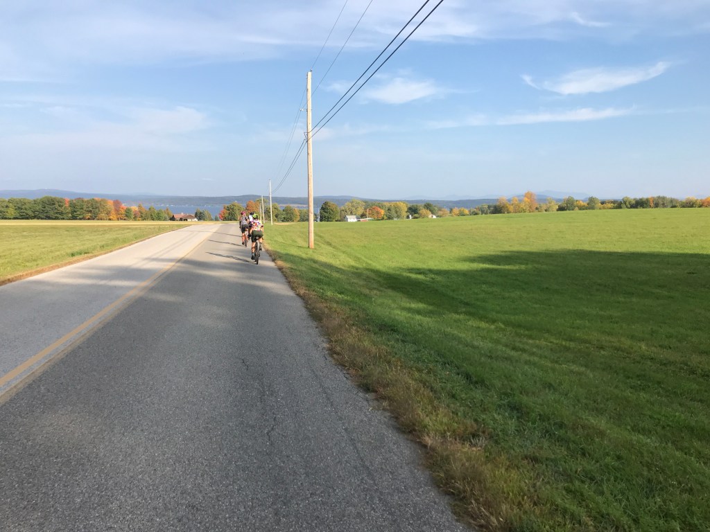
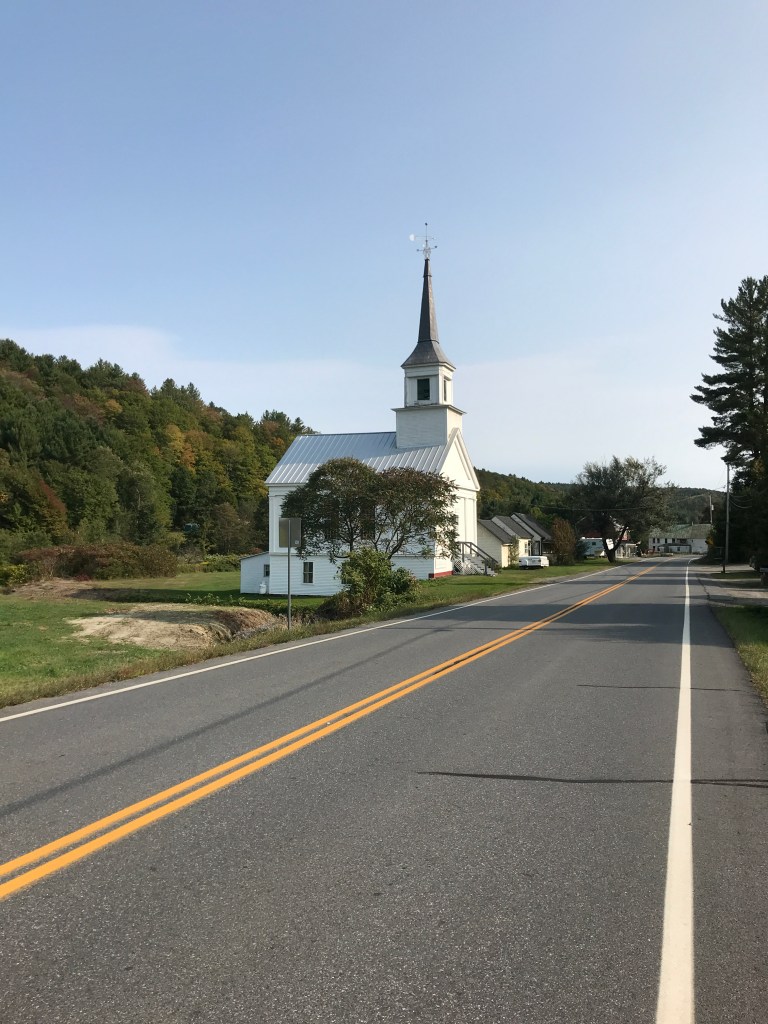
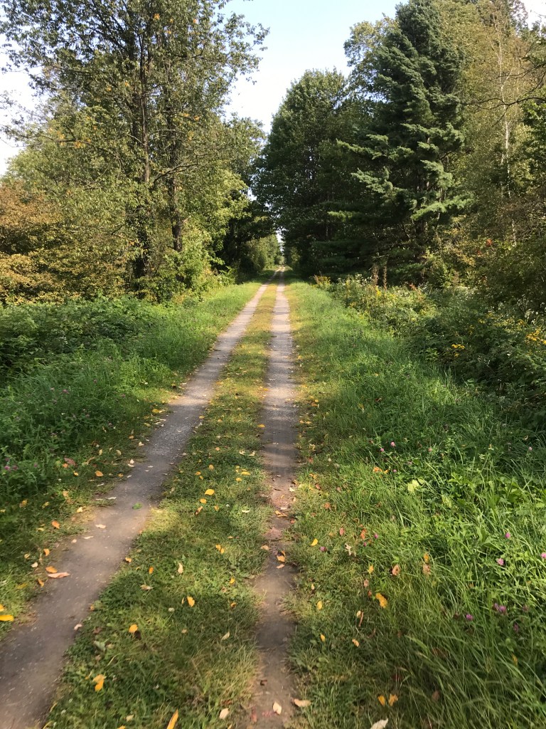
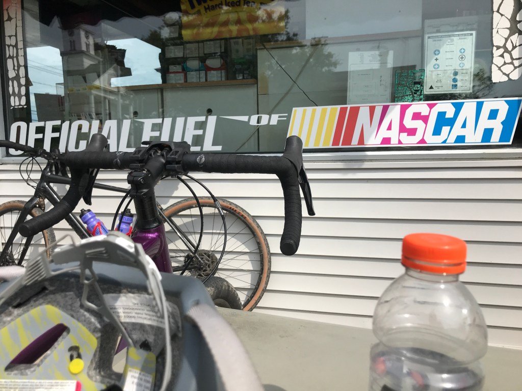
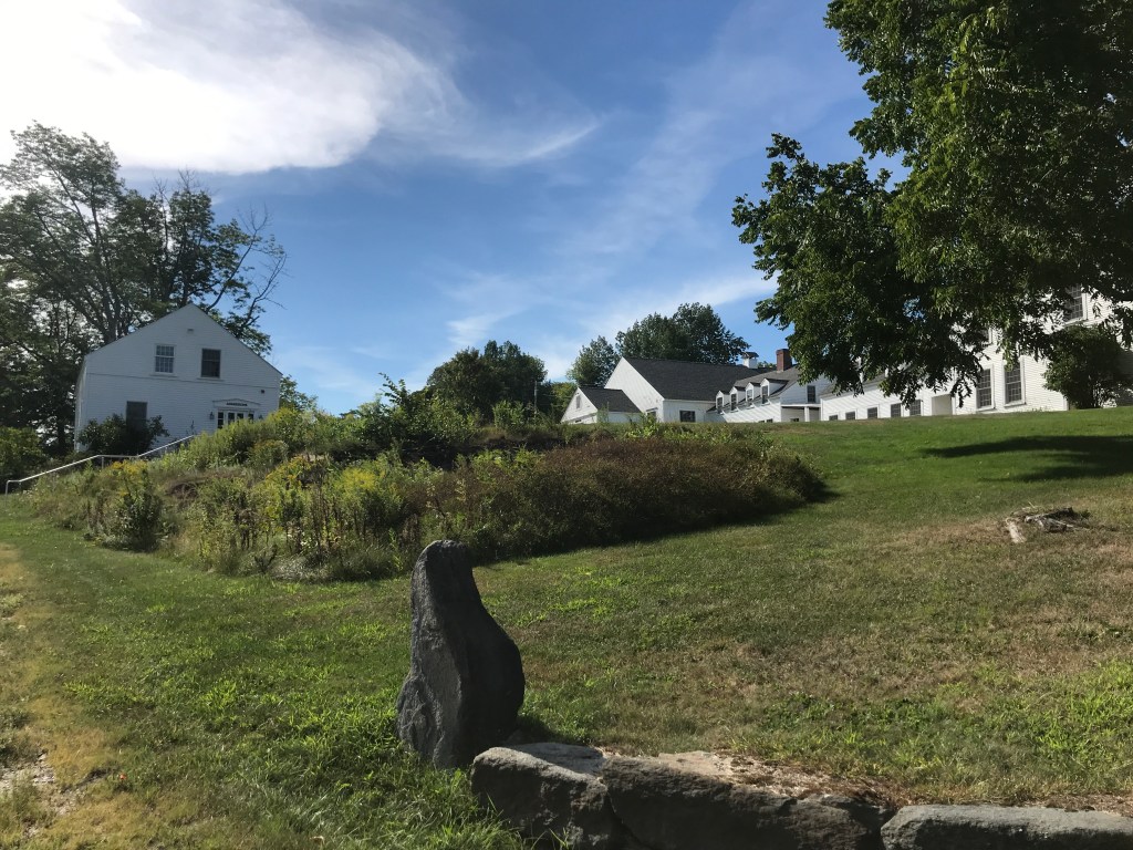
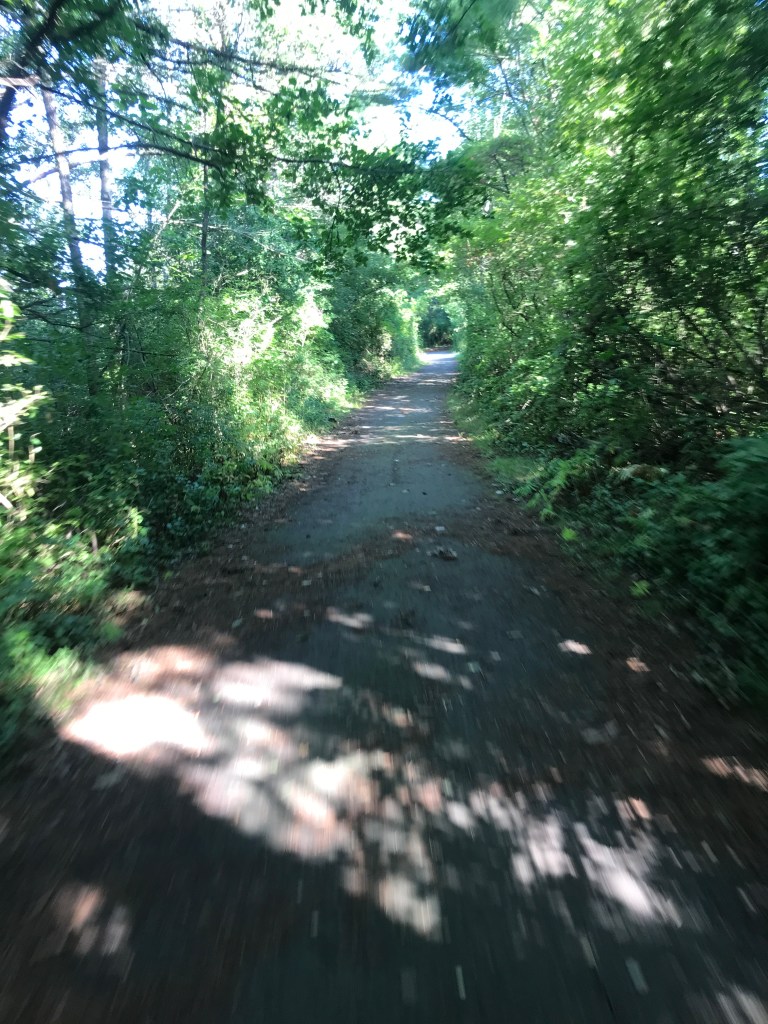
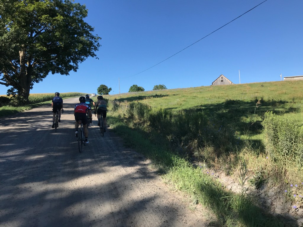
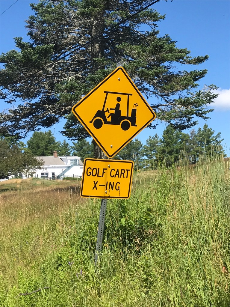
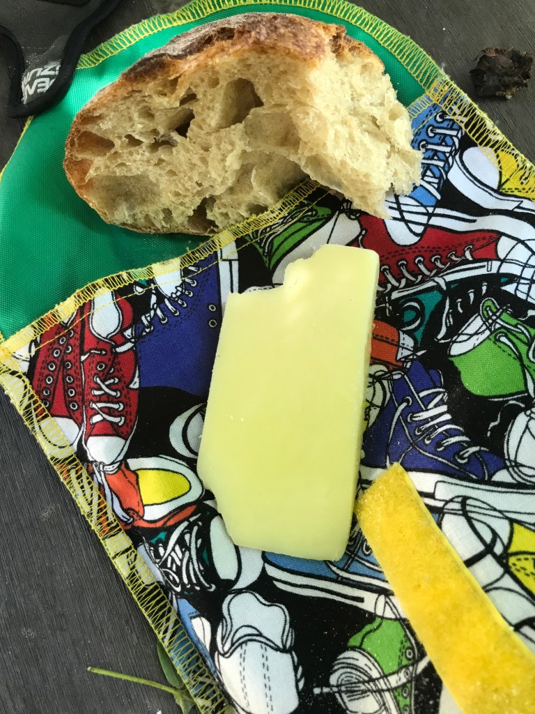
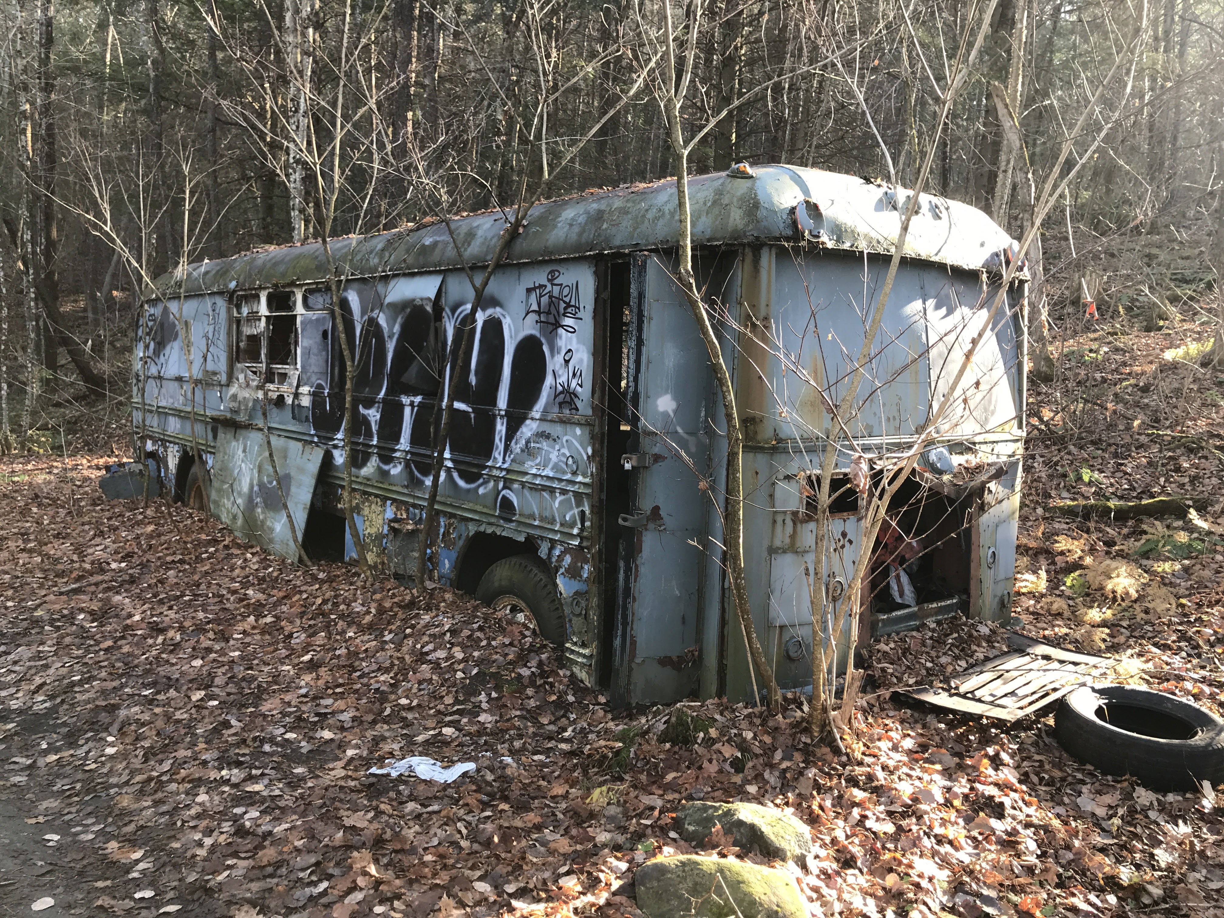
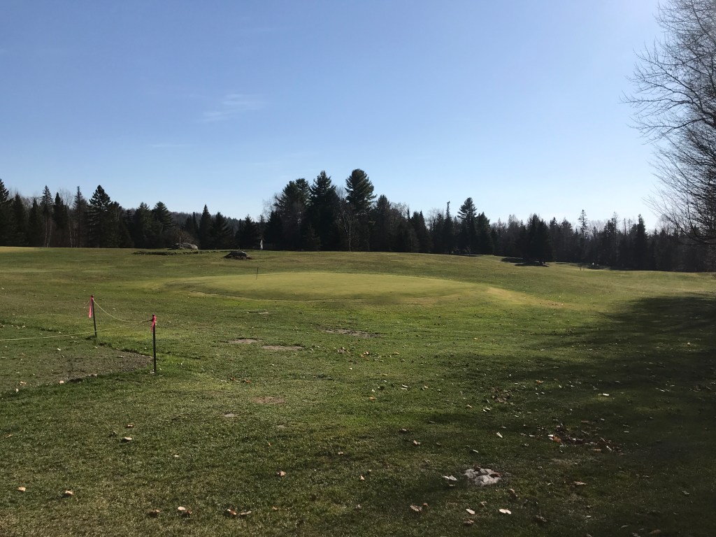
We took a left on the buzzing, busy road, and were headed to Plainfield. We quickly reached Goddard College, a school now mainly consisting of low-residency programs, which sits on the outskirts of town. We passed the local library and the Opera House, taking a right on Main Street to speed by the local Co-Op and Positive Pie Pizza. We were then given a break from traffic by starting a rail-trail that begins in Plainfield. It follows an old railroad bed that was laid out to accommodate the Montpelier and Wells River Railroad. The railroad was developed in the early 1870’s and offered both passenger service and freight including dairy, poultry, logging, wood products and granite. The line was in service until 1957 and you can see a ton of pictures thanks to the Plainfield Historical Society. We very much enjoyed the double track which smooth overall, and punctuated by only sporadic mud and the occasional abandoned bus. We took a wrong turn at one point where the old rail bed had become someone’s driveway and the trail diverts around their home. But we were soon back on the trail and worked our way down into Marshfield where we took a break. I had hoped to pop into the Rainbow Sweets Bakery, a spot I’ve driven by many times, but never stopped. Sadly, they’ve closed (temporarily I hope) due to coronavirus. So our snacks were not nearly as exciting as they could have been, but they fueled us for the climb up towards Cabot. The town of Cabot is of course associated with the delicious cheese manufacturer which is the standard bearer in a state known for its cheddar. It began in the town when a collective of 94 farmers pooled their resources (and milk) to produce cheese. They’ve grown from there to today topping $350 million in sales per year and they are still organized as a co-op (and a B Corporation to boot)! We didn’t actually make it into the village of Cabot. Instead, we got to see “Lower Cabot” after dipping down Ducharme Road to Route 215, only to climb back up the impressively steep Blodgett Road. It pushes over 21% grade at points according to my GPS. That’s pretty darn steep. Oh by the way, I bought a bike computer. It’s a Wahoo Elemnt Bolt I bough off my friend Rachel. It’s been great for navigating and geeking out on stats both on ride and off. Anyway, we enjoyed the Class 3.5 terrain of Blodgett (more so once it leveled out). Then we popped onto East Hill Road and stopped next to the 9-hole Woodbury Golf Course to eat a bit of lunch.

Along the rail trail.
Too bad it was a Sunday.
To the left: the beautifully named Under Orion Farm and to the right: the mountains around Groton State Forest and the area’s state parks.
Old signage.
At the top of Blodgett Road.
FORE!

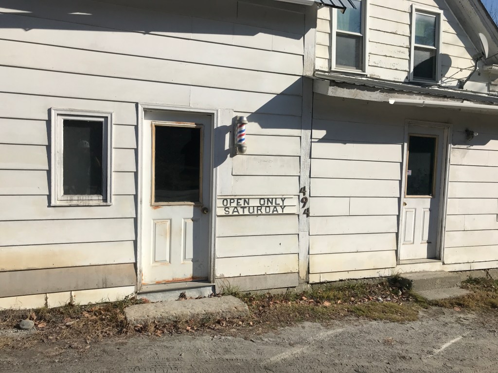
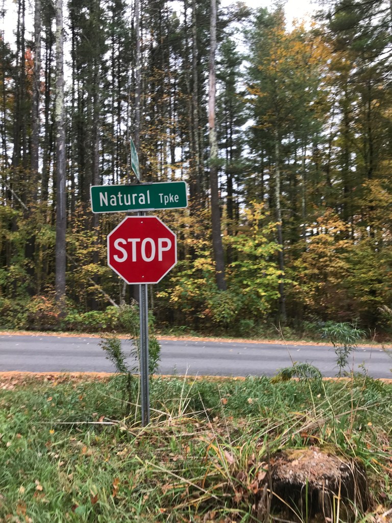
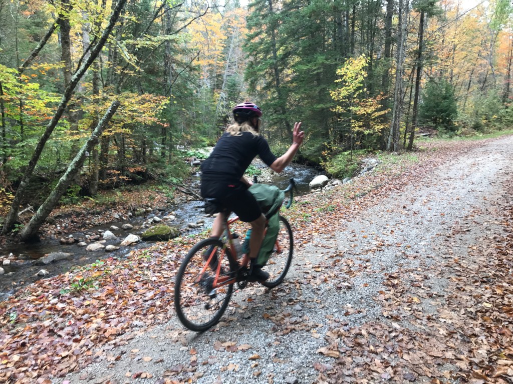
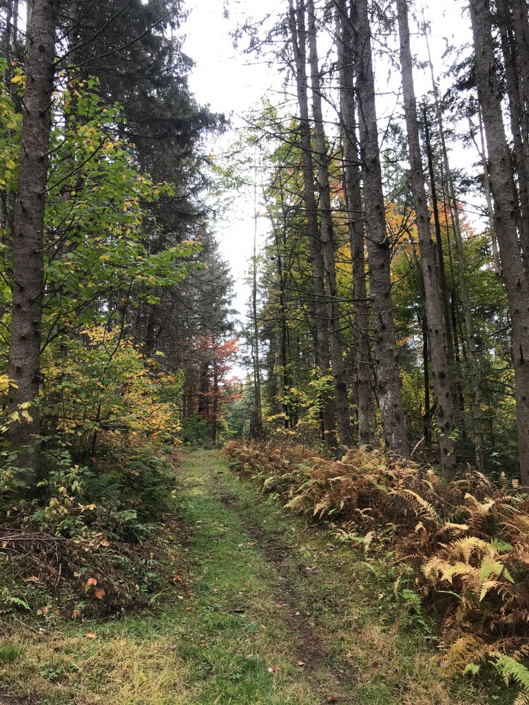
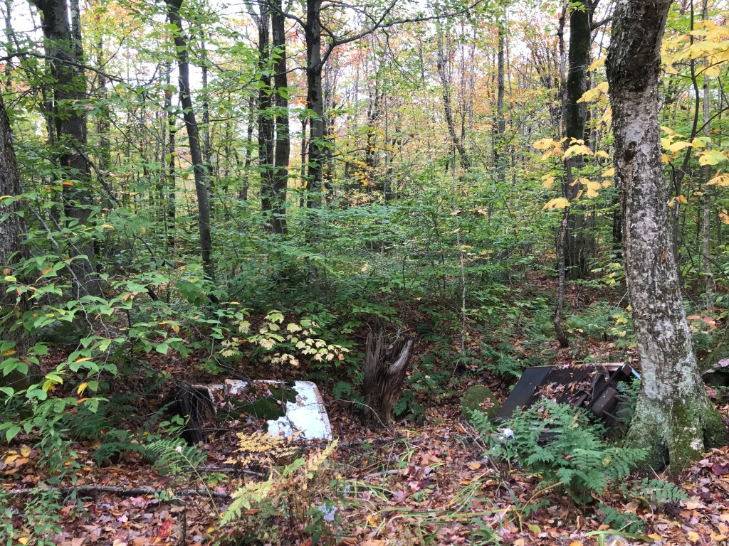
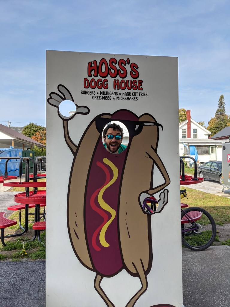
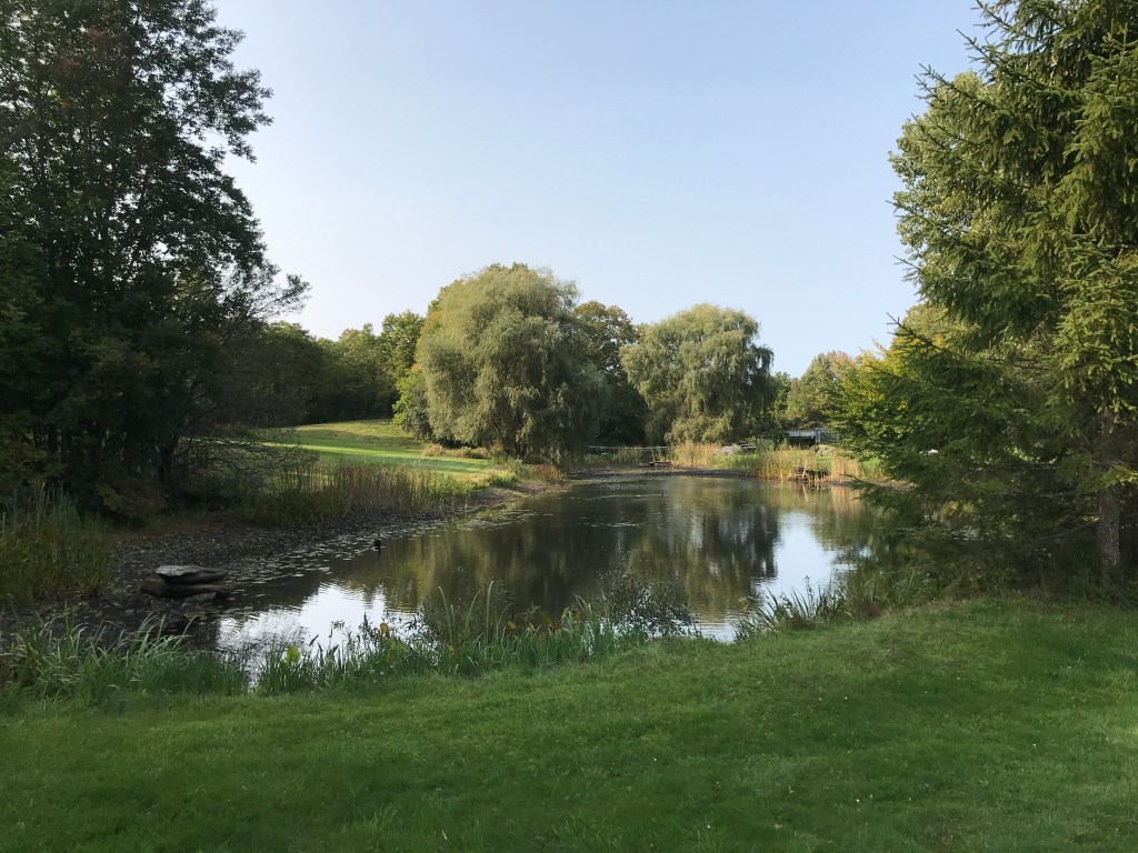
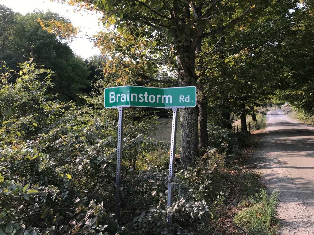
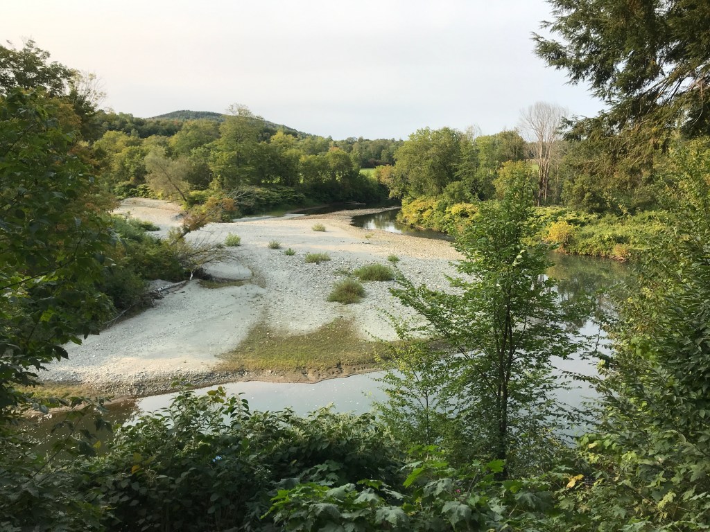
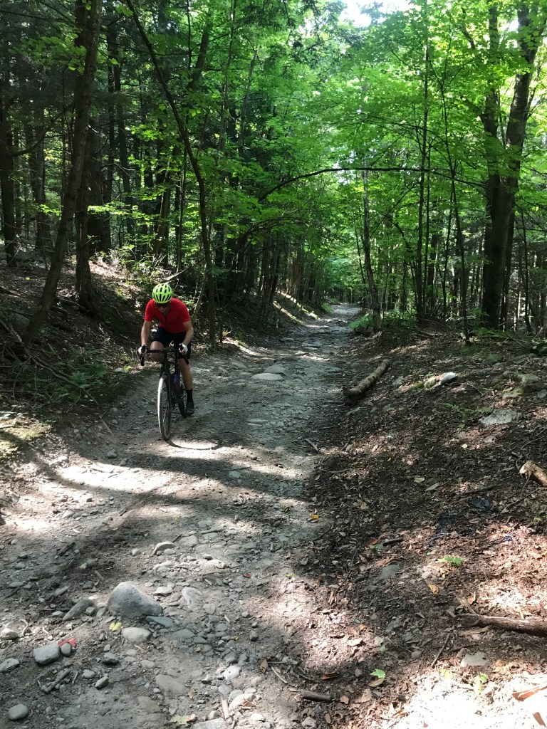
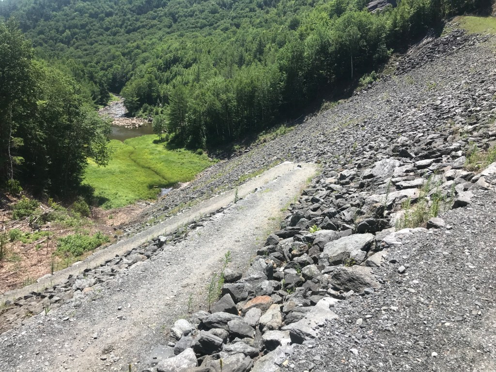
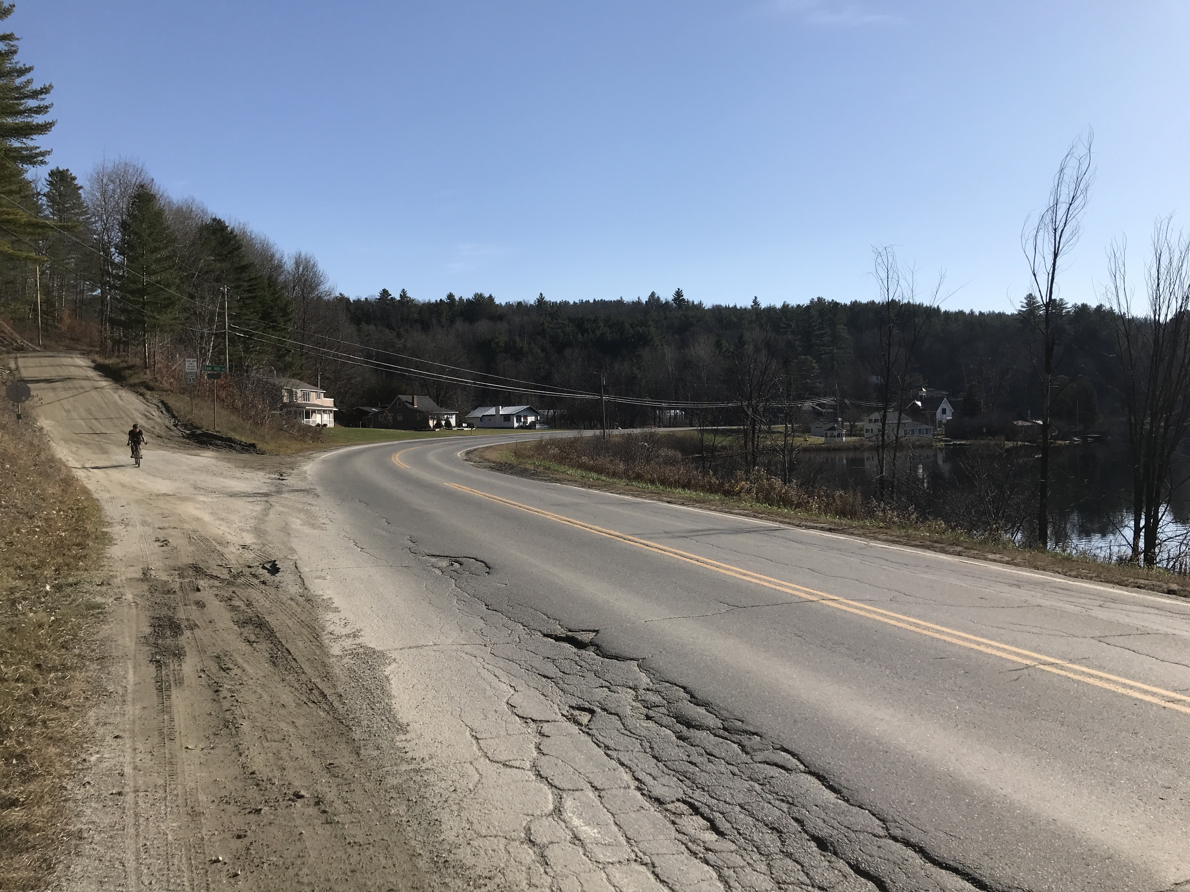
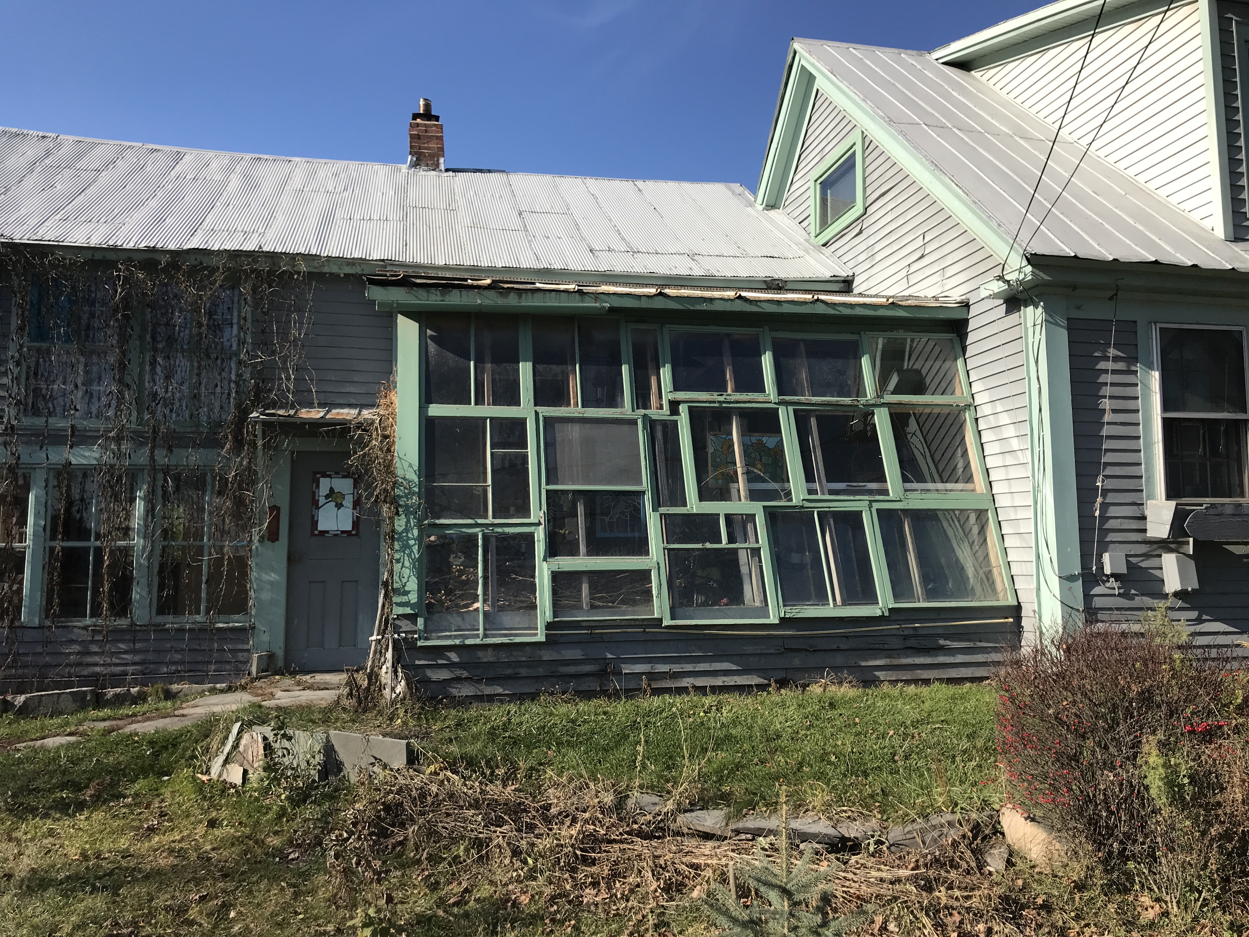
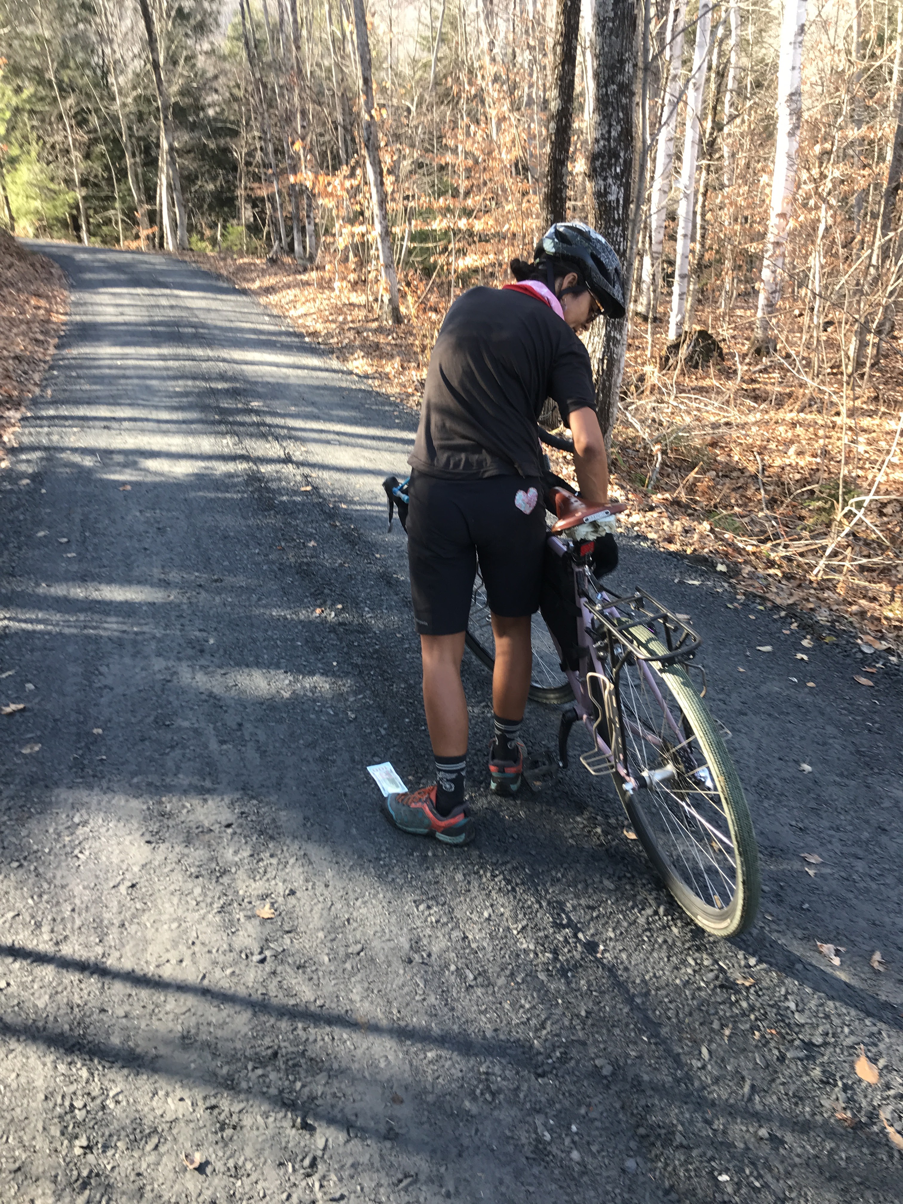
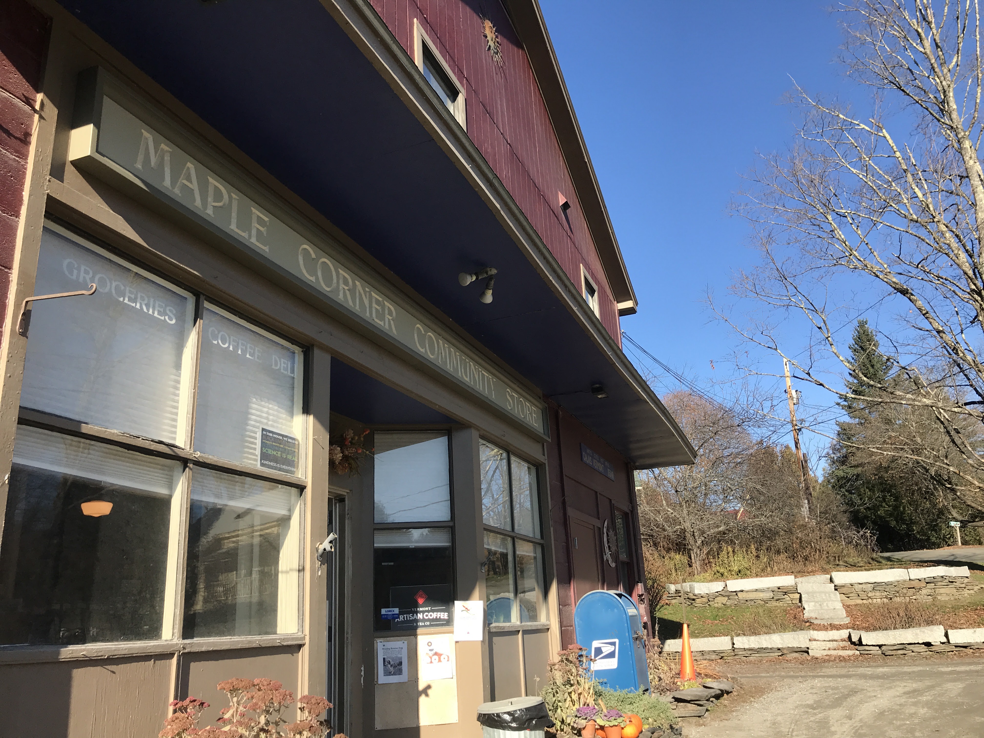
We had another cruise down to Sabin Pond and got to enjoy the sights of South Woodbury. Woodbury is a fairly remote town without much of a village. But South Woodbury was clearly an old mill development, and we passed a series of houses clustered around an old mill pond. From there we hit a series of Class IV sections I hadn’t fully expected. Nothing crazy, but I was glad I had an orange vest to throw on, since though it wasn’t yet rifle season, there were still plenty of folks in the woods with deadly things. Scribner Road and Log Town Road were both ridable for the most part, but presented a challenge. Right before to got back onto the main road and right near a Shamanic Temple, we happened to see a few scraps of paper scattered on the gravel of the driveway. Getting closer, my heart rate picked up and they appeared to be currency: one hundred dollar bills!!! I picked one up and it felt kind of right, but upon closer inspection, there was Chinese script on them and they were clearly fake. Even still, we were quite confused and we each decided to keep one as a souvenir. We then continued southwest crossing into Calais. By the way, it’s pronounced like the things you get on your hands or feet, not the french way that rhymes with bidet. We were working our way towards Maple Corner, a small settlement in Calais known for its General Store. The building is more community center than store since it also houses the post office and has a bar/performance space called “The Whammy Bar” in the back. There aren’t many performances going on, but luckily for us, the store was open when we got there. As we walked in, there was a gentleman who was not wearing a mask who entered the store right in front of us. The woman working the counter kindly reminded him that masks are mandated by the state. He then asked if they could give him one, and she explained they had some for sale. He then half-committed to buying one, but then continued to shop. After a minute or two, he went to pay and, on second thought, declined to buy a mask adding (and this is a classic), “There’s no way I got the covids, I just got tested!” Even if he had just been tested (which I doubt) he clearly doesn’t understand that a test only means he didn’t have the virus present when he was tested, and that he could have picked it up since then and currently be spreading it. Anyway, Vermont is currently breaking daily case records and though we’re doing better than some places, we’ve gotten complacent and are headed in the wrong direction. So: wear your dang mask!

Reaching Sabin Pond.
A perfectly ramshackle DIY passive solar wall, in South Woodbury.
The only real patch of snow we saw.

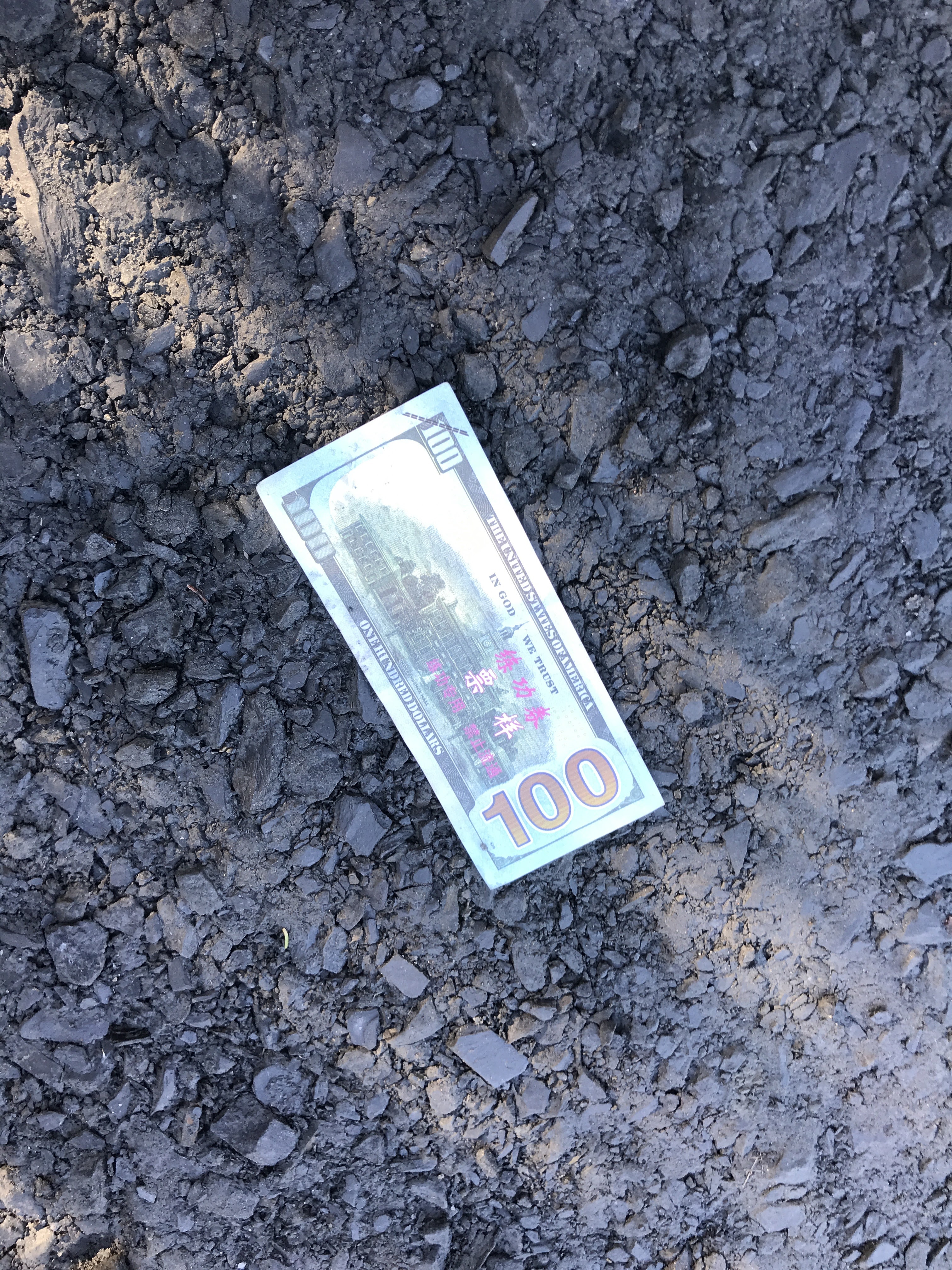
We’re rich! Oh wait…

Yup, that checks out.
Maple Corner: a slice of Vermont.

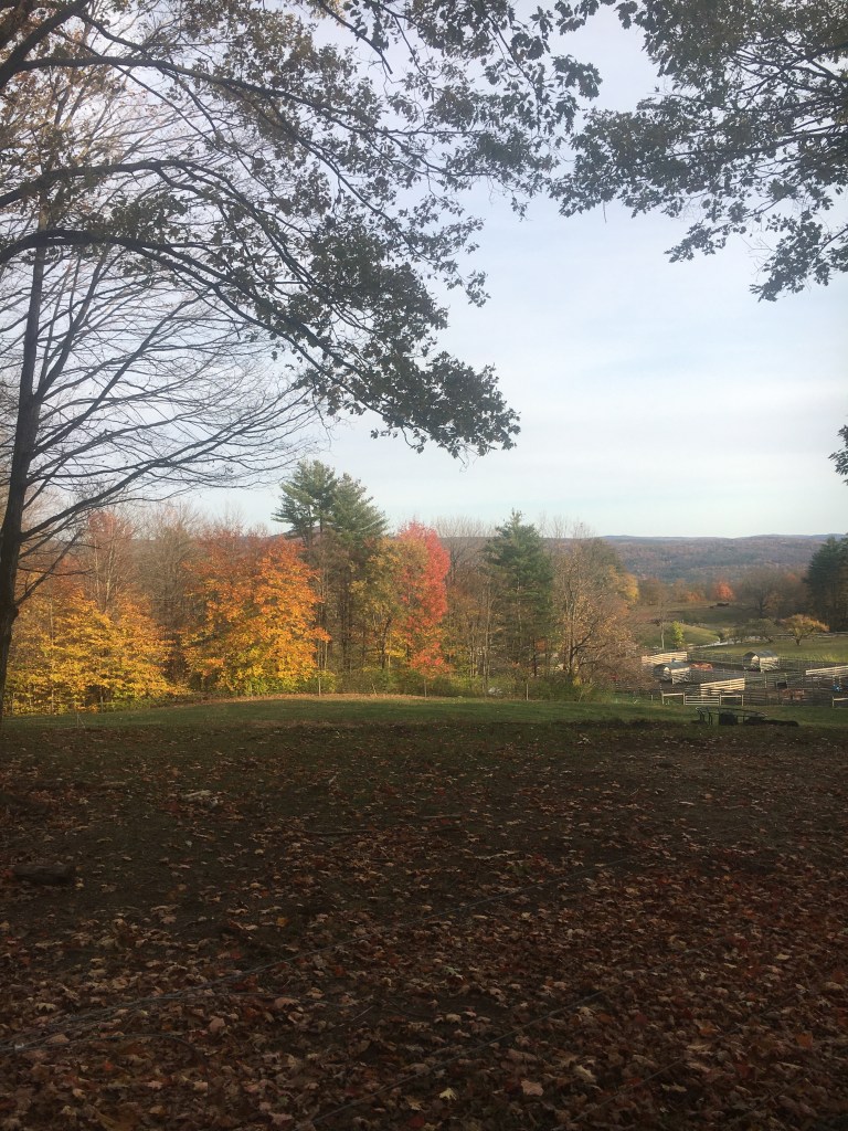
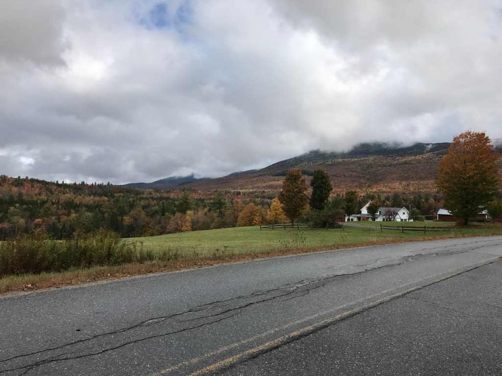
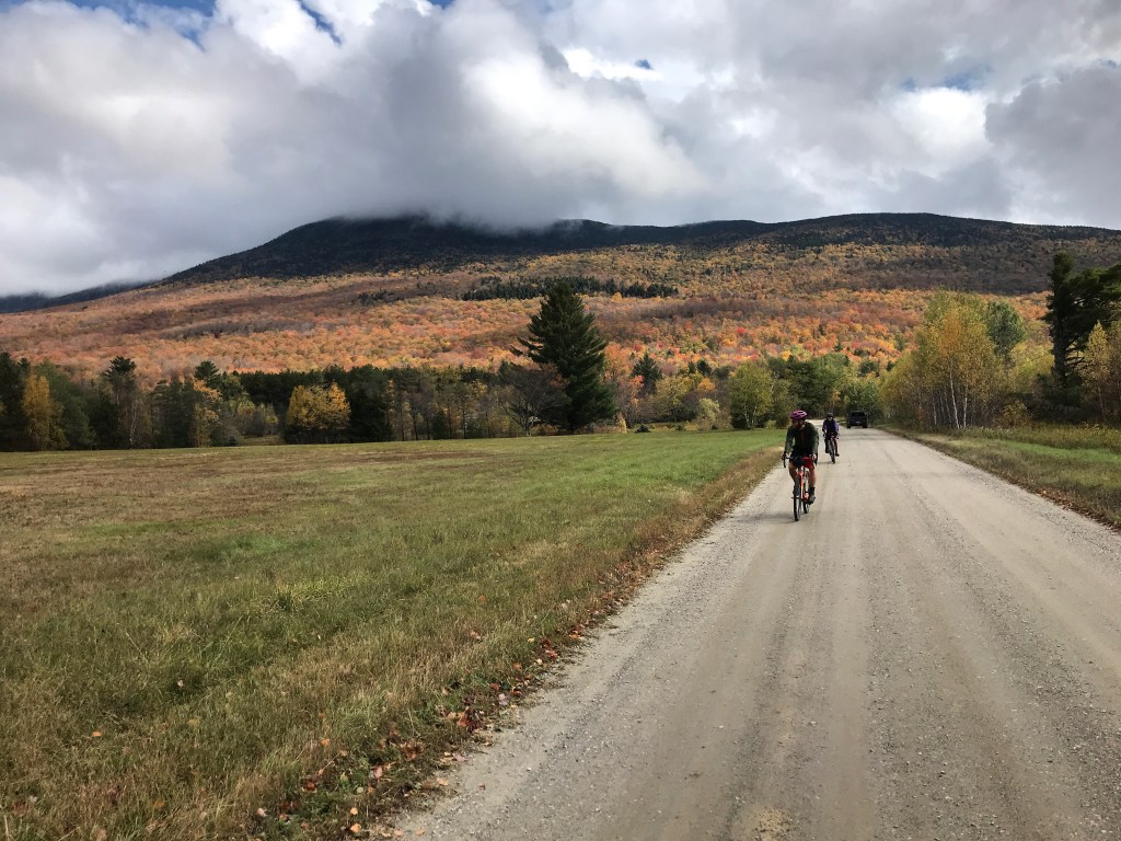
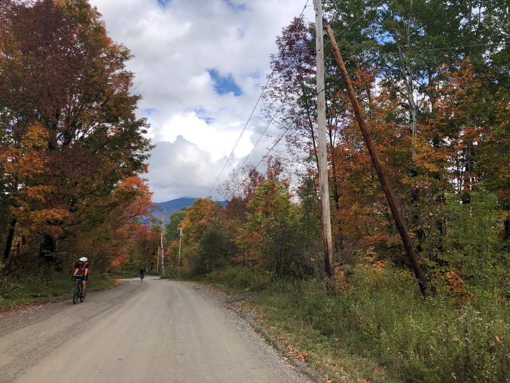
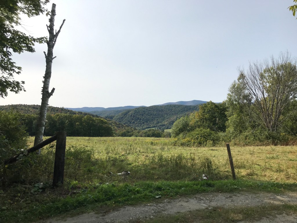
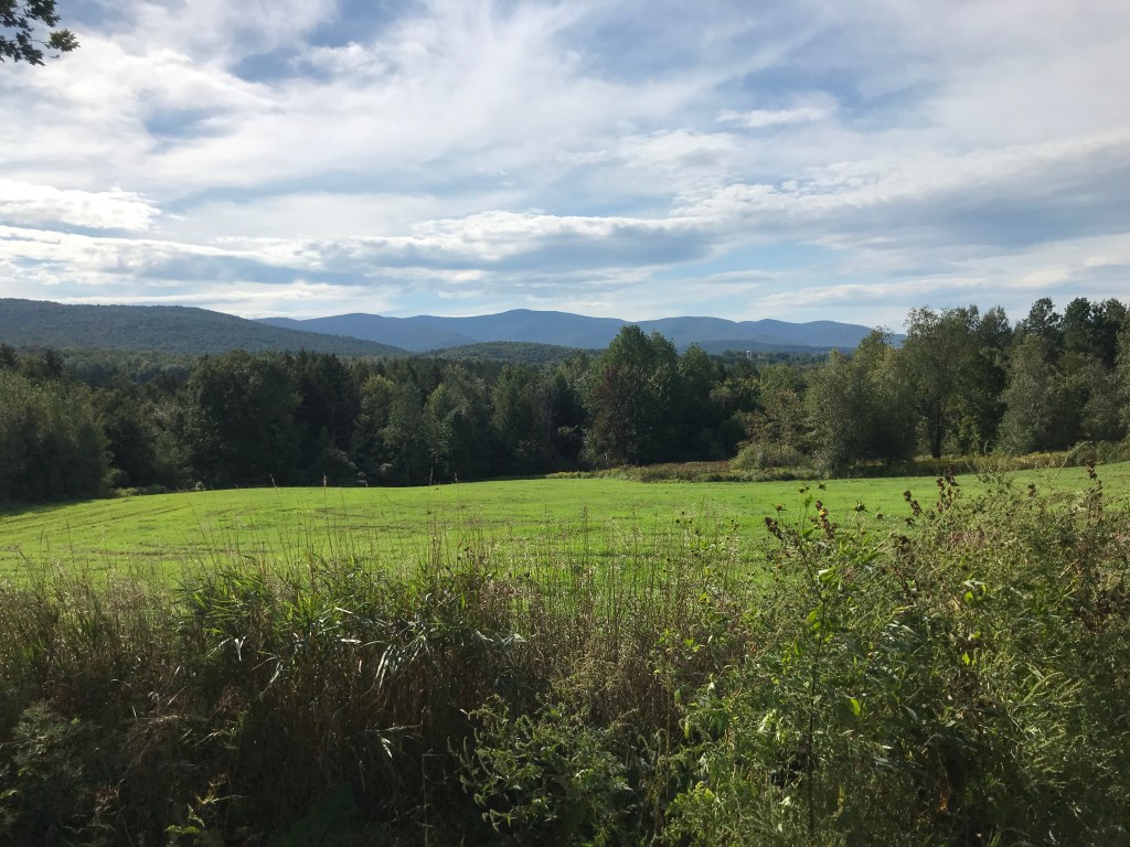
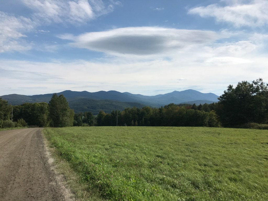
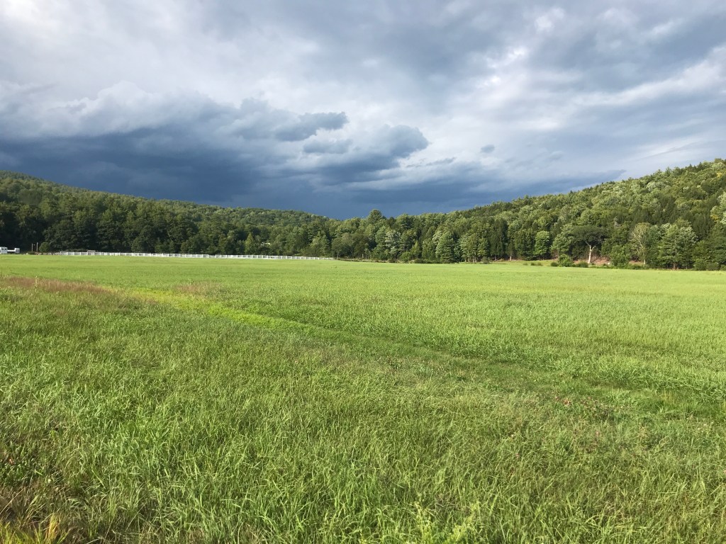
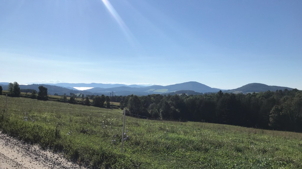
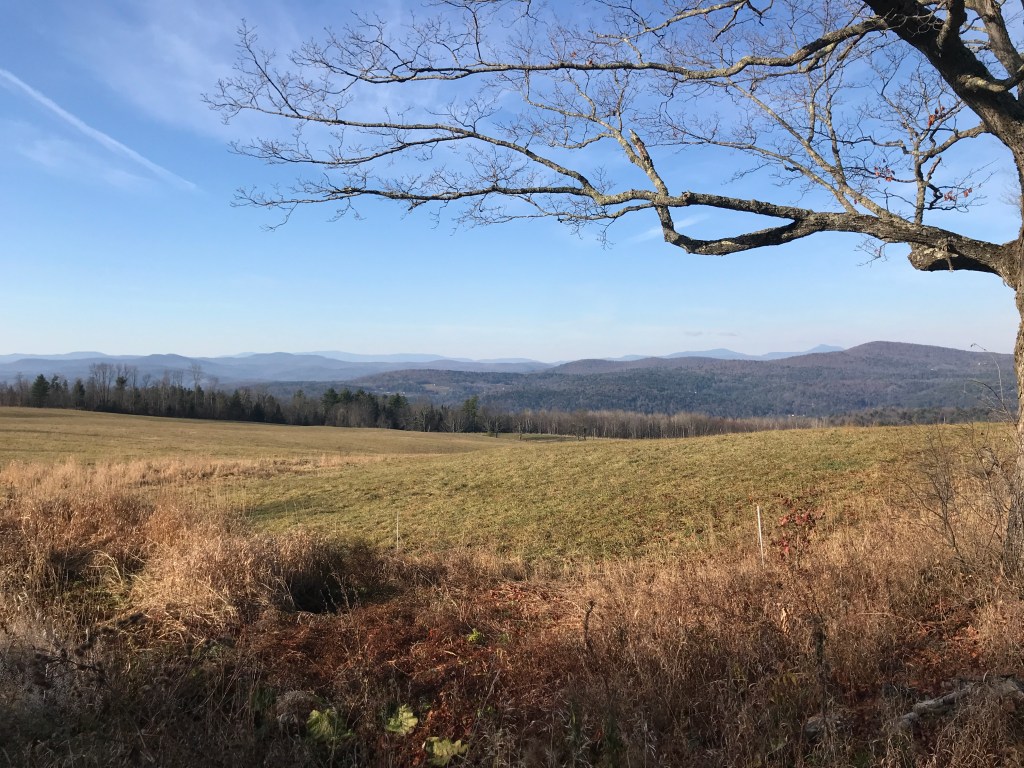
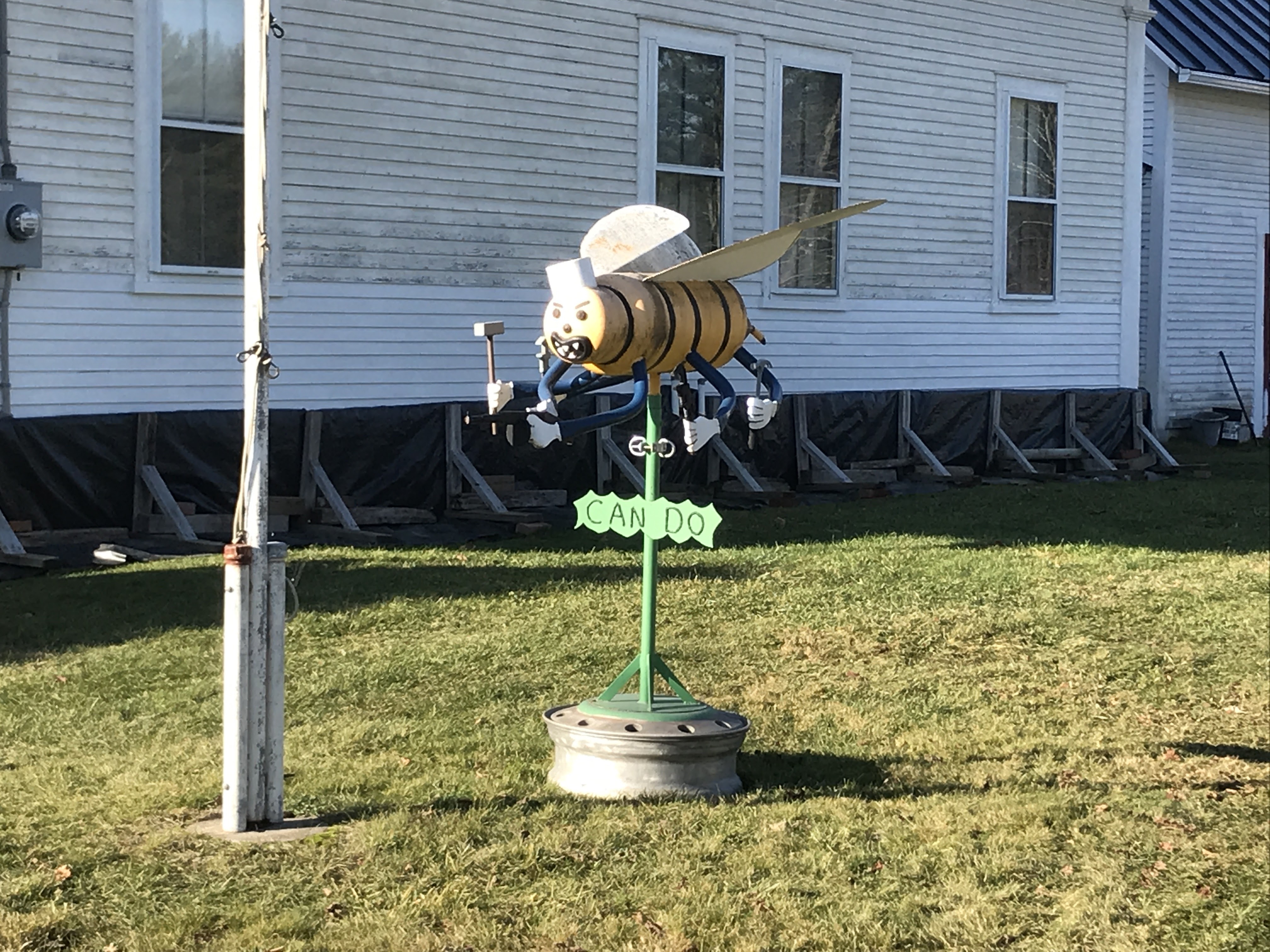
After refueling and resting at Maple Corner, our route turned west, down towards the town of Worcester. Reaching the small village center, we saw a strange sculpture in the front yard of one of the houses. It was about 5 feet tall, made of metal and took the form of a somewhat aggressive looking bee. In each of its many “hands” it held hand tools: various types of hammers and wrenches. But in its front hands, it was wielding a Tommy gun! To top it all off there was a sign below saying “Can Do”. Needless to say both of us were throughly confused. After crossing Route 12 and briefly considering taking it south to the car, we began the climb up into the hills again. On the lower reaches of the slope was passed by a great swimming hole. It’s at the site of an old mill and stays pleasantly shaded and cool in the summer. If you’re in the area, I’d highly recommend stopping. We didn’t have the time, weather or inclination for a dip, so we just continued up. And up. After the long climb we’d be on a plateau of sorts, but still have some ups and downs. The western portions of Worcester and Middlesex tend to level out a bit before they ride up even higher in the form of the Sterling Range which generally separates the towns from Waterbury and Stowe. The ridge has a few prominent peaks including Worcester Mountain, Hunger Mountain and Stowe Pinnacle. We were able to enjoy a few views back east as we trended upward. We finally reached our last real push of the day up East Hill Road after which we were able to layer up for the fast cruise down into Montpelier. Once we hit the city-proper, we turned and went right below the State House. It’s one of my favorite buildings in the state. There’s a lot crammed into its tight confines (except for legislators and advocates at the moment). With its open doors and ease of access to lawmakers, it truly is the people’s house and an inspiration for many Vermonters. When we arrived, there was a strong smattering of people soaking in the last warm rays of sun from that day. People were almost all masked, spread out across the great lawn and there was even a small band in a large circle playing the Battle Hymn of the Republic (AKA John Brown’s Body). It was all very pleasant with just the right hint of patriotic. We pushed on through town, now shaded by the steep hill up to Hubbard Park. We reached the cars and parted ways with me figuring this would be the last 251 ride of the season.

Don’t worry it’s…
So confused.
Rainbow recycled planters.
At the top of East Hill Road.
State house sunshine (with the golden dome and the new Ceres behind me).

The Details:

https://www.strava.com/activities/4310185000

https://ayvri.com/scene/gdkz16el5z/ckh9t3d4000013h6bs5eo2ck3

Ride 13: Rockingham, Grafton, Chester, Baltimore, Weathersfield & Springfield

The transition from fall to stick season had continued its relentless march southwards and with peak foliage already nearing the Massachusetts border, Maddie and I decided to get a ride in. I’d been keeping some of the southern routes in reserve for times like this, figuring there would be a day with sun and moderate temperatures. Plus it’s always fun to take a good long journey on a crisp autumn day. And journey we did. We began by setting course down I-89 and I-91 for the historic village around the Rockingham Meeting House. It’s on the top of a small knoll and surrounded by sweeping views of the surrounding hills and valley of the Williams River. In the year 2000 it was listed on the National Register of Historic Places and deserves the recognition: it’s stunning and needs to be seen in person to be fully appreciated. As a nearby historic marker says:

“The Rockingham Meeting House is one of the finest remaining examples of New England Colonial architecture. It is the oldest intact public building in Vermont. Built between 1787 and 1801, it served Rockingham as a house of religious worship and town meetings for nearly a century. The arrival of industrialization shifted settlement to the nearby villages of Bellows Falls and Saxtons River. The Congregational church survived here until 1839 and annual Town Meetings continued here until 1869.”

We took a little bit of time to soak it all in, but after our 2-hour drive and with daylight hard to come by, we needed to begin. The cruise down Meeting house Road to Route 103 afforded us some fine views of old houses and a little time to settle in. However, quickly enough we were onto the generous shoulder of the state highway. Even with the space, I was not looking to be on there for too long. One of the more curious sights we saw was one of the locations for the Vermont Country Store. The business began by doing a mail order, but the founding family (the Ortons) also quickly bought an historic store in Weston and began selling wares from that as well. The store was an old general store and apparently “has the distinction being of America’s first restored and fully operational country store and has been placed on the National Register of Historic Places.” The store in Rockingham is not quite so historic. It appears to have been purpose-built and has a grist mill and pond, but the pond is below the mill, so there’s no way to power the mill. This and other seemingly out of place items like a covered bridge over a ditch, try to make it look historic and “quaint” but it all seems off. Especially having come from the actual historic center of a town, all this packaging feels way more Hallmark Christmas Special, than what some consider to be “real” Vermont. Either way, we were happy to get back on some side roads and enjoy the slower pace of things. We passed over two covered bridges, by so many barns and also a few little clusters of houses that were once micro-villages in town. Rockingham actually has a number of villages, including Bellow’s Falls and Saxton’s River. These are now the main downtowns, but it seems like the center of population jumped around as farming, industry, railroads, and other economic forces ebbed and flowed thought town. Sadly, a 1908 fire burned much of the original settlement around the meeting house, taking several houses, a store and hotel, ultimately ensuring “Old Town” was no longer a center of activity. In order to tick off the town of Grafton, we took a small detour. When planning routes, for the life of me I couldn’t easily link in Grafton with many other towns, so this unfortunately became a clipping the corner situation. However, Eastman Road was very pleasant, running next to the babbling Hall Brook and we even got some Class IV between Richards Road and Horseshoe Farm Road. Maddie’s old TREK 420 absorbed all the bumps from rocks hidden under the leaves and soon enough we were done with our detour and ready the enter Chester.

The immaculate Rockingham Meeting House.
Nice to be off the main road.
Double bridge views? Yes please!
On Richards Road, Grafton.
Nice carpet.

The road leading into Chester continued the theme of barns and bridges and we noticed a lot more work in stone. Beyond the stone houses that are spread throughout this valley (like the one at the top of this post) there were small stone posts that line much of the road. After some moderately exhaustive research, I’m not too much closer to knowing what they were for. My best guess is hitching posts or fence posts. They seem too numerous and spread out to be hitching posts, but too expensive to be fence posts. Anyway, if anyone knows, be in touch. Soon enough we were in Chester Depot. There’s a more classic downtown of Chester with what many people would consider the classic New England row of shops and a small strip of public green. It’s actually been recognized as an Historic District. However, we took a pitstop at the Chester railway station. It’s used mainly now for a tourist train, but there was clearly a lot of industry in the area as evidenced by the many stores and industrial buildings huddling close to the tracks. We looped into yet a slightly different part of Chester, this one known as Stone Village. It’s actually another Historic District, known for mainly for its concentration of buildings that were built using what is apparently called the snecked ashlar technique. Riding by and marveling at all the beautiful stone work, we almost missed the kettle corn sign. Luckily Maddie noticed at the last second, so we turned around and bought a bag from a nice man who sets up on weekends as his retirement job. We resisted munching right away and pushed on. By the way, if Vermont stones are your thing, there a whole Vermont Stone Trail! But that journey will have to wait until this 251 business is taken care of. We finally had to take leave of the valley and began the climb up Trebo Road, seeing a few more stone houses, as well as some silly Halloween decoration gravestones (made of wood!). We missed the Snell Road turn off thanks to a fun downhill and a kind of tricky sign (but mostly just the fun downhill). So we had to backtrack up, only to finish the down then continue up Chandler Road after crossing Route 10. We were closing in on the tiny hamlet of Baltimore, the second smallest incorporated town in Vermont!

This barn belongs in Maine, it’s got so many bays!
What were you for posts!?!?
All aboard!
Luckily Maddie threw on her pannier to carry our bounty.
Wooden gravestones? In Chester? For shame.
That lichen TOTALLY made it illegible.

The 4.7 square-mile town of Baltimore is a dispersed settlement with no real village. It has only about 250 residents, up from 54 in 1910 and surpassing its historic 1810 high of 207. Its 7 miles of roads are all dirt and there’s just one public building in town. Baltimore’s unique triangular shape came about because it was originally a part of Cavendish, but many early grants were laid out irrespective of the land’s true geography and the early residents were cut off from the rest of town by the imposing (and deadly) ridge of Hawk’s Mountain. In 1793, a new line was drawn along the top of the ridge and the new town created. These natural borders are somewhat rare in Vermont, and not the first time a town had to be reorganized because a pesky mountain got in the way. It makes me think about the proposal I saw a while ago to organize the states by watershed to help avoid more conflicts over water resources. However, none of this was on my mind as we worked our way up into town. The angle was’t too steep, so it afforded us some time to look around and enjoy the lovely isolation of this town. It’s pretty clear the only people who come to Baltimore are those who live here and those who want to see it. There’s really no reason for through traffic. As such, it’s very quiet. Eventually, once we reached the town hall, housed in an old schoolhouse, there was a small crew of people giving it a new coat of paint. We also passed one of my favorite road names of the project so far: Old Shincracker Lane. It’s apparently named after the nearby mountain, but still no word on whose shins were being cracked or why. After the road flattened out, we got views back down towards the Connecticut River valley and up towards Hawks Mountain. Then we were faced with a descent beginning with a surprise section of class IV road. Again, Maddie and the old TREK absorbed everything and we were speeding town into the village of Perkinsville in the town of Weathersfield. I’m not quite sure why Perkinsville was developed as a village. It was potentially due to local soapstone quarrying and finishing, but these days it has a small brick church and a modest town green. Eventually we pushed on closer towards Stoughton Pond and the long valley below its dam.

Perfect isolation
More stone houses!
Towards the Connecticut.
The imposing Hawks Mountain ridge.
Perkinsville.
The Stoughton Pond Dam.

The southwestern portion of Weathersfield was heavily impacted by a flood control project. Conceived of and built in the late 1950’s, this controversial complex of dams had a majorly reshaped the town’s landscape. Constructed and now managed by the Army Corps of Engineers, the sprawling project does provide recreation opportunities, but it’s clear that the Black River it subdued and the larger area of town that surrounds it, were deeply impacted. We decided to try and utilize one of the paths that leads you from just below the Stoughton Pond Dam south to the North Springfield Reservoir Dam. The track began nicely enough as a somewhat rough double track. But soon enough we were essentially biking through meadows. I wasn’t expecting a paved bike path when I planned the route, but I was hoping for something a little more worn in. To make matters worse, the expected gentle curves next to a stream I hoped to find were instead rolling ups and downs as the path clung to the side of the valley. We decided it wasn’t worth it to push on all the way south like this, and eventually we found a path up to Reservoir Road and took that all the way to the south dam. It’s a massive structure that a public road (Maple Street) narrowly crosses. We took it over towards the Hartness State Airport and eventually into the small village of North Springfield. Getting a little nervous about daylight I rerouted us off our intended route onto Fairground Road which took us straight into Springfield. Once we intersected Route 11, Maddie and I decided to split up. There was a monster of a climb coming up and the relatively gentle incline of a state route would be much more forgiving. So, feeling strangely emotional, we parted ways agreeing to either meet at the car or I’d drive my way back along her route. I dropped into the river town of Springfield. I didn’t have too long to admire its old mill buildings due to the stress of racing daylight, but it was fun to pedal hard through those streets. After clearing downtown Springfield, I made it to the beginning of my last big climb. Will Dean Road was beautifully quiet and after missing a turn, I was able to enjoy Parker Hill Road too. I passed a farm specializing in Wagyu beef and also passed (entirely unknowingly) through a “Rural Historic District“. I had a long, speedy drop all the way down to the Williams River and just a little pop back up to the Meeting House. I’d beaten Maddie, but only by a little. After quickly packing up, I met her in the car only a mile or so down the road. We celebrated with some pie purchased from The Southern Pie Company in Chester (HIGHLY recommended by the way) and began the long drive home.

All smiles, despite the sub-optimal path.
The Army Corps of Engineers doesn’t do small.
A hint of Springfield’s patchwork industrial skyline.
On Will Dean Road.
Fall views at Fischer Farm.

The Details:

https://www.strava.com/activities/4213774080

https://ayvri.com/scene/gdkz16el5z/ckgggunk700013g6bpt2d73wa

Ride 12: Lincoln & Ripton

After making the major push to tick off 10 towns on the last ride, taking the time to go for quality, not quantity sounded like a perfect plan. Brad and Dan had already decided to do this ride and I couldn’t resist a perfectly curated route in some of the finest gravel riding territory in the state. So, along with Dan’s friend Rafaela we planned to ride a route based roughly on the Vermont Forest Fondo event that Brad had ridden last year.

We began just north of Lincoln Village heading south past the Lincoln General Store and the Lincoln Community School to begin the climb up Lincoln Gap Road. It was overcast with low clouds and fog, but rumor had it things would burn off by midday. Dan pointed out how funny it is that “burning off” is a phrase. It sounds much more exciting and dramatic than the actual process of changing dew points and evaporation. Anyway, we climbed up towards Geary Road with some obstructed views up towards Mount Abraham (aka Mount Abe). Traversing across Geary, we had some smooth dirt and bright yellow foliage. Eventually we reached the biggest sustained push to the high point of the day: French Settlement Road. I don’t know the precise history of “Settlement” roads in the state, but there are a number, and I can only assume this was an area where French Canadian (or maybe plain old French?) folks first congregated and lived in town. Nowadays, there are a few houses on the way up, but the road eventually devolves into Class IV, being traversed mainly by ATVs, hikers, bikers and the occasional hunter, one of whom we saw by his camp at the top of the climb. After the camp, the path continued to narrow, becoming only a trail for a few hundred yards before widening out again on what I believe were National Forest Roads. The Green Mountain National Forest spans a great deal of the southern spine of the green mountains and we’re in its northern reaches here. In fact we were in the Breadloaf Wilderness Area and also sharing trail with the Catamount Trail, Vermont’s long distance skiing trail. After Dan pulled off a great decent of a gully, were were back on full fledged access roads, ready to wind back north onto Lincoln Gap Road.

Brad headed up lower Lincoln Gap Road
Where are you Mount Abe?

Slightly different surfaces on Geary Road and French Settlement’s Class IV.

Brad Miller on single track!!!

The section of Lincoln Gap we reached is an unpaved portion. For much of its upper reaches (including its “Steepest Paved Mile in the US” section on the Warren side) the road is closed in the winter. Folks even sled down it! Though one day I’ll bike over the top, today was not the day. So after a quick hello to some hikers and their pup, we zoomed down the hill, but only as far as some more gorgeous Forest Service roads. From here we continued to head north: passing sugar lines and some really well maintained, remote-ish roads. After a steep drop down onto James Road, Rafaela had to swing back to Dan’s place but we’d meet up soon after. The route would curve back south before long. So while she headed west, Dan, Brad and I took the Class IV route over Robinson Road. The first part is pretty solid thanks to some of the bedrock that peeks through, but the second portion must be the real reason the road was abandoned: it’s very flat and VERY wet. We made it around most of the huge puddles, though Brad did make the classic mistake of looking where he didn’t want to go…and going there. He ended up getting a tiny bit wet, but it was seriously one of the most athletic things I’d see all day. It could have been much worse. A quick dunk on one shoe and that’s about it. After getting out to Downingsville Road, we passed on including Purinton Road’s closed section (I’ll come back for you later) and continued to meet up with Rafa. On the road I saw a high number of cars and trucks loaded down with barrels and bins. Putting that together with the fact that it was a Saturday morning, I figured the dump must be nearby. And sure enough I was right! The pavement was fast as we pushed back south to continue into the even more remote parts of Lincoln and, eventually Ripton.

One of Lincoln Gap’s larger switchbacks.
Dan always has the essentials at hand.
Starting to burn off!
Going down…
The drier portion of Robinson Road.
…and the wetter portion. This is immediately after Brad’s incredible save.

We continued to drop down towards the New Haven River, only to begin a long climb up York Hill Road. Though it was a bit steep, it afforded great views to to east. The houses thinned out and the roads were immaculate. We all couldn’t help discussing how lucky we are to live here and have this right out our back doors. We again approached a Class IV road (this time Green Road) which may meant we reached a new record for number of unmaintained road sections on one of these rides. And there were more yet to come! As we continued south, the houses were slowly even more sporadic near the Ripton town line. Lincoln is a small town, but Ripton truly feels like a hinterland settlement (thanks to Tyringham MA for that turn of phrase). There’s not a ton there, in terms of “downtown” but they are famous for a few things: the oldest writer’s conference in America, a world-famous author and activist, the author of America’s favorite poem to misinterpret, an independent school with a cool story, oh and a very beloved, needed and photogenic general store. We passed hunting camps with skulls, one room schoolhouses and very old cemeteries going through Ripton. Though there were some amazing views, this section was mostly about marveling at the bountiful dirt roads that just didn’t seem to stop.

Up from the New Haven.
Taking it all in. (Photo credit to Dan)
The views just don’t quit.
At least I think it’s a schoolhouse.
That lichen tough.
Gee Whiz! What a cemetery!
Just so many miles of this. We’re spoiled.

As we got closer to Route 125 (the main way folks get in and out of Ripton) we jumped onto what is called the Natural Turnpike. This is a major thoroughfare of a different sort: it runs back north through some even more remote stretches of town than those we just came through. Carrying cars, bikers, and even snowmobiles, it’s one of the state’s gravel crown jewels. We’d ride the majority of it, but we jumped off this beginning part (paved…ewwwww) to sneak in one more stretch of Class IV. We bombed down Peddler Bridge Road to Wagon Wheel Road. Wagon Wheel is marked as a dead end and the easily drivable portion does stop at the back side of the Rikert Nordic Center. We had come again to the Catamount Trail and the skiing which is so plentiful around here. The woods here were again so beautiful and we enjoyed the sights of popping foliage, even enjoying the scenery of two abandoned fridges we found just off the trail. We eventually popped out onto the dirt of Stream Mill Road and sadly Brad had to boogie home, so he pushed on ahead while Dan, Rafa and I took our time. Amazingly enough, the mother of Cameron (from ride 11) happened to be driving by in one of the very few cars we saw and also happened to recognize Dan and stopped! It was so nice to meet her and so funny to see her on a ride in such a remote place. We rejoined the Natural Turnpike: by this time all glorious dirt. We had basically one last climb before a really fun drop back into Lincoln. At one point going down we were passed by some more off-road looking motorcycles and I had fun imagining I could out-pace them. It was silly and futile, but still enjoyed the make-believe. We passed the base of French Settlement road again, then took a more direct route into town, powering up the last hill to the finish line.

The Natty T!
On Wagon Wheel.
Between Wagon Wheel and Stream Mill.
The fridges were empty (I checked).
How can you resist roads like this?!?

The Details:

https://www.strava.com/activities/4147119305

https://ayvri.com/scene/gdkz16el5z/ckfugdsg500013h6891o9n583

Ride 11: Milton, Georgia, St. Albans Town, St. Albans City, Swanton, Alburgh, Isle La Motte, North Hero, Grand Isle & South Hero

Riding a “Century” AKA 100 miles in one go, had been a goal of mine for some time. With all the riding I’ve done this summer and all the more riding I had to do for this project, it appeared that I had both the fitness and ample opportunity to do just that. However, it being my first one, I didn’t want to go too crazy, so I chose the flattest section of Vermont: Grand Isle County and the Northern Champlain shore. On the day, we’d cover only 3,500 feet of climbing, far short of the average 1,000 feet per 10 miles I normally shoot for. But still, it would be a daunting task, so I called in reinforcements. It ended up being an all star squad: Brad (of many previous rides), Dan (who has been a steadfast riding partner of Brad’s and a guy I’ve wished I’d been able to ride with more), Cameron (who’s ridden from Patagonia to Vermont with an amazing project he dubbed Mundo Pequeño) Alex (Cameron’s fiancée and quite the adventurer in her own right) and Maddie (rockstar/wife). We gathered near Sand Bar State Park early on a picture perfect Saturday in September, the leaves starting to peak up high in the mountains and the wind mercifully calm by the lake. After seeing a bald eagle and all agreeing it was a good omen, we geared up and started out.

Mile 0.1.
(Photo credit to Cameron. Thanks for the great pictures!)

Right away it was apparent that unfortunately Maddie’s bike was giving her fits. After navigating the fast stretch of Route 2 connecting the sand bar/causeway area to the mainland, we stopped to assess. We was having to tire rub and needing to exert much more effort than needed. After a few attempted fixes, a tip from Cameron seemed to help. Maddie’s plan all along was to ride her own ride at her own pace so she assured us all she’d be fine and to ride on ahead. She’d be in touch if she needed help and would turn back when she felt like it. We rode together for a bit more, but soon drifted apart. She had her book and paints with her too and she’d surely have a lovely day no mater how many miles she covered (but don’t fret, this isn’t the last we’ll hear of Maddie). For all of us, getting off Route 2 and into the back roads of Milton and Georgia was a good change of pace. In between some an area of nature preserves that mix with private roads with (presumably) fancy houses on the coastline and the central area of more exurban/agricultural town center, Milton has some beautiful rolling gravel roads. We eventually dropped down onto the mellow Georgia Shore Road which placed us right next to many small seasonal camps along the water. We had light traffic and the first of many fantastic shoreline stretches. Eventually, we reached Saint Albans town but needed to also tick off Saint Albans City. Vermont has nine cities and many of them came about because villages within towns incorporated as cities throughout the years. This was the case for Saint Albans as the city broke away from the town in 1902. The city is only 2 square miles which made finding some dirt to ride tricky. But after a brief stop at Hoss’s Dogg House, home of what some argue is the largest and cheapest creemee in the state, we found a strip of gravel in Houghton Park where we took our first full rest.

A ribbon of Milton dirt.
Dropping down onto Georgia Shore Road.
What’s up dogg?
After your creemee, don’t forget to swing by Dogg’s Wine Arsenal.

To get back towards the lake and continue on our way, we meandered the streets of Saint Albans City, quickly crossing back into the Town. At one point Dan saw a sign advertising Farm Fresh Butt Nuggets. I wasn’t fast enough to get a picture, but that’s possibly the best euphemism for an egg I’ve ever heard. Northwest of the city it’s all pretty much a sweep of plains all the way up to Montreal. We we lucky enough to have a bit of a tailwind, so we were pushed along Country Road until we reached the Missisquoi River and the town of Swanton. The river drains much of Northwest Vermont and boasts both a Wild and Scenic Designation (a distinction it shares with its tributary the Trout River making them the only two Wild and Scenic rivers in the state) as well as the long distance Northern Forest Canoe Trail which stretches from Old Forge NY to Fort Kent ME. We also rode through the Missisquoi National Wildlife Refuge, again the only Refuge located entirely in the state. Unfortunately to truly appreciate the Wildlife refuge you should be on a boat, or at least off of Route 78, but we didn’t have time for side trips, so we stuck to the main road, lined up closely with one another and sandwiched on the shoulder. We took another break at the West Swanton Orchard, then made one more push over the bridge into Alburgh and onto the quieter roads of Grand Isle county. Here we were able to chat a bit and other than a bee stinging Cameron, it was perfectly uneventful. But soon, we’d be making a break for the border and I was getting nervous.

The great plains.
Brad and the Missisquoi.
It sounds more epic than it was. The “gravel” section was actually quite smooth and literally only 10 feet long.
Alex and (some of) some of the area’s typical buildings.

Once we took a right onto Border Road, we were headed due north, straight for the Canadian customs house. I had a mini bout of worry about this section because we’d be riding right up to the border, then skirting west on Line Road which IS the border. When you map it out on Google, it’s not promising, given the tight restrictions on leaving the country. However, Google directions aren’t gospel and you can easily skirt around the buildings. Once on Line Road we couldn’t help imagining the how easily we could slip into the cornfield to our right and make a break for it. However there were some obvious cameras and I’m certain some less obvious motion and thermal sensors. So we never did more than speculate. We passed Borderview Farm which is a research farm associated with UVM. It’s been quiet up in that area as of late, but they do a ton there with all sorts of agricultural practices. It was a bit funny to spell the hemp growing within 100 yards of Quebec where cannabis is now legal. The other fun thing about Line Road is it’s where Cameron and Alex recently got engaged! Alex is Canadian and Cameron American and they were in separate countries when they decided to get married. Cameron actually rode his bike up and they sat on either end of a log that crosses the border when they decided to take the leap. Apparently that spot is popular for folks to hang out, becoming more so during COVID. The neighbors don’t seem to mind. Now Alex is on this side of the border and they could visit the spot together. It was fun to see and surely a very romantic story. But needless to say we pushed on! After a pitstop at a gas station where we made a 50-something guy’s day by ogling his bike, we zigged east on a rail trail, only to zag back to the west along the shore. We eventually made it down to a short causeway where we’d get a new town: Isle La Motte!

I wanted to get a shot of both sides, but thought better of it.
Borderview farm and Canadian corn.
The engagement spot (see log in lower right).
Typical refuel scene.
Rail trail.

Isle La Motte is the spot where Samuel de Champlain landed on his 1609 voyage of “discovery”. Today it’s a sleepy island community known mainly for its ancient fossilized reef and Catholic shrine. It boasts some fantastic views and even some dirt roads! East Shore Road is a must ride if you’re there. We ended up doing a short loop, but if you can explore more, do it. Oh and for sure stop at Happy Bird Poultry Farm and pick up a smoked chicken. You won’t be disappointed. After tracking back north we then rode down the other side of the bay we’d just skirted, this time on the Alburgh side. Alburgh is a peninsula that spits out from Canada and the southern tip of it is called the tongue, for somewhat obvious reasons. We rode into Alburgh Dunes State Park, closed for the season- so free to enter, but still busy with beach-goers. It’s recently been redone and the main welcome center and tiny changing houses/bathroom sprinkled along the path we rode gave it a very European vibe. You could easily camp there off-season and have a great night. We then crossed another bridge onto North Hero. This stretch of road was quite busy, so we made a little peloton and put the hammer down to reach the Hero’s Welcome General Store. A small grocery, deli and tourist trap gift shop, they are certainly one of those “If we don’t have it, you don’t need it” type of stores. We ordered sandwiches and I set about looking for Maddie. She’d decided to continue north, following a streamlined version of our route. She said she’d stopped at a store but I couldn’t find her. After filling my belly and water bottles, I took one more look and found her! She’d been on the grass out back taking a break and reading! We were able to catch up and make a plan: she’d continue down the straight shot of Route 2 while we curved more back and forth. If all went well we’d finish at the same time.

East Shore Road beauty.
Isle La Motte church in typical stone construction you find along the lake.
Hero’s Welcome humor.
North Hero view.
Dan playing up the drama.

By this point in the ride (mile 76) I was in uncharted territory when it comes to distance. We had almost a quarter to go, but some fantastic scenery lay ahead. After crossing over a temporary drawbridge (I didn’t even know you could do that), we entered Grand Isle. Instead of sticking to Route 2, we headed out onto East Shore Road. We enjoyed sweeping views back towards Milton, Georgia and Burton Island that continued as we curved south and back west. You really do stick right to the water and there were a number of spots where I was tempted to jump in. Despite the date there were a few folks posted up in the bay just east of the Grand Isle Lake House. I’ve been lucky enough to attend some end of year work dinners and a wedding there. We actually rode right by or within a mile of four different venues where I’ve attended weddings on this ride. Grand Isle county certainly is beautiful and has plenty of placed to get hitched.

After this semi-circle we made a beeline back to the west shore which would allow us to complete the fishhook of our route back to our cars. We enjoyed some great preliminary sunset views, peeks at old barns, a sea of birdhouses and a vineyard or two. Sadly many of the roads in South Hero that until recently had been dirt are now freshly paved and cars seemed to want to go faster. Towards the end of the ride I pushed on through a rest break to get some extra time visiting with my friends Phelan and Kelsey who own Pigasus Meats and stunning property and operation in South Hero. They’re an AWESOME power couple who rock it as hard at the farmer’s market as they do on the dance floor. I really enjoyed getting to see them (as well as Phelan’s sweet new Crust bike). Soon the rest of the crew caught up and were restless to push on. So we joined back up with Route 2 and made our way across the causeway. There’s a lot of history to that pile of stones and I tend to prefer the old railroad causeway which is now part of a world-class bike path. But at this point in the ride, we were just hungry for our planned dinner of pizza. Amazingly the timing had worked out quite well and Maddie was there to meet us. We all had a toast to a solid day of riding and took a moment to drink in the sunset and reflect on a full day’s adventure and another 10 towns in the book!

Down to the eastern shore.
Grand Isle’s Gambrel Garage.
Beautiful foliage. Ugly pavement.
A true fixer-upper.
Cheers to that!

The Details:

https://www.strava.com/activities/4116478277

https://ayvri.com/scene/gdkz16el5z/ckflhp06n00003h6a32p7og5w

Ride 10: Bethel, Randolph, Brookfield, Roxbury & Braintree

I had spied a good day on the weather calendar the other weekend, and I got it into my head that I wanted to do a 251 ride on that day, so I took off a few hours on a Wednesday afternoon and made it happen. Consequently, it needed to be relatively short and relatively close and this route I’d worked up fit the bill. It began in Bethel, what I like the call the town that’s equally inconvenient for everyone in the state. For work, I sometimes have to plan trainings and meetings for statewide partners, and though it’s not close to a population center, it’s fairly equidistant for people, no matter what corner of Vermont they’re coming from. So I know the town somewhat, but mainly the amazing co-working/community space and and its downtown. I was excited to get onto the back roads. After finding a small shoulder to pull onto, I parked a little northeast of downtown and began. Sanders Road began as a bit of a slog, but it mellowed out and by the time I got to Town Highway 15, it was one of those pleasant uphills where you barely notice it. Soon enough, the benefits of being up on that ridge began to show themselves and I got the first glimpse of the westward view. It’s a view I’d seen variations on from Interstate 89, but this one felt much better (certainly queiter). Gaining the ridge also meant a little section of Class IV. It wasn’t very technical, but you can tell it stays pretty wet along there. Even with our dry summer, there were deep standing puddles, and where there wasn’t water, there were still very deep, crusted-over ruts. After the mile or so of unmaintained road, I popped out to see an even broader, full 180-degree view of the valley below and ridges beyond. There was a gorgeous, but abandoned house at the end of Fish Hill Road and the view swept over to a white barn and silo looking north towards Randolph. I paused to drink it in, but also knew I had some more time to savor those sights: the road ahead served up some rollers and more views. At one point, I needed to turn around to take a photo of an old burgundy convertible. I have no idea the make or model, but it certainly was an eye-catching machine. Soon enough I was down to Route 66. No, not THAT one, Vermont-66, the main artery you typically travel from 89 into Randolph. The humor of the shared name isn’t lost on locals though.

First glimpses of the view from Sanders Road.
I would not want to be attempting this one in May.
The very end of Fish Hill Road and the start of unreal views.
Brownie points for anyone who knows what kind of car this is!

After the traverse down to 66, I needed to head up again to gain the ridge and get over to Brookfield. I took Herbard Hill Road back up and enjoyed more (though slightly obstructed) westerly views. At the top, I crossed over I-89 which runs along the ridge in this part of the state, and I saw some confusing graffiti: “Bacon for Trump”. My guess is it’s a dig at police blindly supporting Trump, but its message wasn’t exactly clear. I had time to ponder it, though as I continued north on the eastern side of the ridge, trending down but with some more climbs. I passed the Brookfield Elementary school and there were busses outside: a nice reminder that schools are providing some semblance of “normal” during these times and also that I was out riding during the workday, which I took subversive pleasure in. Speaking of subversive roadside messages, I next saw a funny instillation in the yard of a home. It was a wooden dock leading down away from the road with pilings and all the normal accoutrements, but instead of being over water, it was in grass. And not only that there was a flagpole and a small fishing boat beached at the bottom. Intrigued, I had to pull off to investigate. It turns out it’s the “Climate Change Yacht Club – Parati Erimus [We will be ready] – Elevation 1350”. This tongue-in-cheek statement really made me chuckle, but also was a bit of a wet blanket over an activity that otherwise helps distract me from all the craziness going on today. Shaking off the reality-check, I continued down into Brookfield. The town of Brookfield is most famous for its floating bridge. It’s kind of the centerpiece of the town and a focus of many community events. It was developed due to Sunset Lake’s depth making driving pilings impossible. Beginning in about 1820 as a set of floating logs, the bridge now in its 8th iteration, after having been most recently rebuilt by VTRANS. It was a lot of fun to see, though not as bouncy as I’d hoped!

Count me as confused.
We will be ready.
Your barn door’s actually NOT open!
Floating Bridge. I wonder if that traffic drum floats too.

As you can see from the picture above, the road after the bridge jumps right back up. A solid punch to head back over 89. Interestingly enough, it’s dirt, but it’s also a numbered state highway (VT-65). There aren’t too many roads like this in the state, though I did already ride one during this project: VT-58 in Montgomery. I climbed up by the entrance for Allis State Park, one of those parks I’ve never really heard of. I get the impression it’s kind of a sleepy one, but it has a fire tower, so maybe we’ll make a visit some day! I zipped down the somewhat loose dirt of Route 65, popping back onto pavement on Route 12. I was soon to face-to-face with my steepest and last serious climb of the day up Steele Hill Road. I’d psyched myself up for it and while it did require getting out of the saddle a few times, it wasn’t painfully long. Luckily the down was lengthy and I cruised and cruised. So far in fact, that I ended up missing my intended turn onto Davis Acre Road, ending up back on Route 12. Despite the mix-up I still got to enjoy the sights of East Braintree and even got some bonus climbing in…ugh.

State-maintained dirt.
Baker Pond from Route 12.
It’s (kind sorta) all downhill from here.
East Roxbury- Certainly more to explore in these parts.
East Braintree skyline.

At this point, I had a little more to before skirting Randolph, but what a little bit it was! There were some gorgeous houses along this stretch, some old homesteads, complete with dug ponds and some newer builds that were real good looking as well. One of my favorite parts was Brainstorm Road. Normally I try to find the background on some of these, but the internet would not divulge the story behind that one. Maybe one of you knows. Anyway, soon enough I was back on 12 (again) and this time headed south to jump back across Route 66 and cruise along the Third Branch of the White River. The White River watershed is an enormous area (715 square miles) and is the largest free flowing river in the state. It’s running particularly low this year because of the drought, but it was still a nice companion to have on the ride. There have certainly been times when it wasn’t so well behaved and placid, as I saw when I neared the end of my ride. Right near the Findley Bridge (a wood-decked iron truss bridge) is a railroad overpass that has the high water marks painted on it from to flooding events in 1998 and 2011’s Irene. Bethel was hit especially hard during Irene but they are steadily recovering. After one last steep push to the car, I was done, ready to head back north and to take on another day of work the following morning.

Pond with willows.
Any IDEAS where this one came from?
I see you there fall.
The Third Branch taking it easy.
Findley Bridge.
A lot drier these days.

The Details:

https://www.strava.com/activities/4070304032

https://ayvri.com/scene/gdkz16el5z/ckf5zm84u00013h68tc2f5ody

Ride 9: Fairfield, Bakersfield, Enosburgh, Richford, Berkshire, Franklin, Highgate & Sheldon

Labor Day weekend arrived and it both came out of no where and couldn’t come soon enough. I was certainly ready for a break and seeing as how COVID has seemed to distort time, let’s just say I was happy to see the calendar advance. For the first part of the weekend, we joined a crew of friends for some camping on Burton Island, a state park located south of Saint Albans Bay in Lake Champlain. Maddie and I paddled out there on Friday night and had planned to stay until Monday morning. I’d made plans with Brad to do a shortened version of a ride he’d invited me on and through his kind flexibility, he agreed. Sunday afternoon, we heard that Monday would be quite windy (*spoiler alert*: it was) with waves of 5-7 feet. So we headed out around sunset and got back to the mainland just in time to load our stuff and not get locked into the parking lot! Word to the wise: Kill Kare state park closes at official sunset. Anyway, because of our early departure, we could ride the full route that Brad had planned. It was going to cover the right territory to be a 251 ride, plus it would be my longest ride ever!

So the next morning, we met in East Fairfield under ominous skies and blustery winds. Things got off to an inauspicious start when Brad’s chain fell right off in the parking lot. However, it was quickly fixed and the riding improved from there: we headed north out of town on Egypt Road (which has both stellar riding and a stellar story behind the name). At this point, I had made one request of Brad to deviate from his planned route so we could hit Bakersfield. We passed up the fun technical Class 4 of Mitchell Road in favor of the Class 3.5 of County Road. We had an easy cruise down to Route 108, turning east to begin working up and over towards Montgomery. We’d already checked that one off the list, but the views made it a must.

Get that chain back on and we’re good to go!
On the climb out of East Enosburgh.
I swear this wasn’t posed. Brad was just that thirsty.
Looking at Jay Peak from the top of Longley Bridge Road.

We zipped down Longley Bridge Road and into Montgomery. After a bucolic stretch of more views from the bottom, we were greeted by the Longley Bridge proper. One thing I didn’t touch on in the Montgomery entry was the proliferation of covered bridges in the town. There are six in the town limits, and one crossing the town line with Enosburgh, making it “the record-holder for most covered bridges in New England and the United States at large.” As recently as the 1940’s there were 13 in town! This one is a beautiful town lattice that was recently rebuilt with new trusses in 2016. From there we enjoyed some speedy pavement and sunshine on Route 118, a road I remember well from my college days driving from Burlington up to Jay to ski. We re-entered Enosburgh and I didn’t get a picture, but you can always tell when you’re in that town due to their bovine road signs. If it weren’t for Brad’s knowledge of a shortcut, we’d have gone all the way into East Berkshire, but the Class 4 he routed onto was a ton of fun. We climbed up and over some rough stuff: a good challenge of loose “baby heads“, cobbles, bedrock and muddy puddles. We made it through, again greeted by another smooth ride. This time it was the double track of the Missisquoi Valley Rail Trail that we glided down into Richford’s downtown. We stopped at a gas station to rest, have a snack and restock before we made a run west up along the border.

Longley Bridge.
Brad and the Class 4 shortcut.
The smooth tracks of the Missisquoi Valley Rail Trail.
Gas station still life in Richford.

After our refuel, we crossed the Missisquoi River through downtown Richford. We passed under their welcome sign and along the town’s streets that hold abandoned storefronts, but also architectural gems and untapped potential. One such gem is the Grey Gables Mansion Inn. Built between 1890-1892 for successful entrepreneur Sheldon Borigh, it is listed on the National Register of Historic Places. It looks like something out of a children’s book and is a true show-stopper, just screaming for your attention as you pass by. After getting over the shock of the house, we headed up Pinnacle Road. Normally, we’d have loved to pop into Canada which you can easily do on this road, and I did a few years ago as part of an overnight tour with some friends. However, international relations being what they are, we stopped short of the border at the intersection with Berry Road, drank in the view and continued west. It was some classic back road conditions and the climbs and descents were all moderate. Per usual, there were punctuation marks of views, including a stunning stretch of Skunk Hollow Road that gave sweeping views to the south in which you could see all the way down to Mount Mansfield. We tackled a few more paved and Class 4 roads, eventually calling an audible to join a partially constructed portion of the Lamoille Valley Rail Trail after climbing out of East Highgate. Fun side note: the Governor just announced that this rail trail will be fully funded and hopefully completed by the end of 2022. Once done, you’ll be able to ride the 93 miles between Swanton and St. Johnsbury all on trail! This small section carried us into Sheldon Junction where the Lamoille and Missisquoi rail trails come together. It’s also where we began to get hungry again. We stopped to check out Papa Noel’s which it turns out is mainly a pizza joint and creemee stand. So we decided to detour over to Sheldon Springs for a proper gas station stop.

Welcome!
I want to look out through every single one of those windows.
Skunk Hollow views.
Camp ruins.
Not the most convenient paper towel dispenser at Papa Noel’s.

At our second gas station stop of the day, I immediately spotted a kid’s lemonade stand across the street. Content to pay for any kind of sugar water, I figured I may as well support these kiddos. It turns out is was even fresh squeezed! So I had them fill a bottle of mine and headed into the Valero to restock with a cliff bar and some chips. I went with salt and vinegar against Brad’s advice of barbecue and I almost immediately regretted it. The salt was too much and as Brad said: you need the sweet to balance it out. But I got to the bottom of the bag and soon we were off again, back down our rail trail spur to continue. Things continued to stay pretty rural through this stretch, and the wind really became more of a factor. Without the shelter of small “dales” as I call them, it whipped around us. It also wasn’t super consistent. Our direction changed but we always seems to have some version of a head wind. It really grinds on you, and I admit to slumping a bit here. Despite more views (of which I didn’t take too many pictures) and more history (of which I didn’t get too excited at the time) I just had to get into grind-it-out mode. Looking back it was some solid Type II Fun. Plus there actually was some cool history: was passed right near the birthplace of Chester A. Arthur one of two Presidents to come out of the Green Mountain State. We also saw a bunch of quilt patterns on barns. We’d seen them all day, but they finally registered in my brain here. It turns out there’s a “Barn Quilt Trail” throughout Franklin County. It’s a subtle way to bring a continuity to a community. We continued trading off lead to try to pull one another down the road and eventually reached Fairfield. This was an inflection point. I’d seen on Brad’s route that we could turn left here and take the paved, main road of Route 36 back to our starting point. However, Brad was very excited about this last section and with some gentle peer pressure, encouragement and a rest taking shelter in a baseball dugout, I was convinced to go on. I was so glad to do so too. It ended up being an amazing stretch of road and out of the wind too! Route 36 would have been miserable: busy and blustery. The route we took had us head up Ridge Road and up to some freshly hayed fields. It would be a prime spot to check out come foliage season. We even chatted with a guy outside his house who had an ATV and clearly knows the Class 4 in the area. With confirmation that our route connected and that there was more to explore there later, we crossed over to Romar Road and bombed down to East Fairfield. We had done 73 miles and I’d done my longest single ride ever!

Salty fuel.
Type II Zone.
To give you some idea of the wind.
Faded barn and black-eyed Susans.
Beautiful Ridge Road zone.

The Details:

https://www.strava.com/activities/4027049632#kudos

https://ayvri.com/scene/gdkz16el5z/cket2509400013g68vbzfo1yw

Ride 8: Brattleboro, Vernon, Guilford, Halifax, Marlboro, Newfane, Brookline & Dummerston

With the summer quickly fading away, I decided to make my first visit out of state since the winter. Some of my family was gathering in the Berkshires where I grew up. So I got tested and headed south, but on the way, figured I may as well do another 251 ride, so took a pitstop in Brattleboro. My Salsa was still in the shop, so this was another time for the Jamis to shine. More dirt this time, but no Class IV so it would be rougher, but doable

I pulled into the parking lot of the “On The Waterfront” shopping center, which is perched right above the last stretch of the West River before it empties into the Connecticut. There is a marina just up river, so there were some boats docked below. I didn’t pause long to investigate however, as I had many miles to cover (on 2 wheels and 4) before my journey was done. I began riding south on Route 5 into the heart of Brattleboro. It’s such a good-looking town, and it was nice to be right in the middle of it. I passed the historic Brooks House which has been refurbished after a 2011 fire, and also cruised down by two of my favorite area business: Sam’s Outdoor Outfitters (for obvious reasons) and also the Brattleboro Co-Op (just a beautiful building with great products). I think it’s because of my ogling the Co-Op that I took my first wrong turn of the day: instead of heading on Vernon Street, I stayed on Route 5. I realized my mistake when I saw the I-91 onramps and detoured past Brattleboro Union High School. Though it wasn’t what I’d planned, it still allowed me to ride down Cotton Mill Hill and enjoy the view of an old mill complex with the Connecticut River Valley in the background. Once down on Route 142, I passed Cersosimo Lumber Company and their enormous complex, some of which looked like room-sized kilns where they dry lumber. There seemed to be some heat coming from them at least. They also had some uncut logs that they were keeping wet with sprinklers. I managed to veer into the path of them, and get a little cool down.

The view from “On The Waterfront”.
Downtown Brattleboro.
It’s just too darn pretty around here!
The bottom of a really fun hill.
I think those are huge kilns…maybe?

After passing the lumber yard, I quickly crossed the Vernon border. Vernon is the most south-easterly state in Vermont and is generally bereft of long stretches of dirt roads, except for Broad Brook Road. It winds up a deep, narrow valley from the Connecticut with trees casting deep shadows. The water level was very low (southern Vermont is officially in a drought) but it was a welcome shift from the hustle and bustle of Brattleboro. I stopped for a peek into the brook after passing a bridge, then soon entered Guilford and crossed under Interstate 91. I wound along Guilford Center Road, admiring the houses and soon missed another turn. This one didn’t matter much, it just meant I was on pavement for a bit longer: no big deal. I continued to follow the Broad Brook up into Guilford Center, passing the Broad Brook Grange. Granges were developed as community meeting centers to encourage “families to band together to promote the economic and political well-being of the community and agriculture.” They often still serve that purpose, as is the case for this one.

I headed up and over into another river valley, passing by a short road named for a local senator. Once on the other side, I began climbing up the drainage of the Green River in Halifax. The road had a vibe much like that of the Mohawk Trail/Route 2, not far away in Massachusetts. It’s on a smaller scale, but is similarly remote and pleasantly winding. Again I left a river, this time on Moss Hollow Road to make the final push up towards Marlboro College. At the very beginning of the road, sat an old one room schoolhouse, labeled “District #10 School”. It was wildly overgrown and if I’d had more time, I would have stopped to explore around it more. I had to settle for admiring the intricately faded facade and the tiny chunks of tenacious paint sticking to the clapboards.

A quick break to enjoy the shade and quiet of Broad Brook Road.
Guilford Center’s Grange.
The view from Senator Hunt Road.
Green River Road as it winds up and up through hollows.
A fascinating facade.

After a topping out of Moss Hollow, I was instantly on the campus of Marlboro College. Until recently, it has been a very small private liberal arts college. With a student population that was steadily falling (to about 150) it ceased operations at the end of the 2019-2020 academic year. As of right now a group called Democracy Builders plans to run a higher education program on the campus and the beloved Marlboro Music Festival will still be able to make its home there. The campus consists of numerous small, white buildings. It has much more of a summer camp vibe than a college vibe. It isn’t where I would have wanted to go to school, but I can see it appealing to a certain student (though apparently not enough of them).

I got a quick descent then brief climb into the village of Marlboro. Luckily, the pattern of rural municipal buildings having water spigots stayed true, and I was able to refill my bottles on the side of the post office. I had a peek at the announcements and also into a small free box. There was an unusual collection of DVDs, but not having the pockets for them, I moved on. Down to Route 9 I went, loving the smooth pavement but not the traffic. Quickly though, I was off the main road, to complete the final part of what had been a log and steady climb so far. Passing Sunset lake, I was about to loose all of that elevation I’d made, but in a much shorter time. This steep drop on a dirt road would have been more pleasant on a bike with wider tires and disc brakes, but I still enjoyed it despite the tired hands I had by the end. Once at the bottom, I worked my way out to Route 30, but instead of taking a right back towards Brattleboro, I kept north, to check off one more small and difficult to reach town: Brookline. This long spur was necessary because no matter how I created routes, Brookline’s geography just wouldn’t let me fit it nicely into a loop. So I made a long out and back to Ellen Ware Road, the closest dirt rod I could find.

Marlboro Summer Camp…I mean College.
From McDreamy to Rob Zombie, this box had everything.
A crumbling, yet still strong-looking bridge at the bottom of Sunset Lake Road.
Brookline’s community bulletin board.
Thank goodness that’s north and I’m about to turn around and head south.

After doubling back to Route 30 I was in the lovely, flat, meandering home stretch. Just a few miles of pavement, then dirt all the way! Before that dirt though, I passed a defunct ski area called Maple Valley. It looked like it had been a nice little place once. The parking was on one side of the road, with a small tunnel underneath to connect over to a modest lodge. The trials beyond were starting to get overgrown and the lifts looked rusty at best. Its last year of operation was in 2000 so the wear and tear in understandable, but it appears a brewery may be put in there, with skiing not far behind?!? Maybe it will have a renaissance like Ascutney! One can hope.

Soon after Maple Valley, I made a left onto the West Dummerston covered bridge. Its 280 feet length makes it the longest covered bridge entirely in the state of Vermont. It certainly was a long cruise through it. It was also quite enclosed, so I felt some slightly spooky feelings as I coasted through. Let’s just say I was happy there were lights. Back onto dirt, and I continued downstream, this time on the quiet side of the West River. After passing some nice swim spots and old bridge foundations, I made it to the rail trail. This trail is technically part of the West River Trail system. If you read about by adventures on Ride 5, you’ll remember this trail and I have a bit of a history. However, from all reports and appearances, it looked like this part would be much more navigable. It certainly proved to be, even treating me to a view of the very fancy bridge that carries I-91 over the river. Quickly I was back by the marina and into my car. I still had two hours of driving to get to see my family, but it had been a long ride, so I (of course) treated myself to a quick swim at what is apparently called “The cornfield“. Rinsed and refreshed, I was ready to head on down the road.

Beer served here soon?
Remnants of “Plug and Feathers“.
We meet again…
VTrans getting fancy on us!
Swimming hole views.

The Details:

https://www.strava.com/activities/3946939245

https://ayvri.com/scene/gdkz16el5z/cke8k9hl800013h69mcdchxiu

Ride 7: Williston, South Burlington, Shelburne & St. George

The Salsa has certainly given me some good miles this summer, so it’s currently in the shop getting some TLC from the fine folks at Bootlegger Bikes. That doesn’t mean 251 rides stop though! I looked through my map and found a route that was lighter on the dirt so it could be more easily handled by the Jamis that I also have as a touring rig. It has skinnier tires and doesn’t feel quite as home on the rougher stuff, but luckily the towns on tap didn’t have much in the way of rougher stuff to throw at it (though I managed to find a little!).

I began by parking near a semi-popular mountain biking spot called Mud Pond. I’d considered incorporating some of the single track into the route when planning, but certainly wasn’t going to tackle any today. Instead, I headed out South Road down towards Lake Iroquois. From there I headed north towards Butternut Road, which I had seen but never been down. It didn’t disappoint! A fine cruise was had all the way down until I crossed Route 2A to be met by Brownell Mountain…and my first detour of the day. When mapping it appeared that there was a logging/Class IV road that skirted around the mountain to the north. But once there, I was met by some pretty steep and gnarly double track with a “No Trespassing” sign to boot. So I tucked tail, and rerouted north. Quick side note: after getting home, I probably could have made it through to the other side had I just continued siuth on Lincoln Road. I would have had to hike a bike for 100 yards or so, but the detour may not have been totally necessary. Oh well. Next time.

Good morning windrows!
Hill Blocks View. Mountain Blocks Route.
Our Brave Little State.
Denied!

I worked my way up 2A, a little perturbed at the speed of the traffic. I also was moving closer and closer to the box store zone of Williston: Taft Corners. Luckily before I got sucked down in, I took a left onto Walker Hill Road and headed due south again on Brownell Mountain Road. There was less traffic here, though I did get passed by at least three FedEx trucks. Their distribution warehouse is just north of here, so many, many of their deliveries must head down this road. After getting out of the literal shadow of the mountain, the landscape really opens up into the Champlain Valley. This is the first ride that’s really included any of the prime views and prime agricultural lands around Lake Champlain. It’s a gorgeous area with views back towards the spine of the Green Mountains to the east and towards the lake and the Adirondacks of New York to the west. My friend Cory actually works at a farm called Bread and Butter Farm along the route and I swung in, though she had the day off. They’re a great place: running camps (even during COVID!) and Burger Nights (in the before times at least). The other notable thing about this farm is it’s mainly in Shelburne, but the entrance road “Leduc Farm Road” is in South Burlington, and is one of the very, very few dirt roads in South Burlington. I wanted to be sure I got my wheels on dirt while I grazed South Burlington border. I continued south on Dorset Street gaining more lovely views and also getting to see one of my favorite oddities: the VORTAC tower. It looks like a giant white sombrero but is in fact a transmitter that helps in aerial navigation. Read all about it HERE.

A giraffe (masked of course!) watches over Route 2A.
A package superhighway!
I really could have used a burger right about then.
Camel’s Hump way off to the east.
No es un sombrero!

At this point I has been in Shelburne and had been for a while. Shelburne has a few distinct flavors, and I’d sampled the rural farm flavor, quickly tasted the quaint village flavor, but eventually tucked into a large portion of the coastal flavor. Heading past Shelburne Community school, I turned right onto the Shelburne “Ti Haul Trail“. It has that curious name because it’s along this corridor that the steamer ship Ticonderoga was pulled out of Lake Champlain and up to its final resting place at Shelburne Museum. It was 1955 when the “Ti” (the last of an era of of steam-power on the lake) was carefully and laboriously moved after having been purchased by Electra Havemeyer Webb for her Museum. It’s an amazing piece of history and I’d highly recommend going to see it.

As for the bike journey, I had been calling audibles a few times during the day and decided to call another here. Originally, I’d not planned to cycle out the point, but it was such a beautiful day and I wanted to be sure I saw the lake in case my next unknown section of road didn’t pan out. In looking at the map now, I should have continued up the Rec Path, but instead I took Bay Road out to Harbor road and headed up the Point. Quickly the houses became more hidden, which means they’re for sure getting fancier. Eventually, a glimpse of Shelburne Bay came and I felt like I was on the ocean. I worked all the way up the the Shelburne Shipyard (where the Ticonderoga was built actually!) only to be boxed out by private drives. It’s not all anti-climax though as you get a sweet 180-degree view towards New York just shy of the end of the road.

I now had to turn back and retrace my steps all the way to Shelburne Farms. This other historic museum/property is also associated with the Webb family. Electra’s parents in-law built their estate and a model farm there in the late 1800’s and it now serves as an educational non-profit and agricultural center. In fact, I used to work there! Like the Museum, I’d highly recommend visiting, or at least ordering some of their tractor cheddar if you can’t make it in person. After zipping by the Shelburne Farms gate, I came up against my other unknown portion of the ride: Limerick Road. It seemed to be a possible connector down to the Town Beach area and Bostwick Road. There are beautiful views from there and I was excited to maybe get there without riding on Route 7. Unfortunately, once I rode out Depot Street, I was met by a gate and a sign warning that you must be registered with Meach Cove Trust and that you must display your registration badge. Being a rule follower, I wanted to avoid any possible trouble, despite the mile and a half length of the road meaning I probably could have gotten away with it. So, again I turned around and rerouted back towards Shelburne village.

The green tunnel of the Ti Haul Trail.
Coastal vibes, and Mount Mansfield in the distance.
The private beach near the ship yard.
Absolutely love this place!
Okay, okay.

At this point, began the climb back up into Williston. I tried to zip through Shelburne, but had to stop for a quick picture of an adorable painting of Champ (the lake monster) next to a sewer grate asking people to consider what goes down the drain and not mess up Champ’s home. From there, I wound up past Shelburne Pond enjoying the relatively long stretch of dirt and lighter traffic. That changed briefly when I turned onto Route 116, but I took a quick break at the Saint George Town Hall. Saint George was named after the Patron Saint of England (and dragon slayer) and is one of a trio of “Saint” municipalities across the state. At only 3.6 square miles, it’s the smallest town in Vermont (though the cities of Vergennes and Winooski are both smaller at 2.5 and 1.5 square miles respectively). I was excited to get onto Ayer Road, as it is a steep dirt road that’s closed seasonally. I’d never ridden it and it didn’t disappoint. It was a good narrow stretch with a thick canopy making it cool and dark. After topping out, I quickly zipped back to the car on the smooth pavement.

Be nice to Champ.
Another gravel, grass and sky sandwich.
Nice dragon.
Seasonal closures mean more fun!

Like my other close to home ride, this was a good mix of the familiar with the unexplored. I enjoyed getting it checked off the list and the fact that I was able to so it quickly in the morning and still be able to go see friends and spend the afternoon in Montpelier. With the days getting shorter, it might be more difficult to do this, but for now it’s time to wring out as much from summer as possible!

The Details:

https://www.strava.com/activities/3922031177

https://ayvri.com/scene/gdkz16el5z/ckdxr9cqr00013h695boafqut

Ride 6: Peacham, Groton, Ryegate, Barnet & Danville

For the next 251 ride the pendulum swung back to the group-ride side of things, and swung pretty far that way. Thanks to some amazing biking friends I was encouraged to sign up for the Peacham Fall Fondo which was due to happen this autumn. More on the details of that later, but unfortunately the event had to be cancelled. However the gorgeous roads of Peacham are still available, so a date was set aside and we decided to meet up and ride anyway. The truly amazing part was that some friends know the organizers so we got to ride a pseudo version of the course with the folks who began the whole thing! Ian and Gretchen Boswell started the Fondo in 2018 as a way to support local organizations and their town of Peacham. Ian has been cycling professionally since 2010 and has ridden for many big name teams and in well-known events. He’s known as a climbing specialist, so needless to say this would be a casual ride for him.

Our crew of nine consisted of: me, Ian and Gretchen, their friend Ethan, Tom, Kevin and Brad (of Ride 2 fame) and my friends from down the road: Tyler and Rachel. We met up early at the Peacham Elementary School and set out, hitting dirt almost immediately. Maple Tree Lane and Green Bay Loop afforded us sweeping southeastern views. We took up a (somewhat) casual pace and settled in. Though we weren’t all going steadily: Kevin made a quick pitstop at his cousin’s house which we were riding by to meet the newest member of their family! The roads were in great shape and having so many folks, it was nice to be able to jump from person to person having short chats as we mixed and mingled in our relaxed peloton. Eventually we worked our way to Country Road which became North Country road and was some light Class IV. It apparently isn’t maintained in the winter, but there were certainly some substantial looking houses there. Maybe they’re all summer homes? Or potentially accessed by snow-machine? Who knows. We then began to loop back north and the real highlight of this part of the trip was Ethan producing a full slice of pizza from his jersey pocket. It had been chilling back there wrapped in a towel and everyone was quickly very jealous. We wound north towards Mosquitoville, a section of Barnet Vermont. It gained that nickname (the bane of any local real estate agent I’d assume) due to the swampy landscape that surrounds Harvey’s Lake. Fun fact about the lake: Jacques Cousteau had his first experiences underwater diving there while attending a nearby summer camp!

Part of our petite peloton.
The morning fog holding on in the valley.
YOU try selling a house on Mosquitoville Road.

We continued north on similarly stunning gravel roads. I described them at one point in the ride as the roads that give you a view where you think, “This is the view of the ride!” then it’s superseded within a mile or two. There’s a proliferation of rolling hills, overlaid by farmland and forest and intersected by in incredible density of dirt roads. Check it out for yourself: Peacham and the surrounding towns are one of the most intensely documented rural towns I’ve ever seen on Google Street View. Things were going swimmingly until I began having front derailleur problems. This has happened before but not this badly. Luckily, after dropping a chain for the third time in less than a mile, I figured out how to adapt to the problem and was able to work through it. I caught up to the group and we continued together. One of the best stretches was up Roy Mountain Road and down Garland Hill Road into West Barnet: stunning views looking back towards Harvey Mountain. We stopped briefly next to an old building with the sign reading “Ritchie and Warden” which, according to this book was a garment manufacturer in the 19-teens. We took the steep climb up Old West Road to get another view of Harvey Mountain and pass back into Peacham. We then climbed back up to the Elementary School via Bayley-Hazen Road to complete the bottom of our figure-8 route. Also- does that road name sound familiar? It’s the same one as from Ride 4. It stretches all the way down here. Once back at the school, Gretchen and Ethan peeled off, but before they did we all shared some bubbly refreshment and a blueberry buckle and dilly beans that Gretchen and Ian provided. So generous and so delicious.

Looking out to Harvey’s Lake.
Not sure what the caution tape is all about…
One of the many views of Harvey Mountain we got that day.
Kevin muscling up Bayley-Hazen Road.
Texas can keep its big buckles. New England’s are much tastier.

After the refuel stop, we began the northern portion of our figure-8, jumping back into Barnet and hitting Danville as well. There were some good downs, punctuated by some sunny, steeper climbs, but the occasional stunning view helped keep it interesting. The descent down Warden Road and Barnet Center Road were made especially thrilling by some fun rollers and brand new pavement on the second half. After passing the Joe’s Brook Farmstand and its picturesque little valley, we made a left onto Rake Factory Road. This narrow Class IV road is a steady climb up and over towards Danville. According to the 1875 Beers Map, there was a saw mill and rake factory called Warren and Batchelder on the upper portion of the road, but I didn’t see much evidence of that. Mostly it was remote hunting camps and a few stone walls and old hayfields/pastures that had been marginally maintained over the years. I slowly got dropped by the group, but it was perfect: I rode at my pace and we all rendezvoused at the top to enjoy heading down Thaddeus Stevens (yes THAT Thaddeus Stevens) Road. We ended up at a “Forgotten Village” settlement called Greenbank’s Hollow. It’s now mainly marked by a covered bridge whose open and airy interior is painted white, giving it an almost summer beach home vibe. We gradually climbed on, passing Keiser and Ewell ponds gaining more elevation as well as more fancy houses and long green tunnels of trees. We rolled back into Peacham village down Macks Mountain Road, one that I’d love to ride more of.

The Joe’s Brook Valley
If you look really closely, you can see “Peacham / Danville and Rake Factory Rd.”
Greenbank’s Hollow Covered Bridge
Some of the day’s more modern stone work.

Once back at the elementary school, we gorged on more treats, including a peach pie baked by Tyler, that was even adorned with a fork-pricked bicycle wheel! We made a quick change into bathing suits and beelined towards Harvey’s Lake to unwind. As always, finishing a ride with a swim was the best way to end. Plus having more time to chat with folks continued to drive home how nice riding with others is. Who knows if the pendulum will swing back to me going solo for the next one, but it’s great to have these different types of rides existing within this project.

A peachy keen peach pie in Peacham!
Harvey’s Lake relaxation.

The Details:

https://www.strava.com/activities/3849974072

https://ayvri.com/scene/gdkz16el5z/ckdhnpf7000013h69s2cep611

Ride 5: Weston, Andover, Windham, Townshend, Jamaica, Londonderry, Winhall, Peru & Landgrove

Having taken last weekend off from 251 rides, I was excited to get going on this one. It was also the beginning of a week off from work, so I was especially ready to be on my bike for a while. In choosing which ride to do, I wanted to check off a southern one since I know they’ll be harder to make happen. While not the furthest south, this route was plenty far away: 2 hours one way, so I got up and on the road fairly early. On the way down, I had some creeping doubts about the arbitrary nature of this whole challenge and questioned whether it was worth it to spend 4 hours in my car to ride my bike. But at the very lest I’ll be on the bike longer than in the car. While the journey was long, once I got off familiar roads (I’ve seen enough of you Route 7) and into new towns, that feeling began to fade. Once I made it to the perfect town green of Weston, I was raring to go (plus it was going to be a hot one, so I didn’t want to dawdle).

On the green and ready to go.

This route is the first that is made entirely of towns that I have never visited before and Weston started it off with a bang and didn’t disappoint. There is a classic, simple white church right in town (the first of many I’d see on the ride) and once out of the town center there are plenty of views from roads dotted with Vermont neo-farmhouse homes. You know the type: wanting to look traditional, but kind of oversized, with an attached red barn and all just a bit too perfect and square. Don’t get me wrong, I’d live in one in a heartbeat, but they’re definitely their own genre and definitely distinct from actual old farmhouses. Many of them also seemed to have their own machine-dug ponds. These ponds and also dams (more on those later) also became a theme for the day. One of my favorite views was from Marsh Cross Road in Andover. Some folks were just wrapping up haying, and you can look down a row of trees and out into a little manicured valley in the mid-distance and all the way to Stratton and Bromley ski areas (I think) in the further distance. I worked my way down to Route 11, which they are resurfacing and had been scraped up. Mercifully, I was only on its bumpy surface for a few tenths of a mile, however, Howard Hill Road wasn’t much of a respite.

The Weston Old Parish Church. Completed in 1832, it also served as Weston’s Town Hall from 1866-1972.
Some old and some new mixed in the MANY buildings here. Also, the top of the silo has been converted to a telescope dome, if that helps illustrate the vibe of some of the houses around here.
Marsh Cross Road just draws you down. Somehow I resisted, but I probably should have given it a go, predetermined route be damned.

On the slog up and over Howard Hill, I was greeting by a much more rustic and rural vibe: a few more camps and year-round homes. I was also treated to a majestic view over the top of a yurt someone had put up. This continued until I saw a “Golf Cart X-Ing” sign. I thought it had to be a joke. It was heavily wooded and there had not been much of anything for at least a few miles. However, once I turned onto Popple Dungeon Road (great name by the way) I saw yet another sign, this one with an image of an actual golf cart! It couldn’t be a mistake, and sure enough just beyond the sign I came across the overgrown remnants of the Tater Hill Golf Club. This course had most recently been owned by Okemo resorts, but was shuttered within the past year. Other than a guy who was upset that the bar was closed, it has generally good reviews. And if you’re an industrious local, you can bring your own bar to the course. Sadly, its future appears uncertain.

On the more rustic side of Andover.
I didn’t believe it until I saw it…for a second time.
A cart path, the 18th green and the club house. Still playable?
Free range balls. Free: range balls? Free-range balls?

I cruised down into Windham (past another white church of course) and on some hot paved roads, but eventually found some lovely shade. By far my favorite road of the day was Old Cheney road in South WIndham. It’s not maintained in the winter and kind of a Class 3.5 road. You go along past some working farmsteads (one with sheep if my nose is to be believed) and have amazing views into their pastures. It then narrows out and you get a fun down and quick up into the village of South Windham. I then had a slight climb up out of town then a very long descent down Back Windham Road into East Jamaica (as opposed to West Jamaica). On the way down I just had to stop at a small collection of signs. Many of them weren’t exactly my style or sentiment, such as “Welcome to Vermont. Now Leave!” But in addition to the Don’t-Tread-on-Me type themes, there was also a pair of fantastic directional sign posts. It shared the distances to such world capitals as Moscow, London, Bangkok, and…Pensacola Florida?!? Knowing I had many more miles myself to go and not wanting to wear out my welcome, I moved on quickly downhill. I reached Jamaica proper soon after and grabbed a few things at D&K’s Grocery Store, refilled water at the community church (guesses on what color it was?), and settled in for “lunch” enjoying the proliferation of “Black Lives Matter” signs and banners about town.

Picturesque Old Cheney Road in South Windham.
Where to?
Pensacola?!?
Part of lunch: bread and sweaty cheddar. Glad I wasn’t the only one sweating.

Next up was Jamaica State Park: the gateway into the most unknown portion of my journey. I paid the $4 at the gate and quickly I was through the campsites and cruising up the shared use path that snakes that way through the steep valley that has been cut by the West River. I worked my way upstream, past many incredibly tempting swim spots to finally see the massive face of stone rising above me. It was the Ball Mountain Dam. Completed in 1961, it was built by the Army Corps of Engineers for flood control, and it is quite the sight especially from below. I worked my way up the face of the dam along tight switchbacks, hiking my bike for most of it, since a slip-up would mean a steep, sharp trip back down to the bottom. Once on the spine of the dam, I rode over to the tower that must serve some function other than as a viewing point, but I’m more tourist that hydrological engineer so the view was fine for me. I then set off to find the continuation of the West River Trail. Its logo made me believe it would be a smooth rail trail. Maybe slightly underutilized, but an even grade. What I (eventually) found was a trail that was much more mountain bike/hike than gravel cycling. So, not too proud to walk, I hoofed it for about 3 miles. The scenery was fine, and I even passed a group of teenagers at a waterfall swim spot who looked at me a bit sideways as my bike and I plodded along. Mercifully, the track smoothed and flattened out and I enjoyed mellow riding through Winhall Brook Campground a site created as part of the project that built the dam.

Up the dam switchbacks.
Quite the over-engineered viewing platform.
A bit of false advertising.
Can you find the trail? Can you bike the trail?
Back on good old railroad bed. At the site of an old bridge actually, which explains the reroute. So smooth, I could have kissed it!

Eventually the rail trail dumped me into South Londonderry. Just south of the intersection with Route 100, I passed an old railroad depot. This depot used the be the northern Terminus of the West River Railroad which ran between there, and Brattleboro. It had a history of difficult maintenance and accidents and even earned the nickname “36 Miles of Trouble”. The depot is now a visitor’s center and also houses a few offices. One of the organizations housed there is actually the Rowland Foundation which provides fellowships to Vermont secondary education teachers, and I happen to know two of the fellows from the past years: Alyssa and Rachel! Vermont continues to prove itself to be a small even beyond its geography and population.

All that info is interesting, but to be honest, the next section of riding wasn’t all that memorable. It’s not that it wasn’t particularly scenic, there were some choice views, it’s just that it fell in the wrong part of the ride and I mainly planned it to just check off Winhall. Sorry for giving you short shrift Winhall. There were low points: like when the folks at the JJ Hapgood General Store & Eatery wouldn’t refill my almost empty water bottles. But there were high points too: like the scenery of Landgrove and its town hall’s icy cold water spigot. Really the most noteworthy thing that happened was a realization I had. In being alone with my thoughts and grinding out a hot, long climb I realized that I should plan more routes where I start out riding north in the morning and loop back south in the afternoon. Why? Because the shady side of the road tends to be the eastern side as the sun rises and the western side as it sets. The side you’re on is more likely to be shaded if you ride north then south. Hopefully that makes sense. Anyway, you get the idea of where my head was. Here are two of the only three pictures I took from the end of the ride:

The end of the line and time for more climbing.
Thanks for the water Landgrove! The last shot of the day, but a favorite.

I don’t want to make the end of the ride sound like a suffer-fest. It wasn’t all that bad, but let’s just say the dirt cruise back into Weston was good, but the dip at Buttermilk Falls on the way home was much better. Here’s the cooler days for future rides!

The Details:

https://www.strava.com/activities/3782170145

https://ayvri.com/scene/gdkz16el5z/ckct7l8no00013h69vi7z1hlx