It’s been a jam-packed summer so far, and time to ride has been hard to come by. With Covid cases down (and hopefully staying there) there has been more opportunity for travel. We’ve been able to see family and have full weekends, but this project has suffered a bit. We’re also currently a one car family: Maddie’s Toyota Yaris didn’t pass inspection and we’re biding our time for a few more weeks until we hopefully get an electric vehicle. That’s meant that getting away has taken a bit more planning. All that is a preamble to set up why this ride was my first to be a point-to-point ride and the first to happen on after a full workday. In the morning, Maddie dropped me and my bike off at work and she had her full work day, then went to volunteer at the Respite House. That shift would run until 8:00 and I has already planned a route that didn’t take much modification to turn into a very circuitous commute route. So I changed into my cycling gear and left work behind to head out into Vermont’s biggest city on a somewhat impromptu 251 ride.
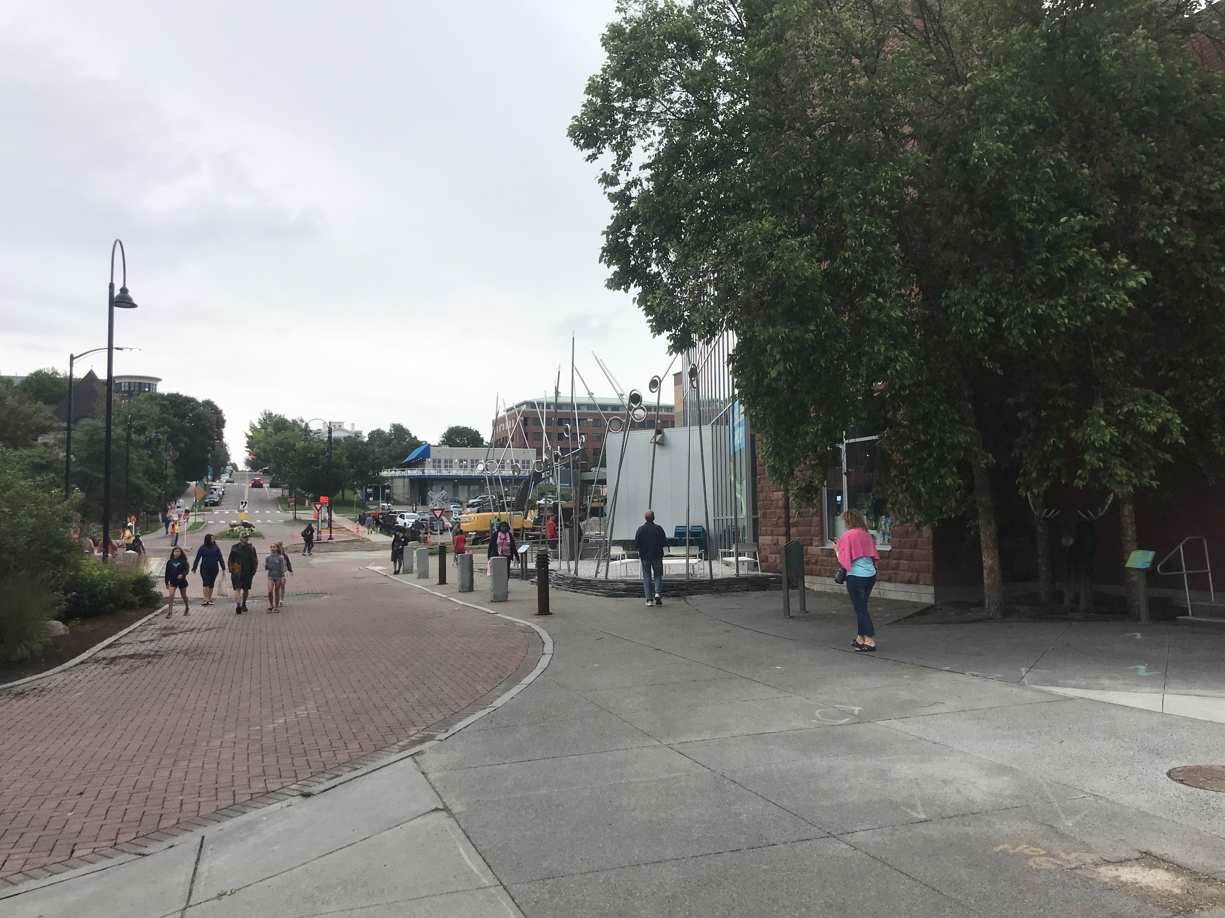
After crossing a parking lot and some train tracks, I entered Lakeside, a neighborhood constructed around the turn of the last century to accommodate the workers of the area factories. Its multi-family buildings housed the predominantly French Canadian residents leading he area to be called “Petit Canada” for a time. It’s a favorite spot of mine for pick-up soccer and it is well known by cyclists because the Burlington Bike Path (also known as the Greenway) passes right through it. The bike path extends beyond Burlington as the “Island Line Trail”, but more on that later. From Lakeside, the bike path passes by the swanky new Hula Lakeside space and the Burlington Surf Club, and also parallels the less-swanky Pine Street Barge Canal (a semi-wild, superfund site). The path curves around the patchwork of vestigial industrial aspects of the waterfront like the Vermont Railway Switchyard, Wastewater Treatment Plant and Lake Champlain Ferry Dock. But it also skirts adaptively reused buildings such as Union Station which will hopefully soon have train traffic again, and also served as a film location for the 2000 movie Me Myself and Irene. It also passes the Moran Plant a former coal power plant that went through many, many attempts at redevelopment until one finally stuck. The waterfront has changed drastically over the years, and has a diverse history but it’s a real gem and will be a resource for recreation, tourism and even wildlife long into the future.

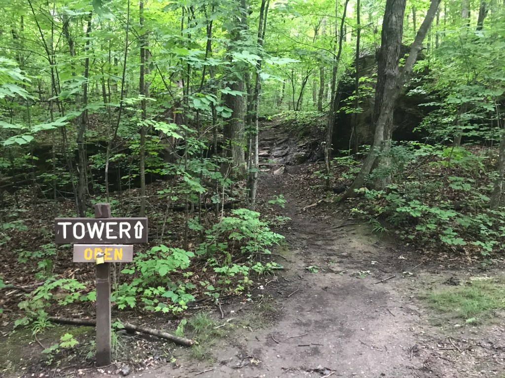
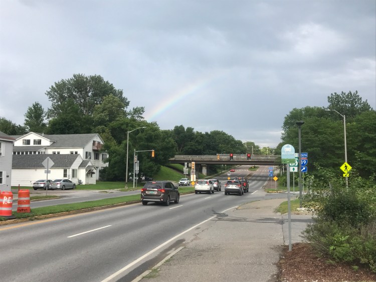
The bike path continues to parallel the lakefront for a little while longer, passing “Texaco Beach” named after the corporate owner of the huge gas tanks that used to line the shore here. Up a slight hill, the path diverged from the lake slightly as I approached North Beach park. I haven’t swam there in a few years, but it’s always hopping when UVM is in session. I much prefer the quiet trails of Rock Point, just to the north. Our friends Pat and Andrea actually got married there and it’s just a glorious serene spot. I then diverted off the path onto Killarney Drive, a roughly ⅓ of a mile dead-end road in Burlington’s New North End. I then popped across North Ave (all THREE lanes of it) and was back into the land of public paths. This time it was Ethan Allen Park, the most famous feature of which is its prominent tower. The park was proposed in the early 1900s, but its rock outcropping had been used for millennia. The Abenaki used it as a meeting point and strategic lookout for years before and tower was thought of. The land was subsequently taken by white settlers and was incorporated into Ethan Allen’s 300-acre farm. The tower and surrounding park was developed thanks to the efforts of William J. Van Patten and the people of Burlington who voted to buy the last parcels to complete it: the first time Burlington citizens had voted to spend public money to purchase land for a park. The New North end is now less farmland and more ever changing midcentury-style neighborhoods and shopping centers (with breweries!), but the scruffy park and its carriage roads still retain some of their charm.
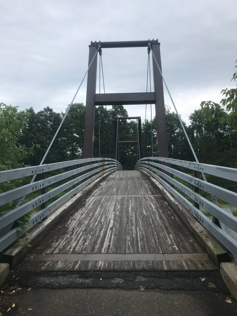
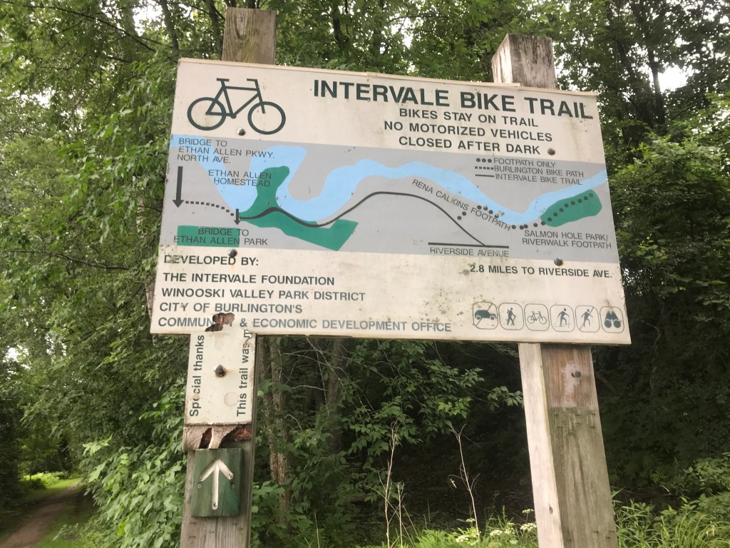
Exiting the park to the east, I crossed over the Burlington Beltline (one section of a never-completed ring road around Burlington) on yet another bike path. I was now deep into the Winooski River floodplain traversing lands managed by the Winooski Valley Parks District. The area is home to a museum as well as the New Farms for New Americans program. The agriculture theme continued as I crossed onto the Intervale Center’s land. At various points, the Intervale land has been home to Abeneki hunting and agricultural practices, a diary, a municipal dump, a pig farm, and now a constellation of small farms, and natural areas thanks to the Center’s founder Will Rapp of Gardener’s Supply (which is still based right in the Intervale). It’s also a wedding venue and is home to Burlington’s McNeil Power Plant, which burns wood chips and is a large part of how Burlington Electric was able to reach 100% renewable energy a few years ago (the first city to do so in the US). After climbing up the steep hill out of the floodplain, I turned onto…you guessed it: another bike path!
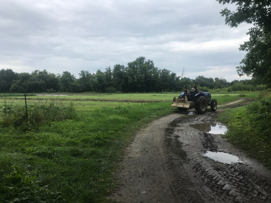
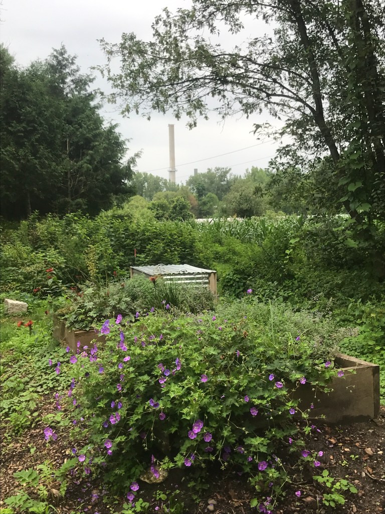
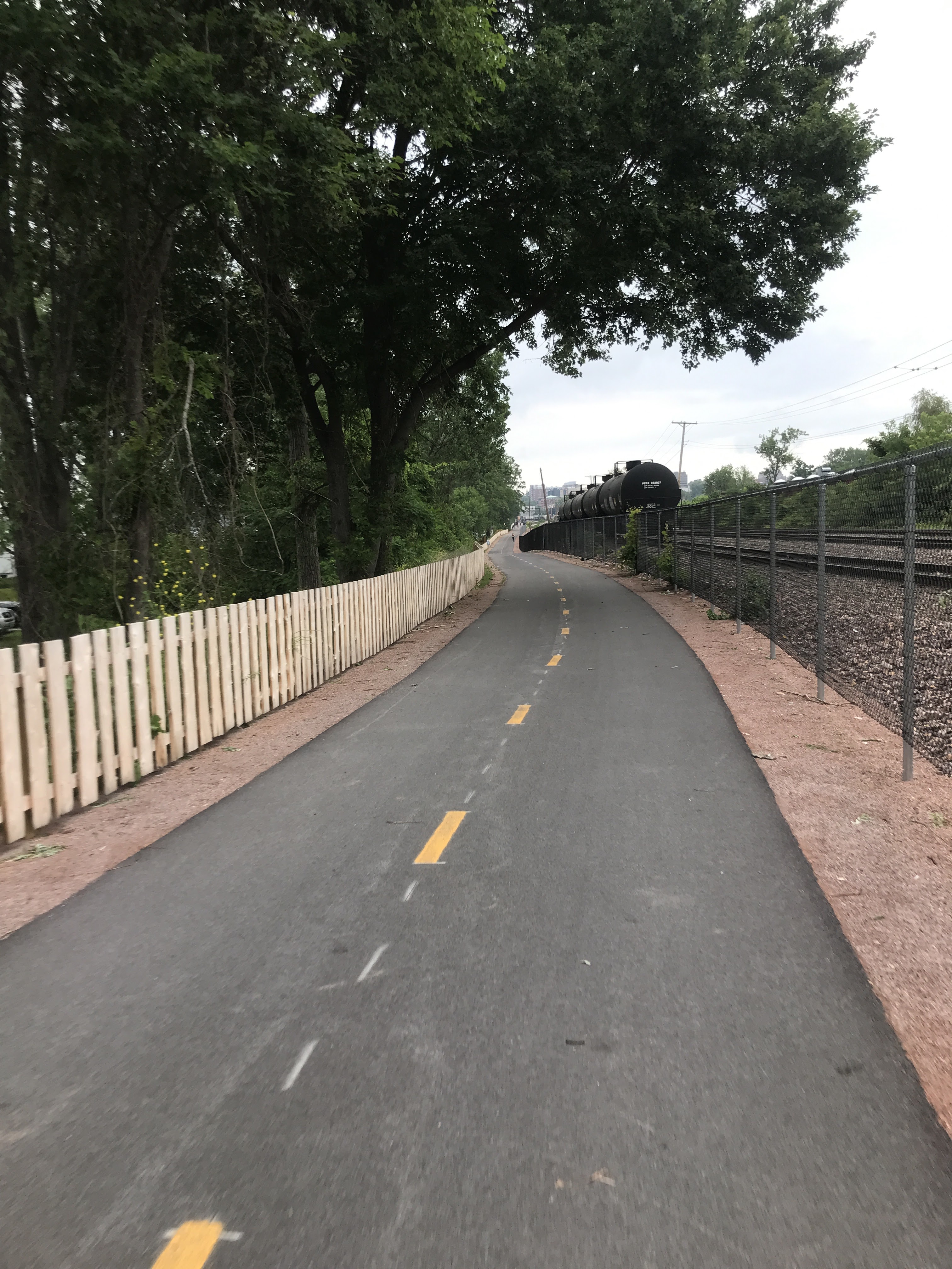
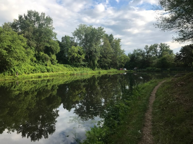
The Riverside bike path takes you upstream (but downhill…you figure that out) towards the city of Winooski. Along the way, your nose is bombarded by a cacophony of scents: wastewater treatment, barbecue, mechanics, and until recently a bakery. Sadly, the Koffee Kup Bakery abruptly lost its redolence just a few months ago: shuttering its doors, trying to screw over its employees and stopping those amazing donut smells for now. Even if their new buyer ramps up production again, I doubt their oddly lumpy mascot “Mr. Cruller” will carry on. So with a heavy heart and empty nose I pushed past. I soon came upon the Winooski river again, at Salmon Hole and the Falls. Winooski manages to fit a lot within its 1.5 square miles to help it come out from Burlington’s shadow. I sometimes think of Winooski as Burlington’s Brooklyn: a funky, kind of scruffy, but oh so hip enclave across the river. The old mill city has had its fair share of urban renewal travesties, but many of its old mills still exist and it’s certainly working hard to balance preservation with expanding housing and business growth. I took a small detour down to the dam to see the water that was rushing over, thanks to the rain-swollen river. I then looped under Main Street and over to grab a bit of food at the natural food store in town. Some momo dumplings and a plum were enjoyed looking out on the river, but I soon boogied up the hill to ride one of the only dirt tracks I could find within city limits.
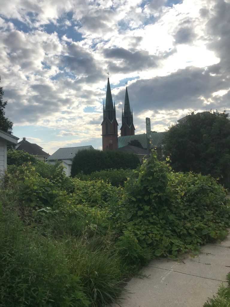
The Gilbrook Natural Area is tucked right on the city boundary between Saint Michael’s College, Camp Johnson (a base for the Vermont National Guard), Interstate 89 and some industrial businesses. It’s not a huge area, but dirt is hard to come by in this tiny city and bikes are allowed, so I took a rip on some of their mellow trails before heading back into the Winooski neighborhoods. These residential streets were the first time on the ride I logged real miles on a true road. I passed the double steeples of Saint Francis Xavier church that can be seen from all around the city. I then dropped down onto Malletts Bay Ave and soon enough was into Colchester (of which Winooski was a part until it incorporated as a city in 1922). The houses spread out as I passed a horse boarding operation and I was quickly back down into the floodplain. After a little time on the avenue, I took a left onto Pine Island Road. Pine Island isn’t a proper island, but it is surrounded with lots of lowlands. They’re now mainly cultivated or left natural. The land is owned by the Vermont Land Trust and the farms are run much like the New Farms for New Americans: providing access and shared resources for refugees and recent arrivals. It’s a very cool model, plus they have goats with a taste for Christmas trees! I had actually never been out there, so I took my time as I pushed out their flat dirt access road. As I approached the main buildings, I was pretty sure I could connect over to the Macrae Farm Park, but wasn’t 100%. I picked up my pace and moved confidently as I ducked down a small access road and onto some lightly used tracks through thick grass. It was wet, but rideable and soon enough I entered the park’s boundaries. I rode the “Old Town Road” trail to the parking area (no sign of Lil Nas X). From there I continued to follow an old meander of the Winooski on Macrae Road. I continued straight onto Porter’s Point Road, passing the Sunset Drive-In. I couldn’t stay for the Space Jam / Godzilla vs. King Kong double feature (what is this the late 90s?), so I pushed on. I eventually reached Airport Park and rejoined the Island Line bike path to head up onto the causeway.


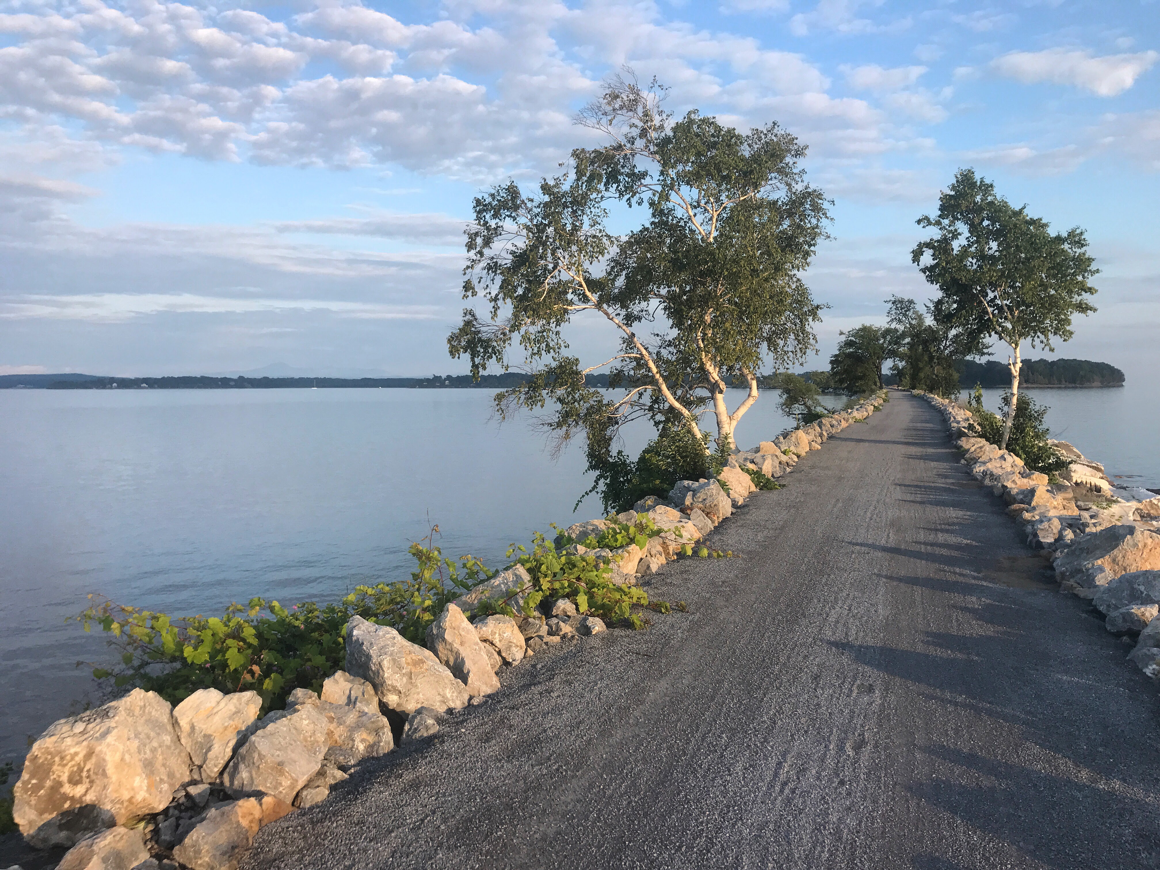
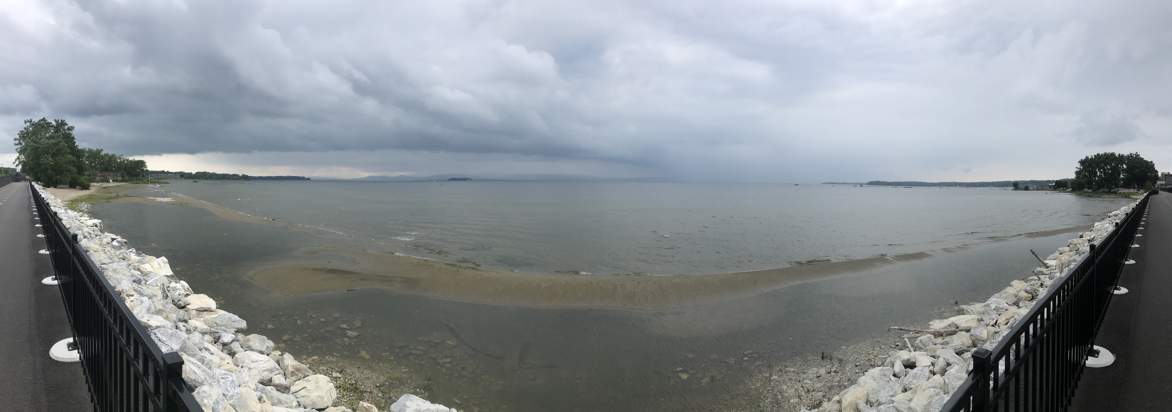
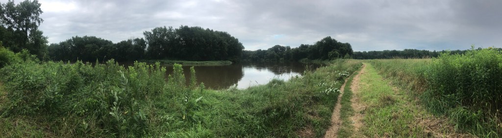
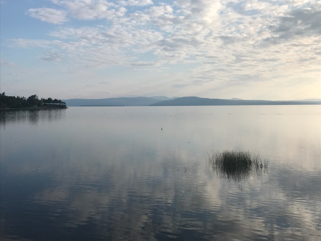
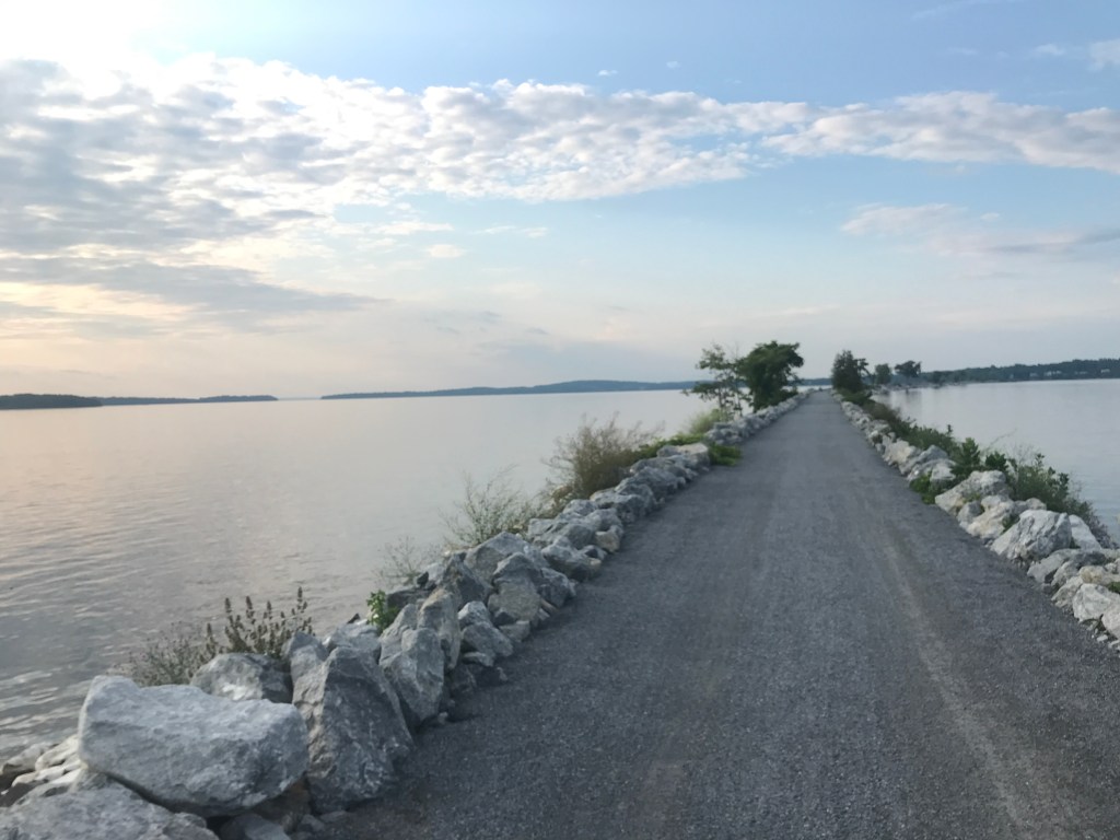
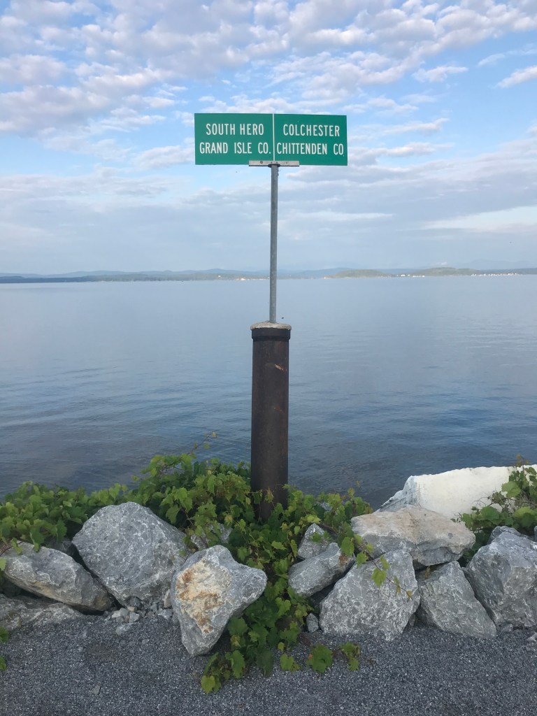
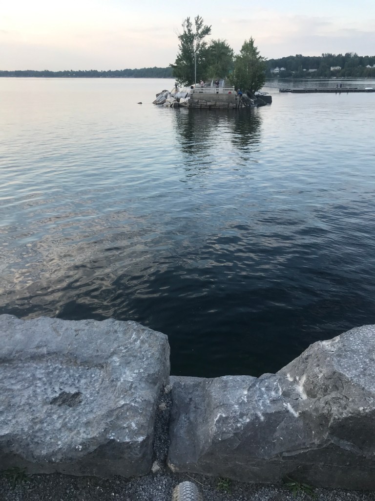
The Causeway is a thin spindle of riprapped marble snaking about 3 miles across Lake Champlain from Colchester and South Hero. It was built by the Rutland Railrailroad in 1899, taking only one year to complete. It cost around one million dollars and provided service from Burlington to Alburg. There is a “cut” a few hundred yards south of the northern terminus that had previously been connected by a swingbridge, but is now connected by a seasonal bike ferry. This ferry is operated by Local Motion, a bike advocacy organization that was integral in converting the causeway into a bike path after the railroad finally shuttered the line in 1961. The bike path has been a popular spot since its formal beginning in the 90s though it needed major repairs in 2019 after high winds and water levels caused major erosion. It’s now in great shape and is seriously beautiful.
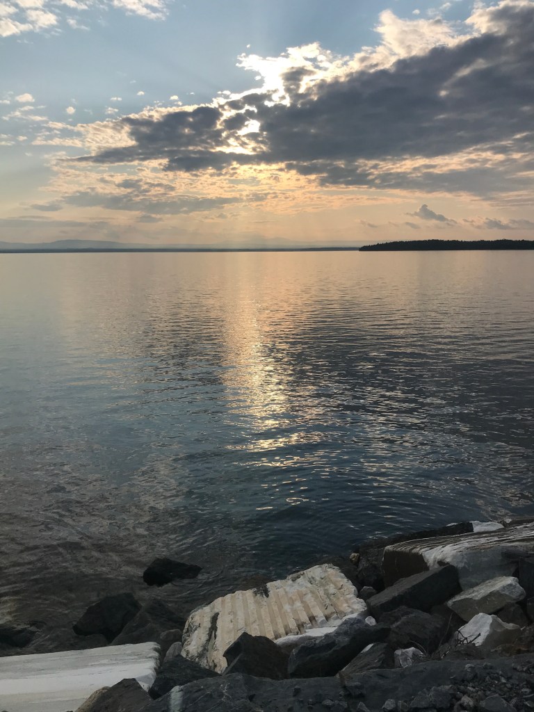
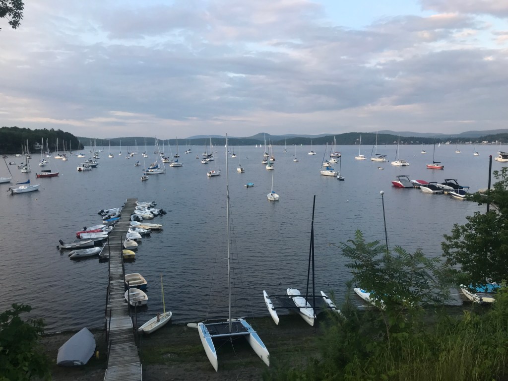
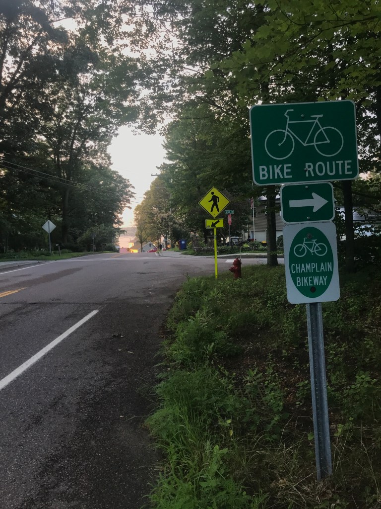
Before getting to the causeway proper, I followed the old railroad corridor through Colchester Bog which was thick with moths. There has been a gypsy moth infestation in parts of Vermont and they can do quite a number on foliage. After avoiding some wet spots, along with the moths, I popped out onto the causeway. The dark clouds had cleared and the sun was shining bright as it dipped to the west. The immediacy with which you go from a green tunnel of trees to being basically surrounded by water is always jarring. And as you head north, the curve of the path and the distance from shore opens up more views of the Green and Adirondack Mountains. The mixture of old industrial processes with the reclamation of nature just checks all my boxes. I stopped to take photos a number of times and passed folks, walking, running and biking. At one point I caught up to a group of younger guys who were peering over the edge of the path. It turns out that they were looking at a long-tailed weasel dipping in and out around the large chunks of marble! At the cut, I admired the view yet again, but had to turn around quickly to ensure I met Maddie when she was done with her volunteer shift. I retraced my steps all the way back to Porter’s Point Road, at which point I jumped onto the path that parallels the West Lakeshore Drive leading to Malletts Bay. I enjoyed being separated from traffic yet again. Once into the busy area around the Bay, I had plenty of boats to look at out on the water. Malletts Bay has long been home to summer recreation and boasts many seasonal camps. I continued through some of Colchester’s many neighborhoods, following a path that’s part of the Lake Champlain Bikeway: a series of routes that you can ride all round the lake through Vermont and New York. After zig zagging through those houses and getting some nice peek-a-boo views of the lake and the sunset, I took Bay Road onto Route 2 to pull into the Respite House lot just as Maddie was walking out. Great timing and a perfect way to end my work day and my first point-to-point 251 ride!


The Details:
https://www.strava.com/activities/5666238095
https://ayvri.com/scene/gdkz16el5z/ckrevcfbu00013h6iz7pedtfy

2 thoughts on “Ride 20: Burlington, Winooski & Colchester”