
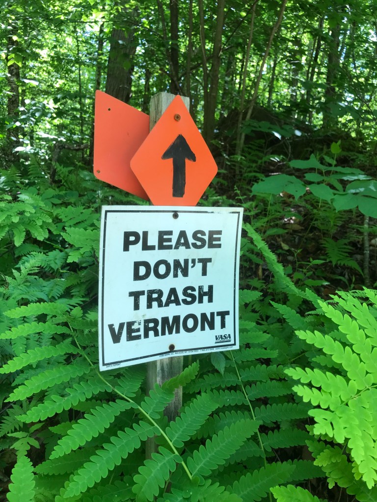
After three-straight full weekends away from home, I decided to keep the streak alive (for the day at least) and head two hours south. This route originating in North Shrewsbury is in the areas south and east of Rutland that’s been a mystery to me. Much like the area covered by Ride 5, these towns are a part of the state where I may have heard the names, but had little knowledge, let alone direct experience of what they are like. Add to that, the fact that I did less than my normal amount of research and vetting of the route, and you had a recipe for a pretty mysterious, surprising and (for the most part) fun ride. We’ll get to that qualifier in due time.
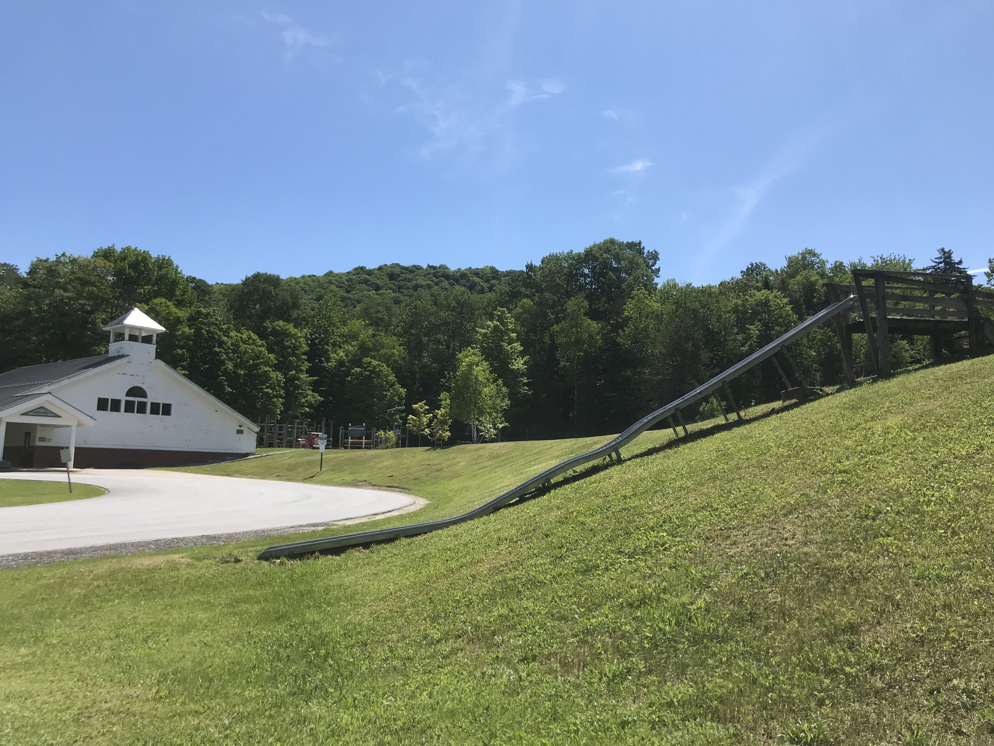
This ride began at the Shrewsbury Mountain School, the public K-6 school for the town. The dirt parking lot was abandoned, but there was a wickedly fun-looking slide that was super long and ended precariously close to the driveway. But I bet it’s a blast. Having taken my time a bit in the morning, I hustled to get geared up and got under way under sunny skies. I headed uphill and almost immediately encountered Pierce’s Store. I’ll provide more details on the store later, but having seen it on the drive in and realizing I probably only had one store stop, I regretted not shifting the route to have this stop-opportunity land outside of the first five minutes. I turned onto CCC Road and began a stead climb into Coolidge State Forest. The road was named after the Civilian Conservation Corps that built it back during the depression. CCC camps were sprinkled all throughout the state and the young men employed by the Corps completed many amazing projects that are still enjoyed today. The road was smooth, but pleasantly remote: it’s not plowed in the winter. There is a network of trails that crisscross it that are hiked in the summer and snowmobiled in the winter. Some of the roads shooting off even looked like okay riding. This is certainly an area I’d like to come back to and explore more. After the steady climb, I shot down a few switchbacks and out into the sun, pavement and fast traffic of VT Route 100. This road is one I explored under people-power a few years ago, but back then it was part of a team doing the (sadly now defunct) 100on100 running race. Team “Hustle and Flow” leapfrogged from Stowe down to Ludlow, each running three legs for a total of roughly 15-20 miles per person. My last leg in 2014 was actually just south of where I popped onto Route 100! That leg also passed through the settlement of Plymouth Notch where Calvin Coolidge was was raised and also where, in 1923 he was sworn in (by his father!) as the 30th President after the death of Warren G. Harding.
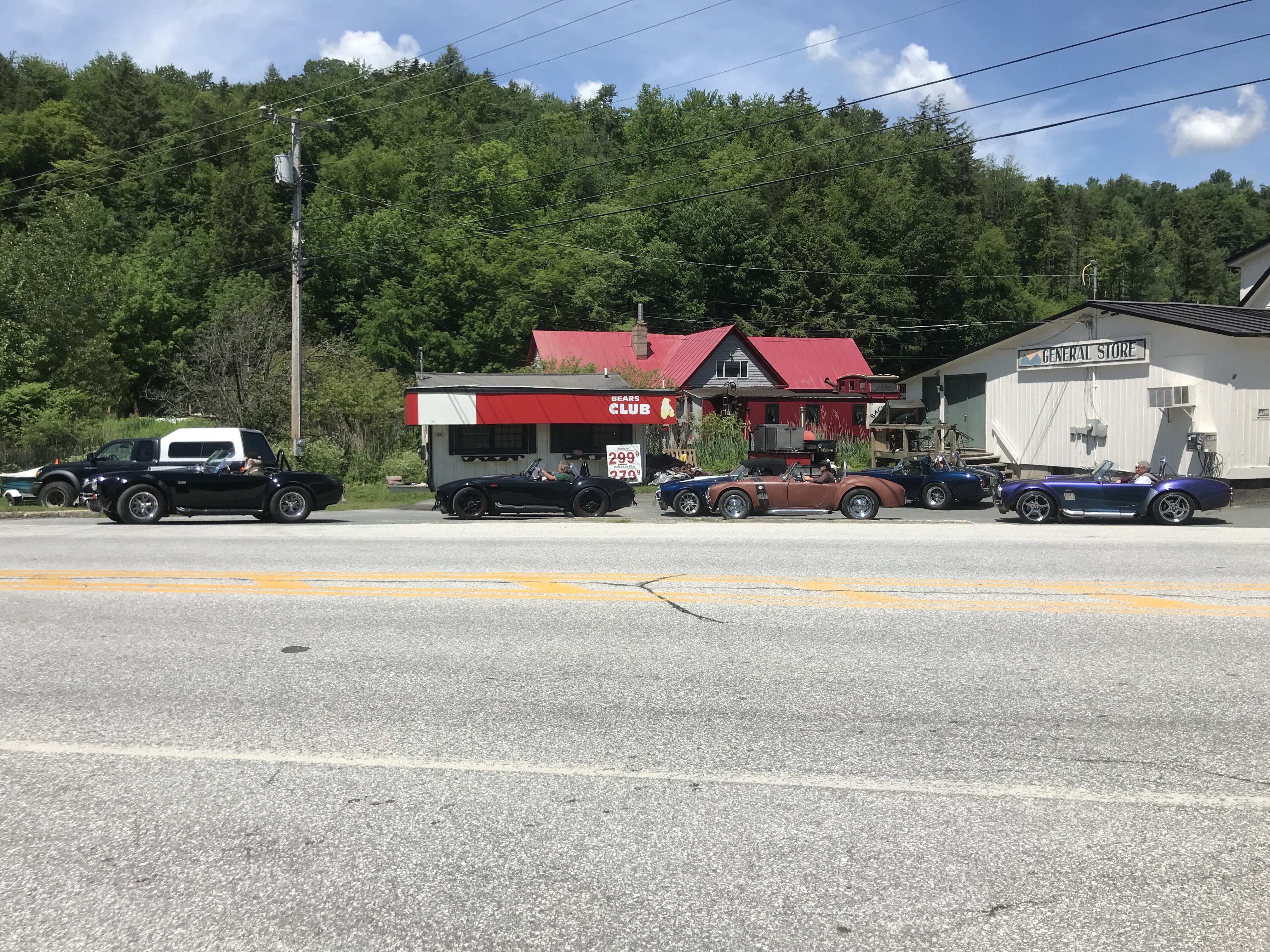
I zipped north and downhill past the Farm and Wilderness camp situated on Woodward Reservoir and quickly reached the intersection with Route 4. Had I turned left for even a few feet, I’d be in Killington, but that’s a town for another ride. I was close to the resort though and because of that you tend to see random big houses and other odd sights. The odd sight today took the form of at least six Shelby AC Cobra convertibles in various states of customization. Clearly it was some sort of owner’s club out for a drive that stopped at the Sunrise General Store for a pit stop. I’m not a huge car guy, but it was neat to see. I took a right and continued enjoying the downward sloping grade, making a quick detour onto tiny Mountainside Road to be sure I rode on a little dirt in the town of Bridgewater. I cruised into town, already hankering for some lunch.


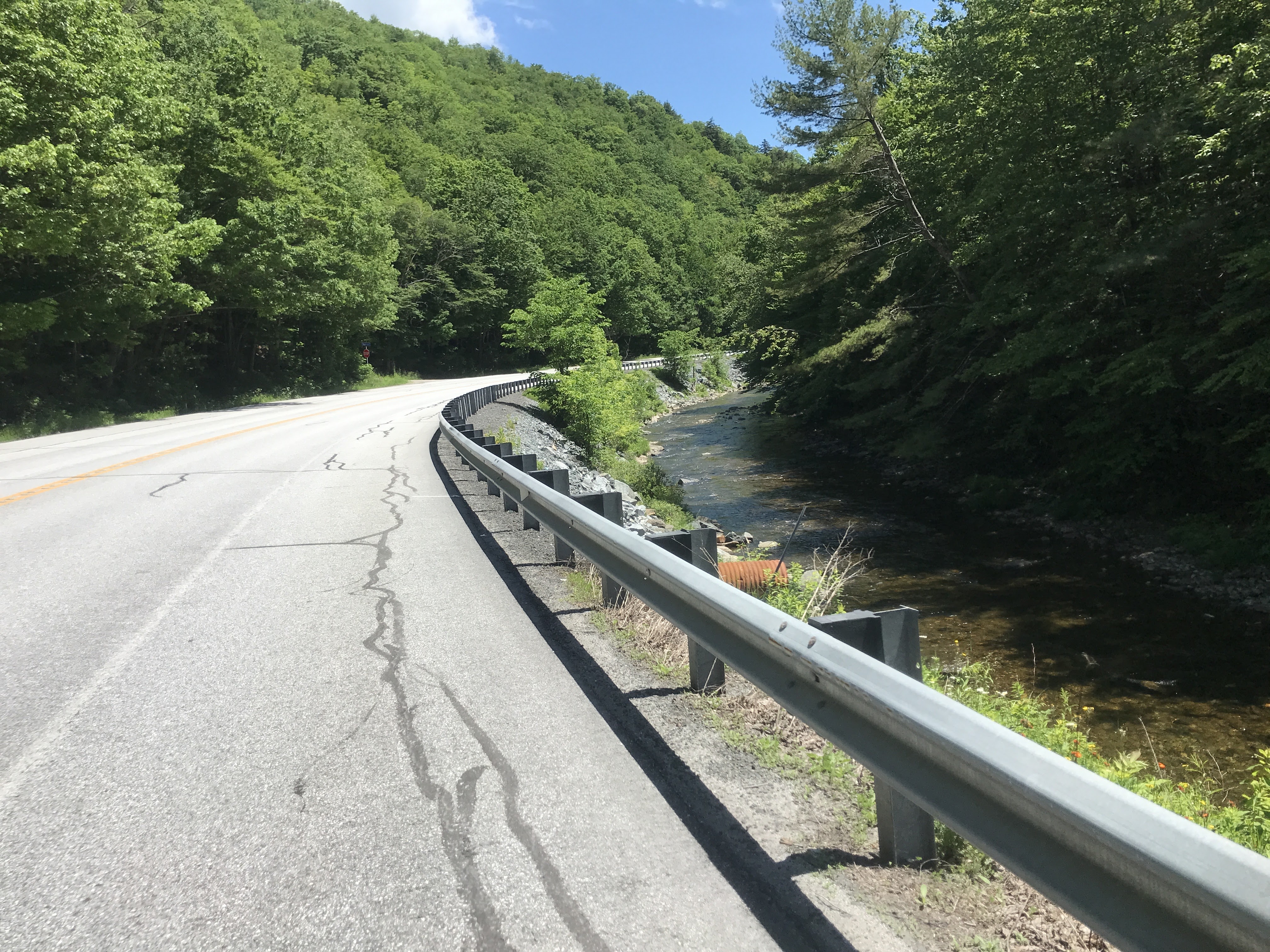
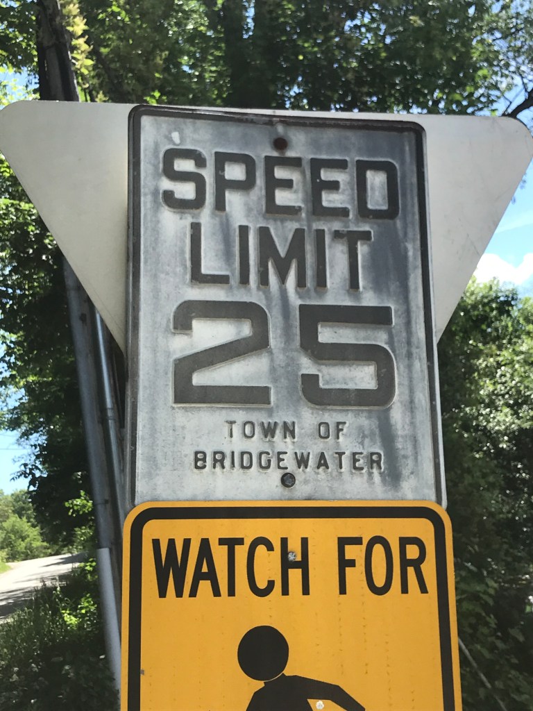
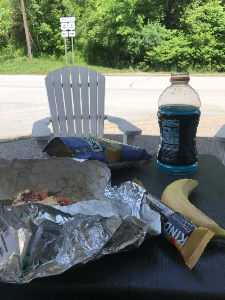
As I neared Bridgewater Corners, the Long Trail Brewery suddenly appeared before me. This small settlement is certainly best know for the iconic Vermont brewery, where they’ve been headquartered since 1995. The brewery is currently closed to the public, but is set to reopen later this month. I took a left to snag another small stretch of dirt road called Upper Road and was pleasantly surprised by how quiet it felt despite it running parallel to Route 4. At its entrance, there was an awesome old town speed limit sign: embossed metal with “Town of Bridgewater” below the “Speed Limit 25”. You don’t see many of these signs left. I looped back off of Upper Road and then to the Bridgewater Corners Store. I grabbed a somewhat satisfying lunch and had to buy water and use a pretty nasty port-a-potty since they don’t have a public restroom. Not the best store, but it was hard to leave knowing it was my last real stop of the day and I was less than a third done with the miles. I took a little extra time and enjoyed doing a little people watching. There were clearly folks from out of town and I especially enjoyed hearing a man with a pretty strong New York accent (maybe a second homeowner?) waxing poetic to two women (who were for sure from out of town) about maple ceemees as they enjoyed their first ever taste of them.
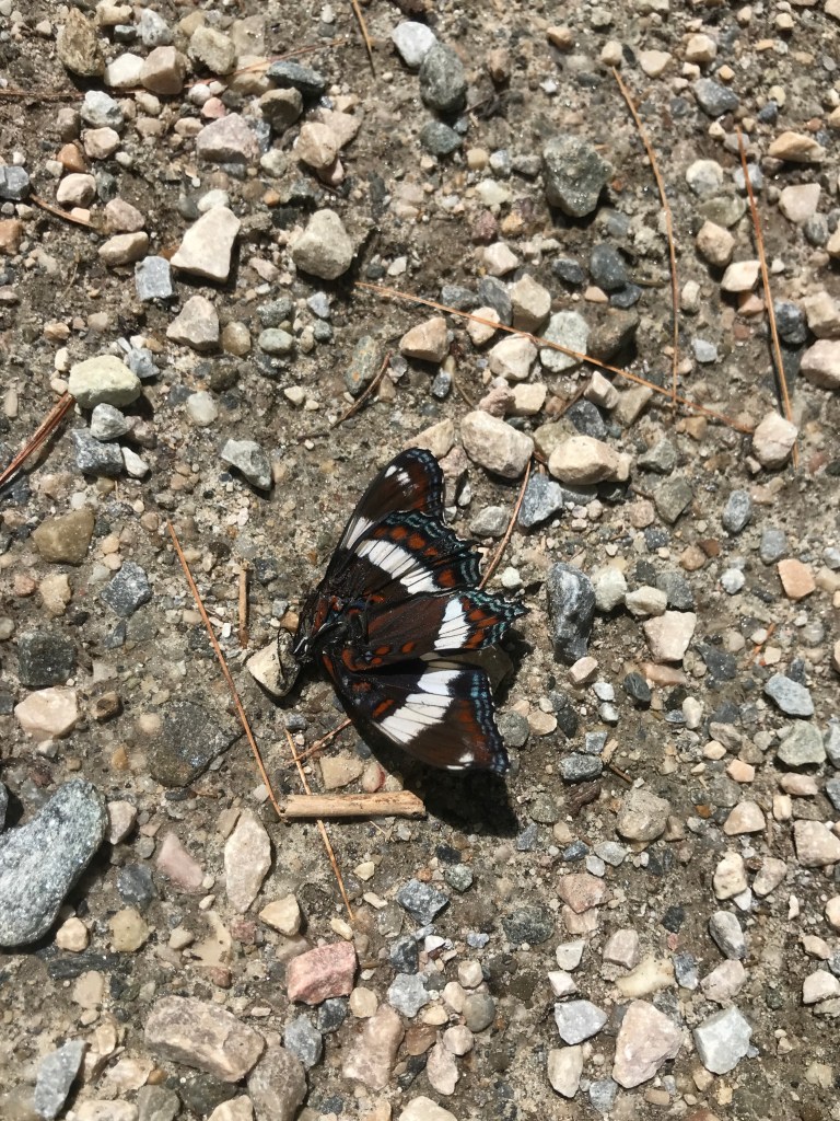
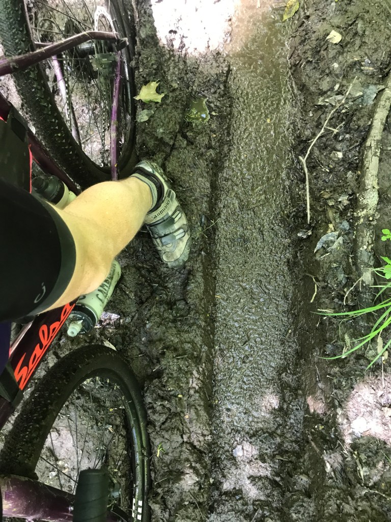
The road ahead was a bit of a mystery to me, but as far as I knew it was some classic Vermont Class 4. The tricky part with researching these rides is knowing what’s actually going to be on the ground. Maps can only take you so far. But the condition of this section I probably could have surmised with a little more snooping. But it’s also sometimes fun to just show up and see! Worst case scenario is you just walk. So after a short stint on Route 100A, I turned onto Hale Hollow Road. It was a fairly gentle slope up as I darted in and out of White Admiral Butterflies sunning themselves on the warm road. They would appear brave, defiantly staying put, then flit away at the last second. I sadly did find a few that weren’t quite fast enough to beat the engine powered traffic on the road. After a mile or so, I took a left onto what would soon become clear are ATV trails. And not just the kind that trucks or even side-by-sides could easily traverse. There were large loose rocks, some deep-ish mud and running water at points. The angle also ramped up, but I was able to stay on the bike for the most part. Luckily my wheelbase is a bit more narrow than the normal traffic, so I could sneak onto the shoulder. I climbed steadily, taking a few breaks and navigating the trails thanks to my GPS, but also the prolific signs at each intersection. At the shoulder of Mount Moses, I reached the top of the climb and was greeted by a large swath of water which set the tone for the decent. The eastern side was much muddier than the west and I was happy to be going down hill. I had to hop around mud bogs and running water more than before for sure. I also encountered a couple on 4-wheelers who gave me a courteous, but curious nod as they put-putted by. I eventually popped out back onto true dirt roads and had a smooth and easy roll down Brown Schoolhouse Road.
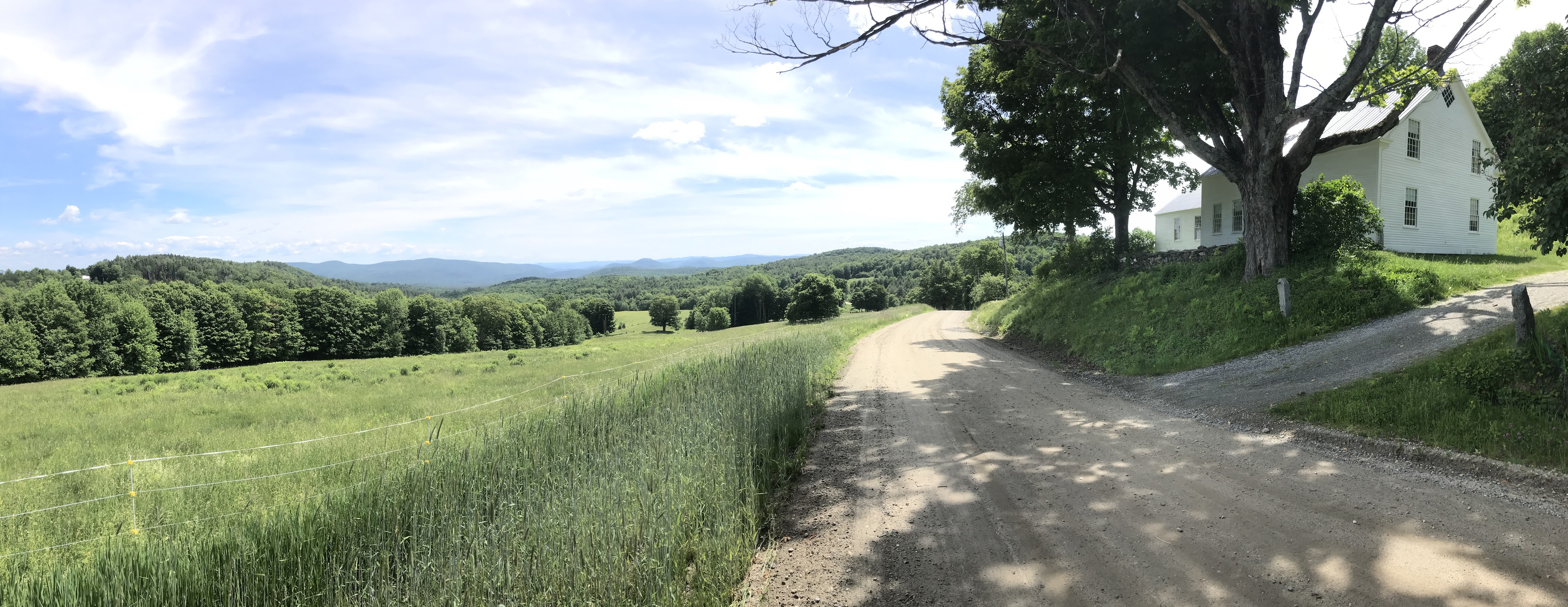
By this point in the ride, I had crossed into the town of Reading: home to 666 people and one of the most photographed farms in Vermont. Pulling onto North Puckerbrush Road, I began one of the most gorgeous stretches of the whole 251 attempt so far. There were ancient maples, and pleasant fence lines. Bright fields and shaded allées. I also got to see one of the best signs so far too: once I arrived at Grasshopper Lane, some scoundrel had use green duct tape to cover up the “Gr”. Juvenile humor, I know, but it really made me chuckle. The best view of this portion was coming along a perfect stretch of smooth dirt road which was lined by maples on my left, that then opened out into a far view of rolling hills with the most picturesque white farmhouse appearing on the right. Just stunning. Oh and there was a massive hill to bomb down right after too. So that didn’t hurt either.
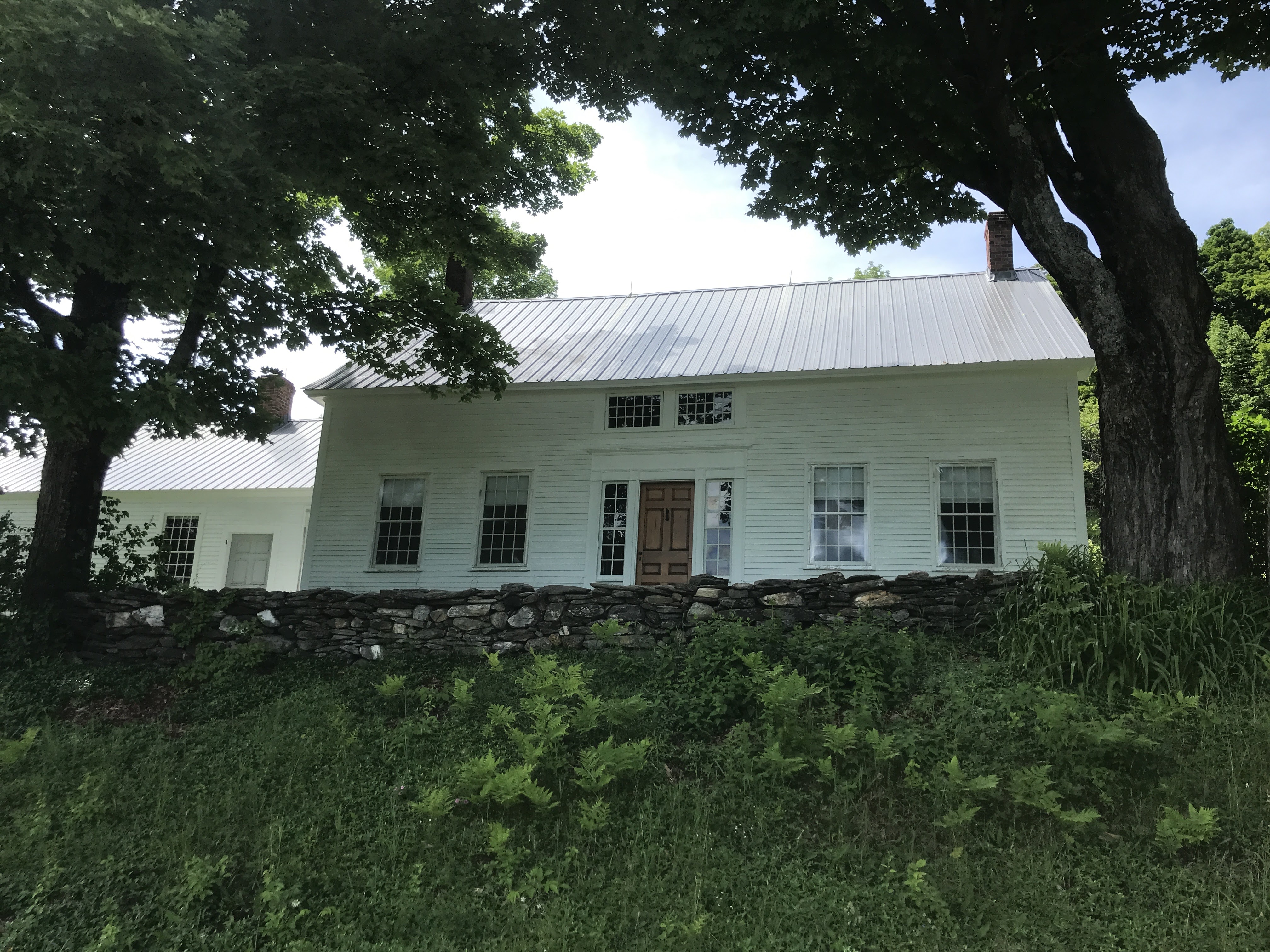
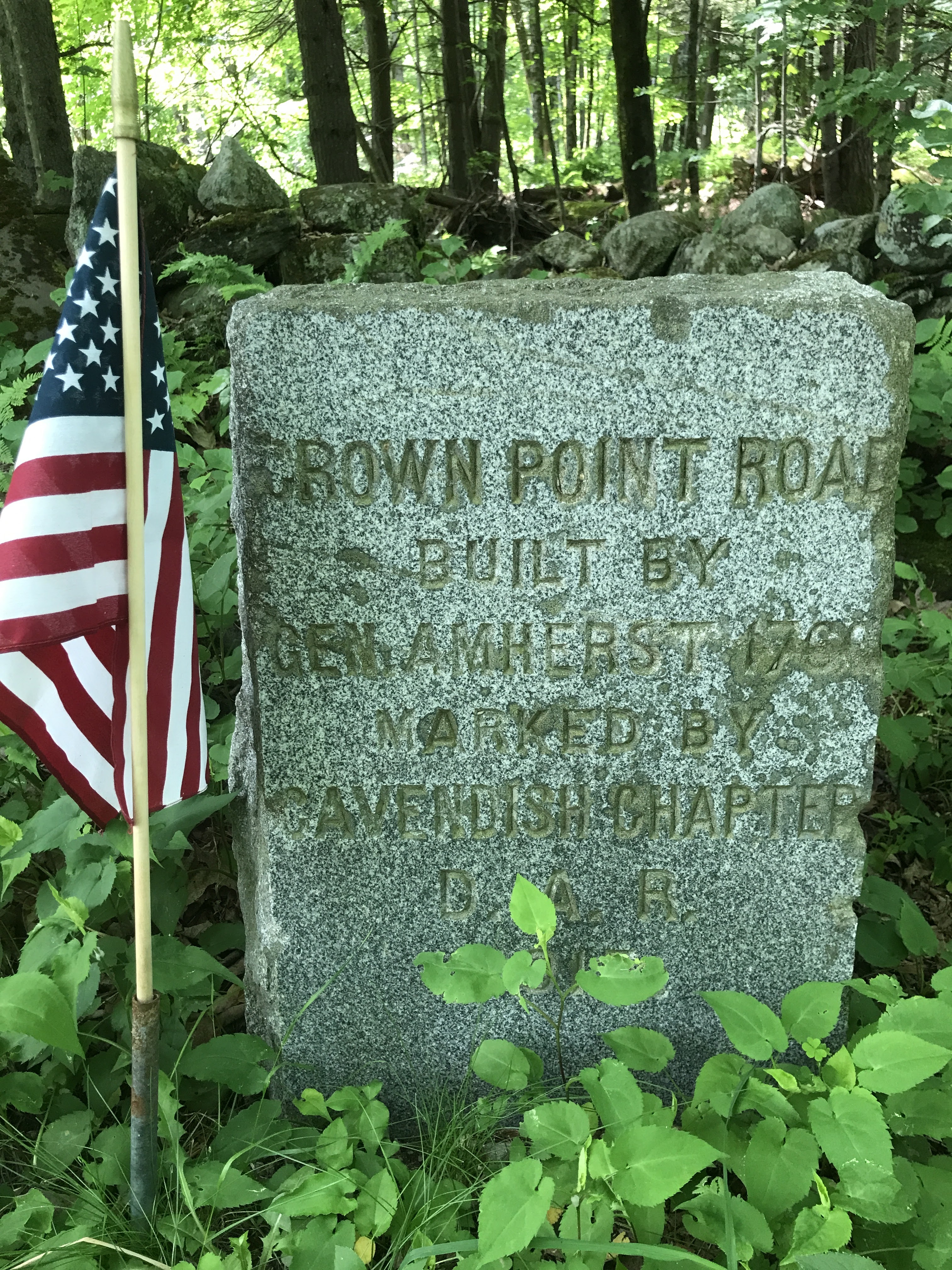
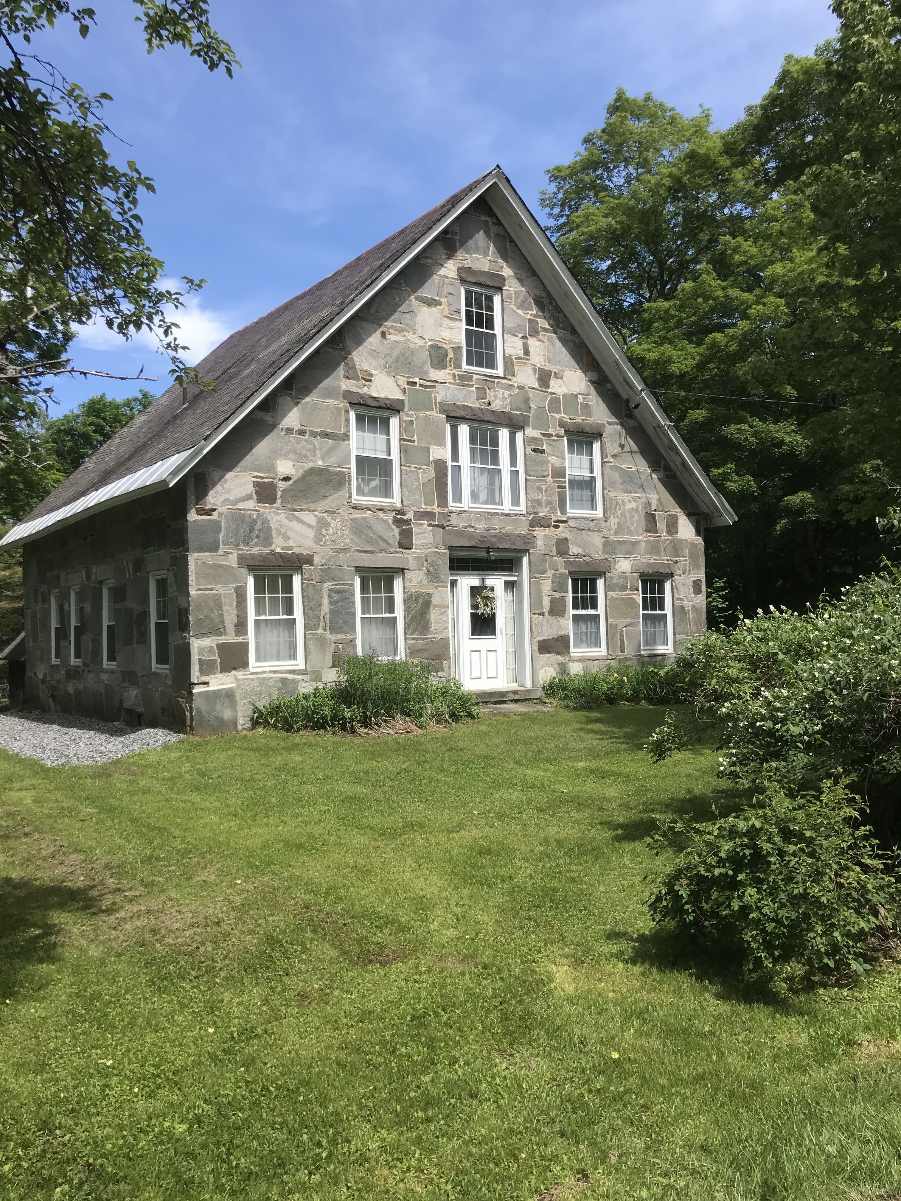
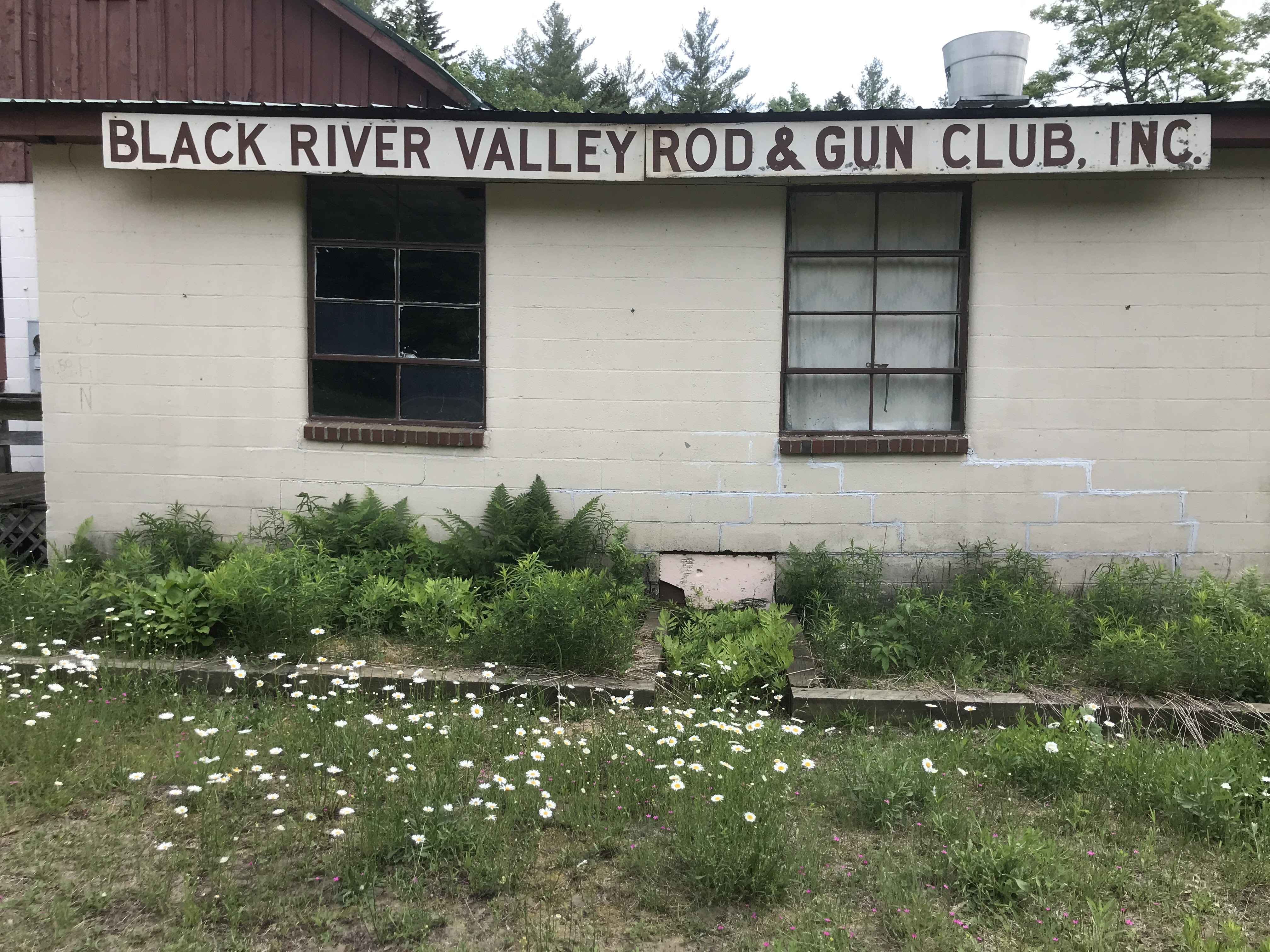
I soon reached the most southerly part of my ride and began working my way back north on some paved roads towards the Ludlow town line. There were a few houses that had similar stone construction to those I saw on Ride 13 which makes sense since we’re only just over the ridge from Baltimore. I also passed a few small monuments to the Crown Point Military Road which was finished in 1760 by the British Military. Parts of it have been subsumed by modern roads along its length from Crown Point in New York and the “Fort at Number 4” in New Hampshire. I eventually climbed up to a mellow stretch of Class 4/hiking path that connected me over towards Lake Rescue. The provenance of the lake’s name is up to debate, but it either involves a heroic dog or a kindly mama bear. The area is clearly a seasonal camp zone with many smaller 3-season houses and the occasional winterized ski home mixed in. This makes sense because the lake is only a few miles north of Okemo Mountain. A popular ski area around which many people (including my aunt and uncle!) own properties. I reached route 100A and took it south for a hundred yards or so, then turned onto Rod and Gun Club Road. I heard a few distant pops of gunfire in the distance, then none. Then all of a sudden I was right nearby a range and the sound almost made me wobble off my bike! I then turned onto Buttermilk Falls road to head up and take a needed break.

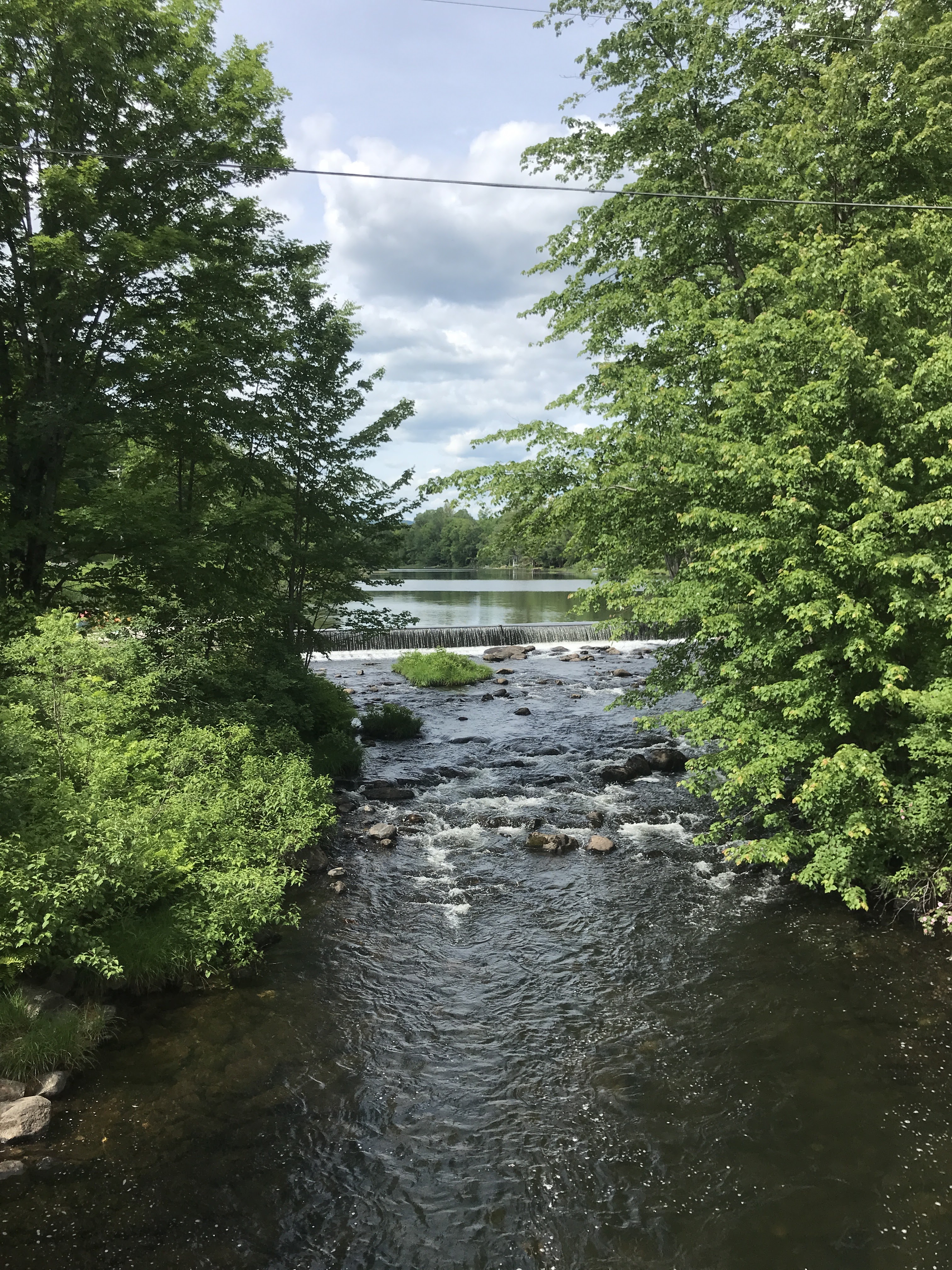
Buttermilk falls consists of a series of pools and small cascades that runs along a dead end road. The bridges at the west end have been abandoned for vehicle traffic and every hot day, cars line virtually the entire length of the dusty road. I actually swam there after Ride 5 last year. With the air and water temperatures being what they were, and having roughly 10 more miles to pedal I could only sit by the river and splash some water on my face. But it was a welcome respite. I ate a snack then headed over the two bridges and the Mount Holly town line, after which I popped out onto Route 103. I was on its mercifully-wide shoulder for only a little bit before taking a right onto Shunpike Road. Shunpikes were roads that were created to avoid tolls. Often they would run parallel to a more major route and skirted the tollbooth: shunning the turnpike. Presumably at some point there was a fee assessed for using the route that now carries 103 and I was able to avoid the 50 mph cars (not tolls) thanks to those penny-pinching Vermonters that preceded me.
I continued climbing until I reached Lake Ninevah Road. When planning, I decided to take this northward jog to add in a little spicy Class 4. Having assumed that much of the earlier Class 4 was going to be easier, I wanted to be sure to get even more in. At that point in the ride I certainly didn’t need more, but I was a little nervous about deviating from the route in my GPS and plus: could it really be as rough as the earlier stuff? Spoiler alert: it could. After the climb up the Lake Ninevah, the views of which were occluded like those on Rescue Lake, I turned left and began another rocky, wet section of Class 4 (see the main photo above). It wasn’t as steep as before, but the legs were feeling it now. I hopped on and off, walking plenty. But wanting to avoid the more present mosquitos, I kept moving. Mercifully, I popped out onto Tabor Road. I had a few more ups and downs plus a second beautiful view next to a white house. I had a good cruise back into North Shrewsbury and to the school. I packed up, and headed up to Pierce’s Store. That spot has been home to a store since at least 1865 and from 1918 until 1993 it was run by successive generations of Pierces. The store was sold to Preservation Trust of Vermont and is now run by a cooperative of local residents. I refilled water bottles, bought a few snacks and purchased my new favorite recovery drink: maple milk. It really hits the spot. I also popped into the barn next door where they were displaying a series of photographs that had been shared by the family that ran the store for years. It was a very neat way to end the ride. I headed back north the two hours home where Maddie had dinner waiting. How lucky am I!?!?
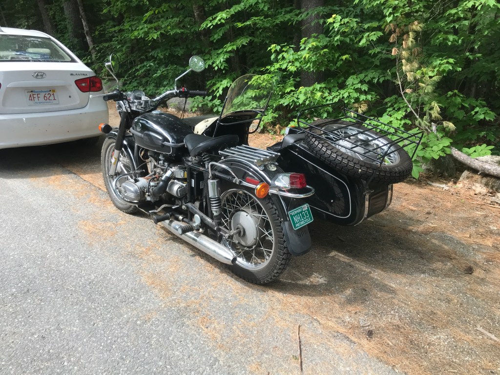
I’ve always wanted to ride in one of these 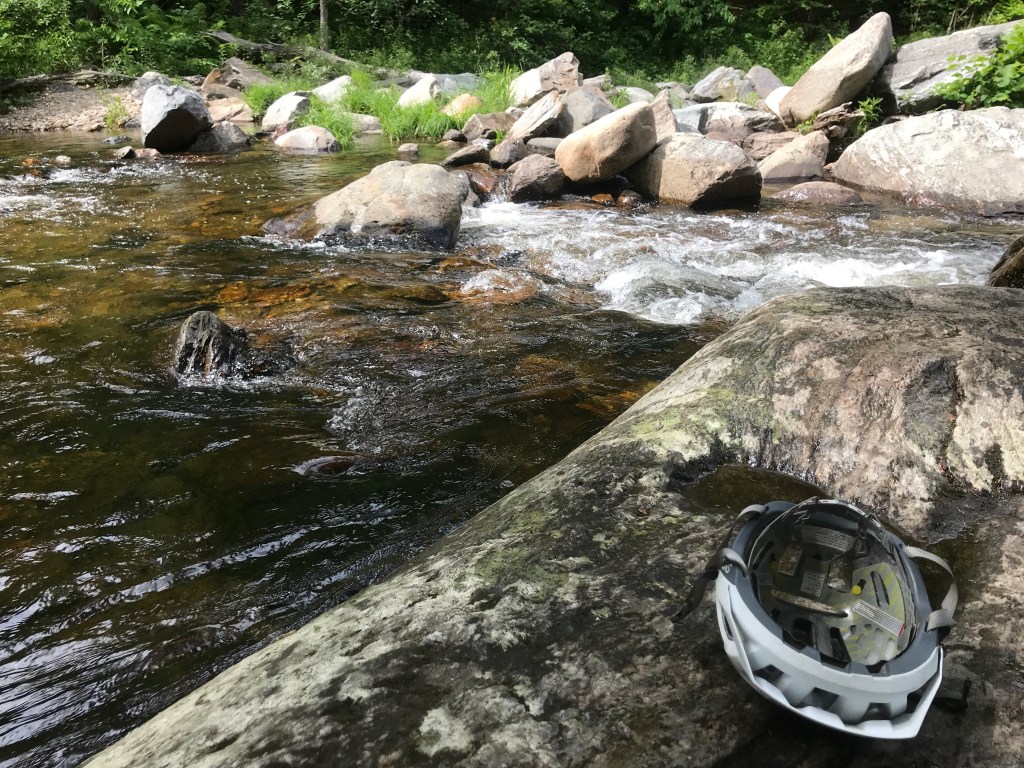
A little R&R 
The abandoned bridge deck 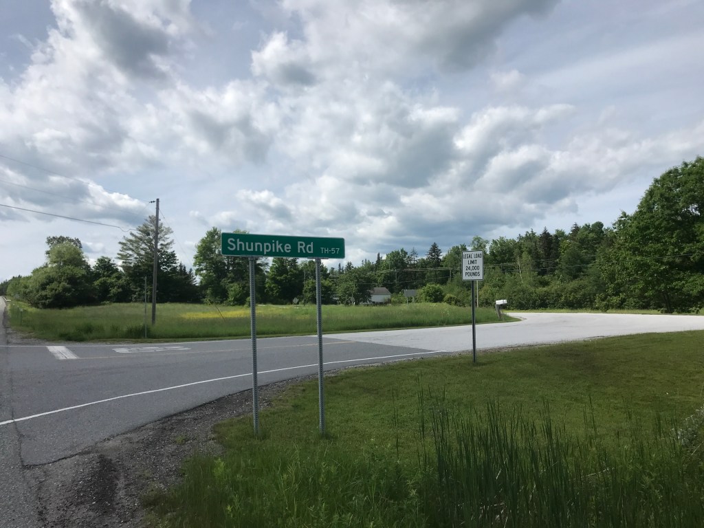
No tolls for me! 
They perfectly matched their Subaru to the barn. Or is it barn to the Subaru? 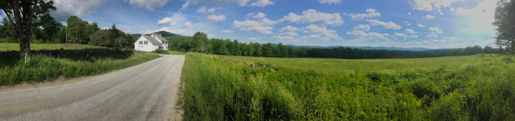
White houses and views 
Those are some funny-looking sheep 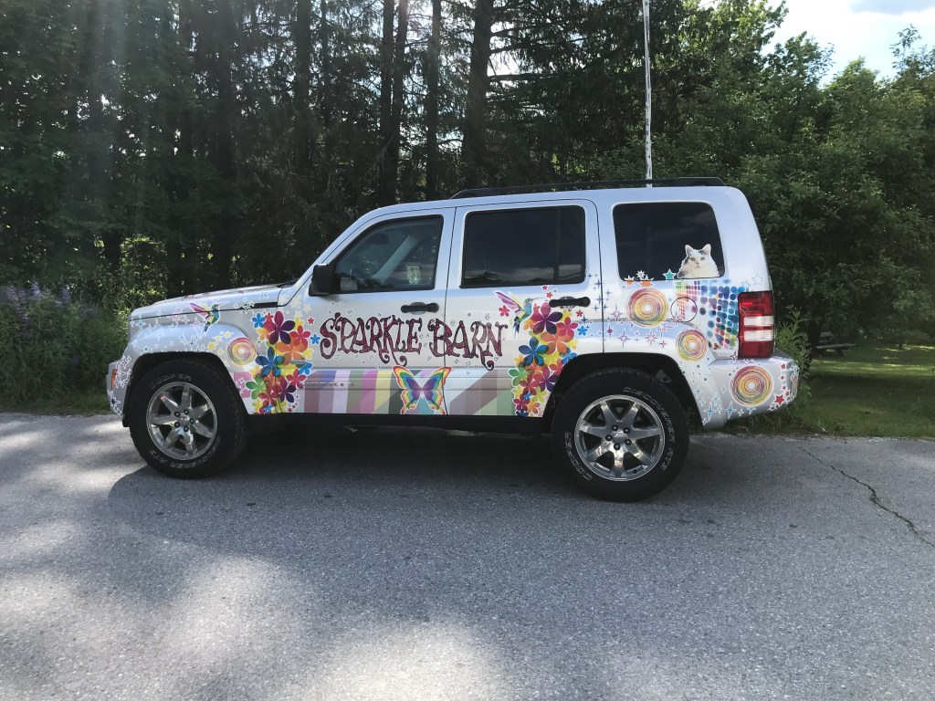
The Sparkle Barn of Wallingford offers “Unique art, eclectic girts and curated whimsy” plus they have a sweet custom jeep. 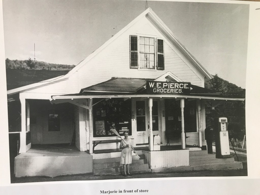
Honestly, not a whole lot has changed

2 thoughts on “Ride 18: Shrewsbury, Plymouth, Bridgewater, Reading, Cavendish, Ludlow & Mount Holly”