
The transition from fall to stick season had continued its relentless march southwards and with peak foliage already nearing the Massachusetts border, Maddie and I decided to get a ride in. I’d been keeping some of the southern routes in reserve for times like this, figuring there would be a day with sun and moderate temperatures. Plus it’s always fun to take a good long journey on a crisp autumn day. And journey we did. We began by setting course down I-89 and I-91 for the historic village around the Rockingham Meeting House. It’s on the top of a small knoll and surrounded by sweeping views of the surrounding hills and valley of the Williams River. In the year 2000 it was listed on the National Register of Historic Places and deserves the recognition: it’s stunning and needs to be seen in person to be fully appreciated. As a nearby historic marker says:
“The Rockingham Meeting House is one of the finest remaining examples of New England Colonial architecture. It is the oldest intact public building in Vermont. Built between 1787 and 1801, it served Rockingham as a house of religious worship and town meetings for nearly a century. The arrival of industrialization shifted settlement to the nearby villages of Bellows Falls and Saxtons River. The Congregational church survived here until 1839 and annual Town Meetings continued here until 1869.”
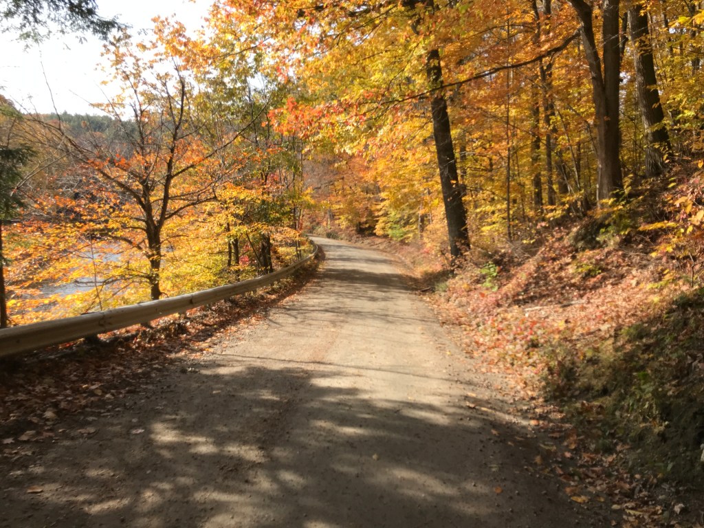
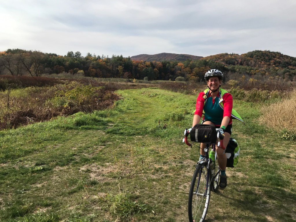
We took a little bit of time to soak it all in, but after our 2-hour drive and with daylight hard to come by, we needed to begin. The cruise down Meeting house Road to Route 103 afforded us some fine views of old houses and a little time to settle in. However, quickly enough we were onto the generous shoulder of the state highway. Even with the space, I was not looking to be on there for too long. One of the more curious sights we saw was one of the locations for the Vermont Country Store. The business began by doing a mail order, but the founding family (the Ortons) also quickly bought an historic store in Weston and began selling wares from that as well. The store was an old general store and apparently “has the distinction being of America’s first restored and fully operational country store and has been placed on the National Register of Historic Places.” The store in Rockingham is not quite so historic. It appears to have been purpose-built and has a grist mill and pond, but the pond is below the mill, so there’s no way to power the mill. This and other seemingly out of place items like a covered bridge over a ditch, try to make it look historic and “quaint” but it all seems off. Especially having come from the actual historic center of a town, all this packaging feels way more Hallmark Christmas Special, than what some consider to be “real” Vermont. Either way, we were happy to get back on some side roads and enjoy the slower pace of things. We passed over two covered bridges, by so many barns and also a few little clusters of houses that were once micro-villages in town. Rockingham actually has a number of villages, including Bellow’s Falls and Saxton’s River. These are now the main downtowns, but it seems like the center of population jumped around as farming, industry, railroads, and other economic forces ebbed and flowed thought town. Sadly, a 1908 fire burned much of the original settlement around the meeting house, taking several houses, a store and hotel, ultimately ensuring “Old Town” was no longer a center of activity. In order to tick off the town of Grafton, we took a small detour. When planning routes, for the life of me I couldn’t easily link in Grafton with many other towns, so this unfortunately became a clipping the corner situation. However, Eastman Road was very pleasant, running next to the babbling Hall Brook and we even got some Class IV between Richards Road and Horseshoe Farm Road. Maddie’s old TREK 420 absorbed all the bumps from rocks hidden under the leaves and soon enough we were done with our detour and ready the enter Chester.

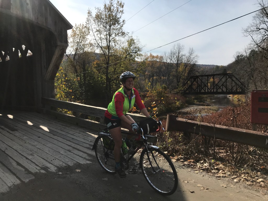

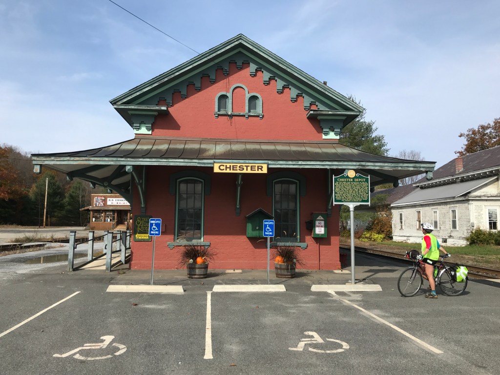
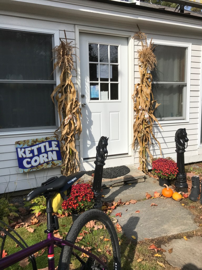
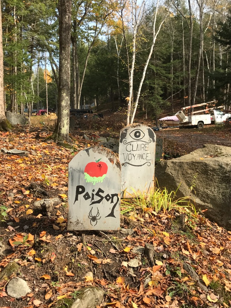
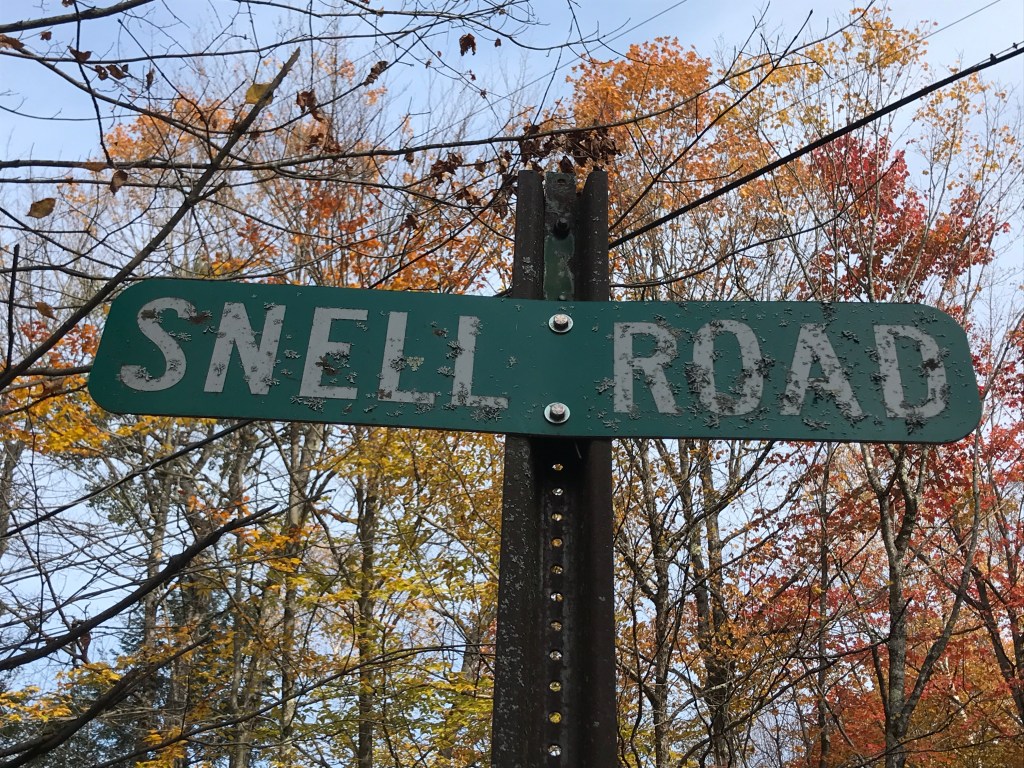
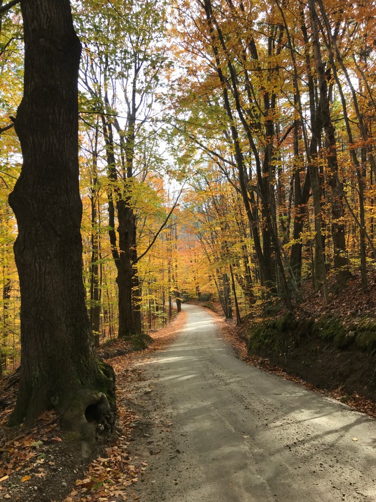
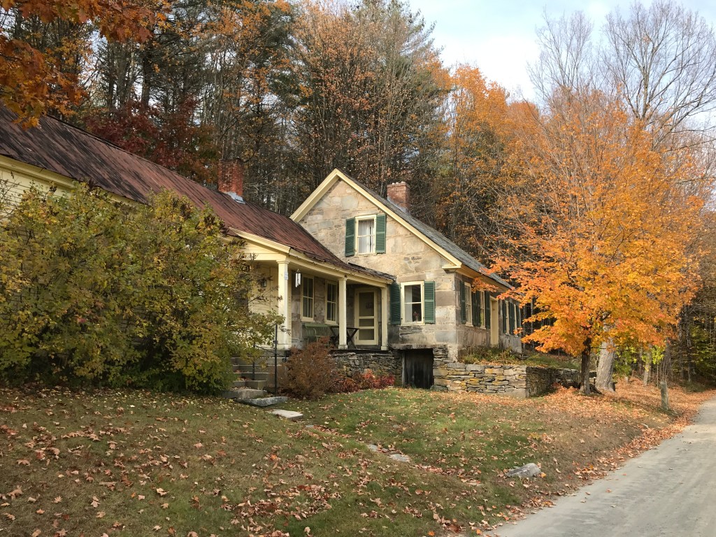
The road leading into Chester continued the theme of barns and bridges and we noticed a lot more work in stone. Beyond the stone houses that are spread throughout this valley (like the one at the top of this post) there were small stone posts that line much of the road. After some moderately exhaustive research, I’m not too much closer to knowing what they were for. My best guess is hitching posts or fence posts. They seem too numerous and spread out to be hitching posts, but too expensive to be fence posts. Anyway, if anyone knows, be in touch. Soon enough we were in Chester Depot. There’s a more classic downtown of Chester with what many people would consider the classic New England row of shops and a small strip of public green. It’s actually been recognized as an Historic District. However, we took a pitstop at the Chester railway station. It’s used mainly now for a tourist train, but there was clearly a lot of industry in the area as evidenced by the many stores and industrial buildings huddling close to the tracks. We looped into yet a slightly different part of Chester, this one known as Stone Village. It’s actually another Historic District, known for mainly for its concentration of buildings that were built using what is apparently called the snecked ashlar technique. Riding by and marveling at all the beautiful stone work, we almost missed the kettle corn sign. Luckily Maddie noticed at the last second, so we turned around and bought a bag from a nice man who sets up on weekends as his retirement job. We resisted munching right away and pushed on. By the way, if Vermont stones are your thing, there a whole Vermont Stone Trail! But that journey will have to wait until this 251 business is taken care of. We finally had to take leave of the valley and began the climb up Trebo Road, seeing a few more stone houses, as well as some silly Halloween decoration gravestones (made of wood!). We missed the Snell Road turn off thanks to a fun downhill and a kind of tricky sign (but mostly just the fun downhill). So we had to backtrack up, only to finish the down then continue up Chandler Road after crossing Route 10. We were closing in on the tiny hamlet of Baltimore, the second smallest incorporated town in Vermont!


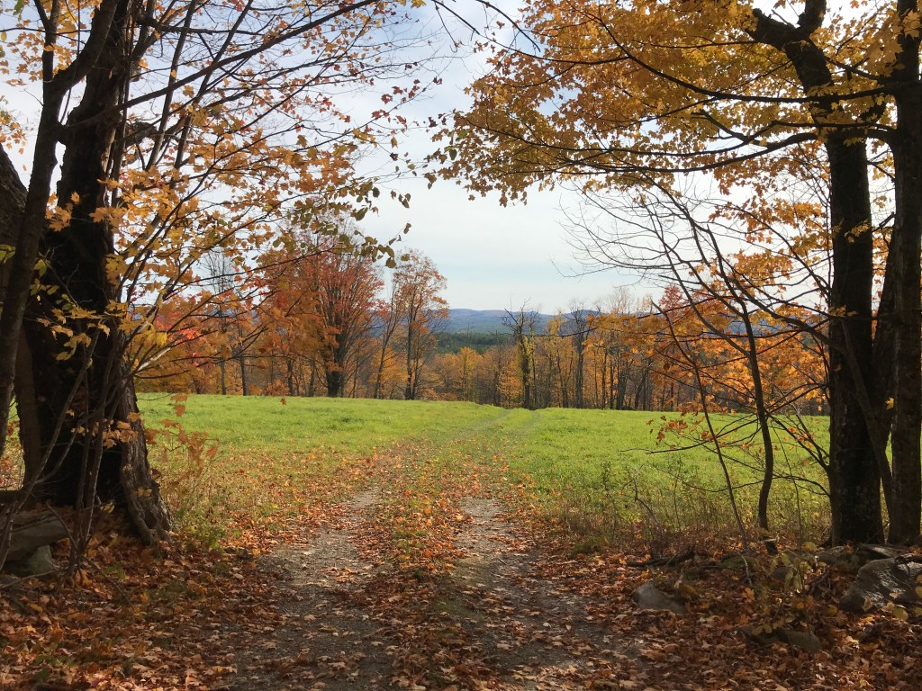
The 4.7 square-mile town of Baltimore is a dispersed settlement with no real village. It has only about 250 residents, up from 54 in 1910 and surpassing its historic 1810 high of 207. Its 7 miles of roads are all dirt and there’s just one public building in town. Baltimore’s unique triangular shape came about because it was originally a part of Cavendish, but many early grants were laid out irrespective of the land’s true geography and the early residents were cut off from the rest of town by the imposing (and deadly) ridge of Hawk’s Mountain. In 1793, a new line was drawn along the top of the ridge and the new town created. These natural borders are somewhat rare in Vermont, and not the first time a town had to be reorganized because a pesky mountain got in the way. It makes me think about the proposal I saw a while ago to organize the states by watershed to help avoid more conflicts over water resources. However, none of this was on my mind as we worked our way up into town. The angle was’t too steep, so it afforded us some time to look around and enjoy the lovely isolation of this town. It’s pretty clear the only people who come to Baltimore are those who live here and those who want to see it. There’s really no reason for through traffic. As such, it’s very quiet. Eventually, once we reached the town hall, housed in an old schoolhouse, there was a small crew of people giving it a new coat of paint. We also passed one of my favorite road names of the project so far: Old Shincracker Lane. It’s apparently named after the nearby mountain, but still no word on whose shins were being cracked or why. After the road flattened out, we got views back down towards the Connecticut River valley and up towards Hawks Mountain. Then we were faced with a descent beginning with a surprise section of class IV road. Again, Maddie and the old TREK absorbed everything and we were speeding town into the village of Perkinsville in the town of Weathersfield. I’m not quite sure why Perkinsville was developed as a village. It was potentially due to local soapstone quarrying and finishing, but these days it has a small brick church and a modest town green. Eventually we pushed on closer towards Stoughton Pond and the long valley below its dam.

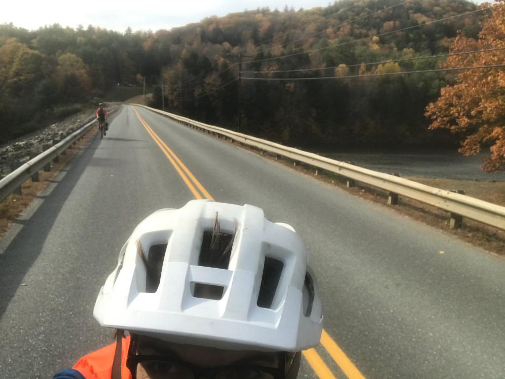
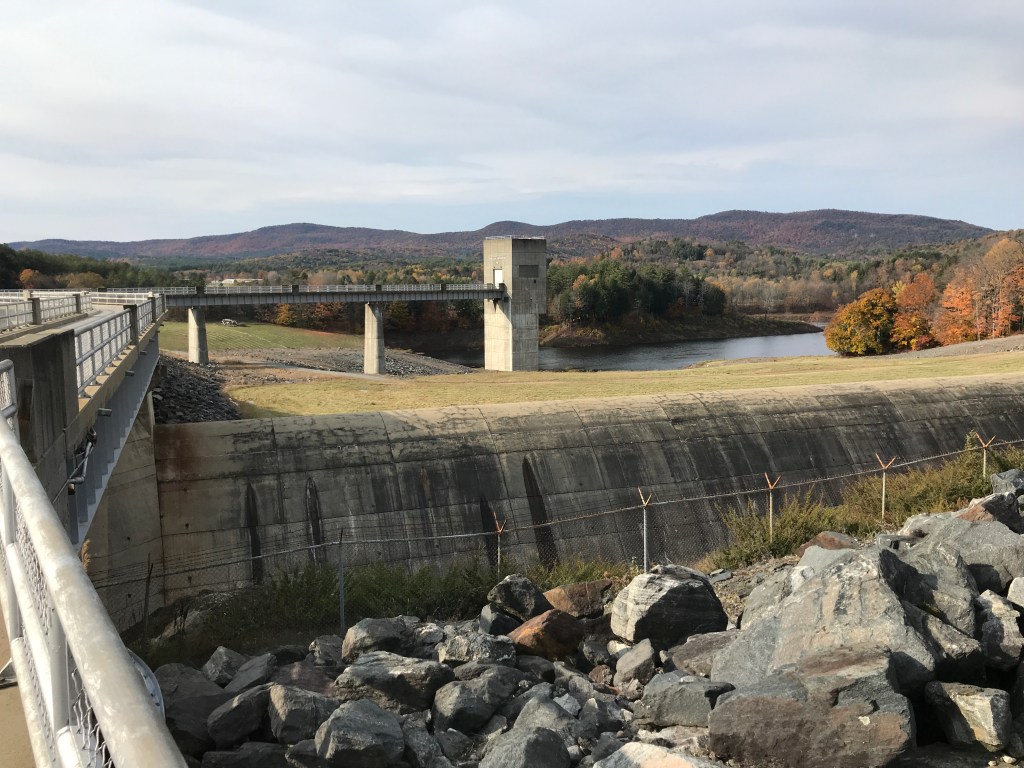
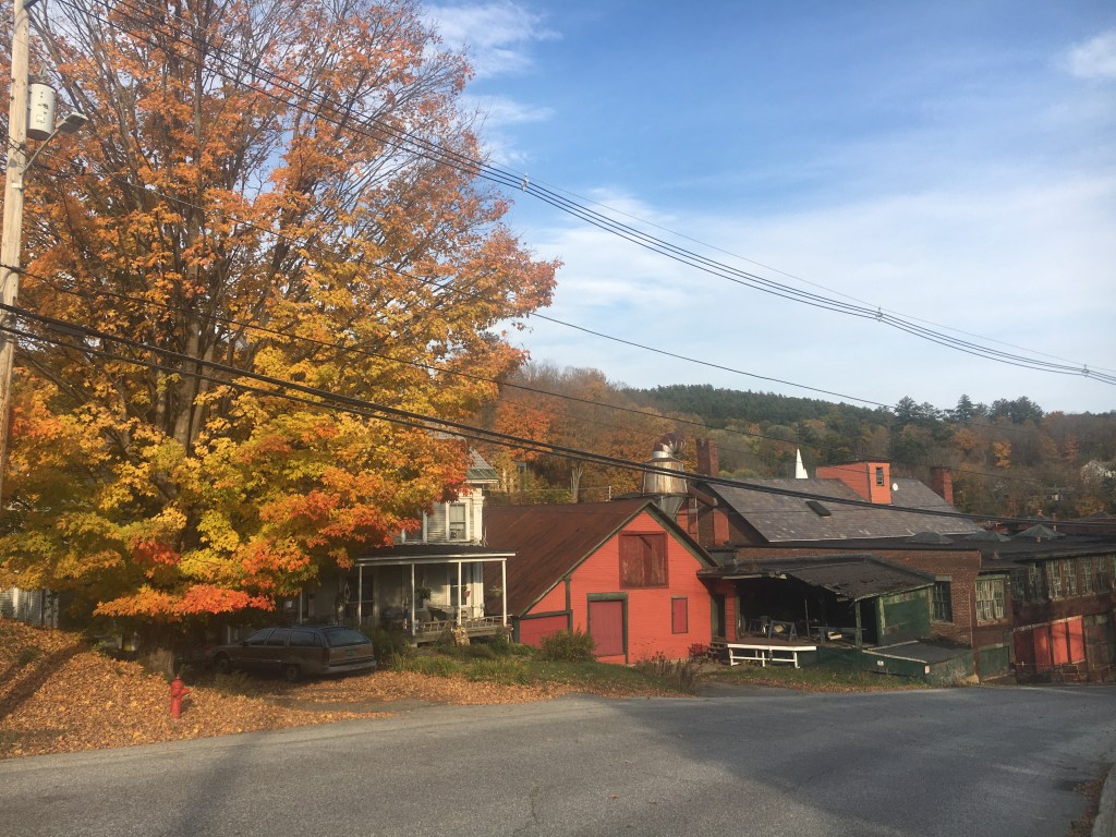
The southwestern portion of Weathersfield was heavily impacted by a flood control project. Conceived of and built in the late 1950’s, this controversial complex of dams had a majorly reshaped the town’s landscape. Constructed and now managed by the Army Corps of Engineers, the sprawling project does provide recreation opportunities, but it’s clear that the Black River it subdued and the larger area of town that surrounds it, were deeply impacted. We decided to try and utilize one of the paths that leads you from just below the Stoughton Pond Dam south to the North Springfield Reservoir Dam. The track began nicely enough as a somewhat rough double track. But soon enough we were essentially biking through meadows. I wasn’t expecting a paved bike path when I planned the route, but I was hoping for something a little more worn in. To make matters worse, the expected gentle curves next to a stream I hoped to find were instead rolling ups and downs as the path clung to the side of the valley. We decided it wasn’t worth it to push on all the way south like this, and eventually we found a path up to Reservoir Road and took that all the way to the south dam. It’s a massive structure that a public road (Maple Street) narrowly crosses. We took it over towards the Hartness State Airport and eventually into the small village of North Springfield. Getting a little nervous about daylight I rerouted us off our intended route onto Fairground Road which took us straight into Springfield. Once we intersected Route 11, Maddie and I decided to split up. There was a monster of a climb coming up and the relatively gentle incline of a state route would be much more forgiving. So, feeling strangely emotional, we parted ways agreeing to either meet at the car or I’d drive my way back along her route. I dropped into the river town of Springfield. I didn’t have too long to admire its old mill buildings due to the stress of racing daylight, but it was fun to pedal hard through those streets. After clearing downtown Springfield, I made it to the beginning of my last big climb. Will Dean Road was beautifully quiet and after missing a turn, I was able to enjoy Parker Hill Road too. I passed a farm specializing in Wagyu beef and also passed (entirely unknowingly) through a “Rural Historic District“. I had a long, speedy drop all the way down to the Williams River and just a little pop back up to the Meeting House. I’d beaten Maddie, but only by a little. After quickly packing up, I met her in the car only a mile or so down the road. We celebrated with some pie purchased from The Southern Pie Company in Chester (HIGHLY recommended by the way) and began the long drive home.

The Details:
https://www.strava.com/activities/4213774080
https://ayvri.com/scene/gdkz16el5z/ckgggunk700013g6bpt2d73wa

3 thoughts on “Ride 13: Rockingham, Grafton, Chester, Baltimore, Weathersfield & Springfield”